Enable Location

We need your location to show you interesting places around you

Discover nearby places

Find interesting locations and hidden gems around you

Precise directions

Get accurate directions and distances to places

Your location is never shared with other users. It's only used when you tap the location button.

Mount Erie

Log in to your account

Start exploring — it's free

Trusted by 61,897 travelers worldwide

Continue with Google
Continue with Apple
or

We will send you a code to connect

By continuing, you accept our Terms and Conditions and our Privacy Policy

Check your inbox

We've sent a pincode in your inbox. Please enter the code below.

Mount Erie

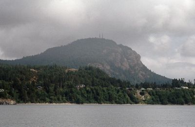
Mount Erie, Mountain summit in Skagit County, Washington, US.

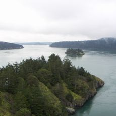
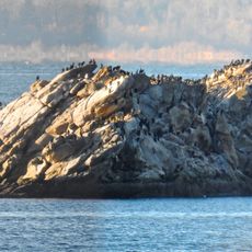
Mount Erie is a mountain on Fidalgo Island in Skagit County that rises roughly 1,270 feet (390 meters) above sea level. From the summit, you can see the San Juan Islands and the Olympic Mountains stretching across the horizon.

The Wilkes Expedition named the mountain in 1841 while exploring the Pacific Northwest coast. The name honors the Battle of Lake Erie from the War of 1812.

Local Indigenous communities maintained connections to Mount Erie's natural resources through generations, utilizing the mountain's strategic vantage points.

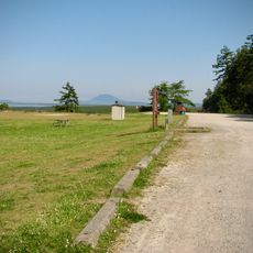
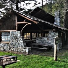
A single paved road winds to the summit, or you can hike on trails of varying difficulty. Parking and picnic areas at the top let you rest and enjoy the views.

The mountain is made of a hard rock called diorite that formed during the Jurassic period through volcanic activity. You can see this distinctive stone throughout the summit area, revealing layers of the region's deep past.

The community of curious travelers

AroundUs brings together thousands of curated places, local tips, and hidden gems, enriched daily by 60,000 contributors worldwide.

Start exploring
Location
GPS coordinates
48.45371,-122.62545
Latest update
December 10, 2025 15:48
Around this place
Deception Pass Bridge
United States of America

Deception Pass Bridge

5.5 km
Larrabee State Park
United States of America

Larrabee State Park

26.7 km
Fort Ebey State Park
United States of America

Fort Ebey State Park

26.6 km
United States of America

Department of Safety

6.6 km
Bay View State Park
United States of America

Bay View State Park

11.3 km
Captain Whidbey Inn
United States of America

Captain Whidbey Inn

26.8 km
Spencer Spit State Park
United States of America

Spencer Spit State Park

19.5 km
Museum of Northwest Art
United States of America

Museum of Northwest Art

11.8 km
Obstruction Pass State Park
United States of America

Obstruction Pass State Park

22.4 km
Rainbow Bridge
United States of America

Rainbow Bridge

11.8 km
WT Preston
United States of America

WT Preston

7 km
United States of America

Joseph Whidbey State Park

14.7 km
Burrows Island Light
United States of America

Burrows Island Light

7 km
Cattle Point Light
United States of America

Cattle Point Light

25 km
Blind Island Marine State Park
United States of America

Blind Island Marine State Park

27.2 km
Smith Island Light
United States of America

Smith Island Light

22 km
Port Stanley School
United States of America

Port Stanley School

20.2 km
Bethsaida Swedish Evangelical Lutheran Church Parsonage
United States of America

Bethsaida Swedish Evangelical Lutheran Church Parsonage

15.2 km
I-5 Skagit River Bridge
United States of America

I-5 Skagit River Bridge

21 km
Island Theatre
United States of America

Island Theatre

7 km
Lincoln Theatre
United States of America

Lincoln Theatre

21.6 km
Deception Pass State Park
United States of America

Deception Pass State Park

6.9 km
Anacortes Cinemas
United States of America

Anacortes Cinemas

7.3 km
Eagle Cliff
United States of America

Eagle Cliff

17.9 km
Skagit City School
United States of America

Skagit City School

21.2 km
Chuckanut Rock
United States of America

Chuckanut Rock

27.3 km
Empire Theater
United States of America

Empire Theater

7.1 km
Bowman Bay Picnic Shelter
United States of America

Bowman Bay Picnic Shelter

4.4 km
Show the full map
« Mount Erie - Mountain summit in Skagit County, Washington, US » is provided by Around Us (aroundus.com). Images and texts are derived from Wikimedia project under a Creative Commons license. You are allowed to copy, distribute, and modify copies of this page, under the conditions set by the license, as long as this note is clearly visible.

Discover hidden gems everywhere you go!

From secret cafés to breathtaking viewpoints, skip the crowded tourist spots and find places that match your style. Our app makes it easy with voice search, smart filtering, route optimization, and insider tips from travelers worldwide. Download now for the complete mobile experience.

Around Us App Screenshot

A unique approach to discovering new places

Le Figaro

All the places worth exploring

France Info

A tailor-made excursion in just a few clicks

20 Minutes

Around Us
Travel Guide & Maps
Download

Send to your phone

QR Code
1

Open the camera app on your mobile.

2

Point at the QR code with your camera. A notification will appear.

3

Tap the notification to open the link.