Chest opened
+${chestReward.xp} XP
Explorer
NOUVEAU ×${chestReward.collectible.quantity}
tapez pour fermer
Chest locked

Open chests in the app

Around Us is built for your phone — chests unlock when you walk, explore and capture nearby places.

Enable Location

We need your location to show you interesting places around you

Discover nearby places

Find interesting locations and hidden gems around you

Precise directions

Get accurate directions and distances to places

Your location is never shared with other users. It's only used when you tap the location button.

Mojave

Log in to your account

Start exploring — it's free

Trusted by 72,967 travelers worldwide

Continue with Google
Continue with Apple
or

We will send you a code to connect

By continuing, you accept our Terms and Conditions and our Privacy Policy

Check your inbox

We've sent a pincode in your inbox. Please enter the code below.

Discussion Reviews 5 Photos
42k Popularity

Mojave, Desert transportation center in Kern County, California

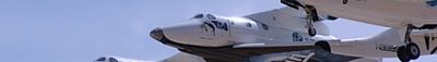
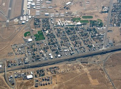
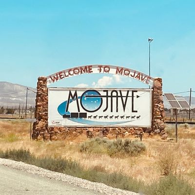
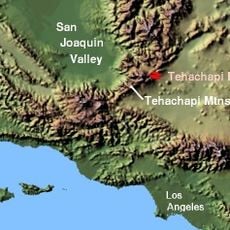
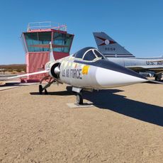
Mojave is a desert settlement in Kern County at 2,762 feet of elevation, surrounded by the Tehachapi Mountains and Oak Creek Pass. The community centers around the Mojave Air and Space Port, which serves as the main hub for aerospace testing and flight operations in the region.

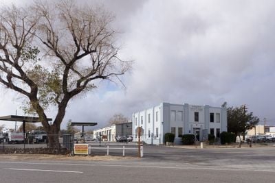
The settlement started in 1876 as a construction camp for the Southern Pacific Railroad and later became a shipping point for borax from Death Valley between 1884 and 1889. These early years as a transportation hub established the foundation for its future role in aerospace.

The community's identity centers on aerospace work, with engineers and specialists from around the world making it their workplace. This focus shapes daily life here and creates an environment where aviation and space technology are simply part of the local conversation.

The town provides basic amenities such as restaurants and accommodation for visitors interested in the aerospace port and surrounding area. The open, flat terrain offers good views of flight testing and airport activities, especially when positioned near the runways and flight paths.

The location experiences extreme wind conditions with speeds between 15 and 35 miles per hour and gusts reaching up to 90 miles per hour during spring and fall. These intense winds make it an ideal testing ground for aircraft and drones under harsh conditions.

The community of curious travelers

AroundUs brings together thousands of curated places, local tips, and hidden gems, enriched daily by 60,000 contributors worldwide.

Start exploring
Location
Elevation above the sea
842 m
GPS coordinates
35.01667,-118.18889
Latest update
December 17, 2025 07:55
Around this place
Willow Springs International Motorsports Park
United States of America

Willow Springs International Motorsports Park

17.2 km
Tehachapi Pass
United States of America

Tehachapi Pass

12.8 km
ESMoA
United States of America

ESMoA

17.9 km
United States of America

Oak Creek Pass

18.9 km
Century Circle
United States of America

Century Circle

24.3 km
United States of America

Tomo-Kahni State Historic Park

19.7 km
United States of America

Beech UC-45J Expeditor

27.1 km
United States of America

Piper PA-48 Enforcer

27.1 km
United States of America

Tierra del Sol Golf Course

24.7 km
United States of America

Race Car Paddock

17.6 km
United States of America

Test Facility Race Car Paddock Area

17.1 km
United States of America

Skidpad

17 km
United States of America

Work of art, sculpture

24.9 km
United States of America

Airplane graveyard viewpoint

7.9 km
United States of America

California City Municipal Par 3 Golf Course

25.6 km
United States of America

Cessna A-37B Dragonfly

27 km
United States of America

Northrop T-38A Talon

27 km
United States of America

Muroc Lake Golf Course

26 km
United States of America

McDonnell NF-4C Phantom II

27 km
United States of America

Fairchild Republic YA-10B Thunderbolt II

27.1 km
United States of America

Sikorsky H-34A Choctaw

27.1 km
United States of America

McDonnell Douglas YC-15A

24.3 km
United States of America

North American YF-100A Super Sabre

24.3 km
United States of America

McDonnell F-101B Voodoo

24.3 km
United States of America

Convair QF-106B Delta Dart

24.3 km
United States of America

Republic F-105D Thunderchief

24.3 km
United States of America

Lockheed F-104G Starfighter

24.3 km
United States of America

Convair TF-102A Delta Dagger

24.3 km
Show the full map
Reviews
Share your experience

No review yet

Discussions
Start a discussion...

No discussion yet

« Mojave - Desert transportation center in Kern County, California » is provided by Around Us (aroundus.com). Images and texts are derived from Wikimedia project under a Creative Commons license. You are allowed to copy, distribute, and modify copies of this page, under the conditions set by the license, as long as this note is clearly visible.

Discover hidden gems everywhere you go!

From secret cafés to breathtaking viewpoints, skip the crowded tourist spots and find places that match your style. Our app makes it easy with voice search, smart filtering, route optimization, and insider tips from travelers worldwide. Download now for the complete mobile experience.

Around Us App Screenshot

A unique approach to discovering new places

Le Figaro

All the places worth exploring

France Info

A tailor-made excursion in just a few clicks

20 Minutes

Around Us
Travel Guide & Maps
Download

Send to your phone

QR Code
1

Open the camera app on your mobile.

2

Point at the QR code with your camera. A notification will appear.

3

Tap the notification to open the link.