Enable Location

We need your location to show you interesting places around you

Discover nearby places

Find interesting locations and hidden gems around you

Precise directions

Get accurate directions and distances to places

Your location is never shared with other users. It's only used when you tap the location button.

Log in to your account

Start exploring — it's free

Trusted by travelers worldwide

Continue with Google
Continue with Apple
or

We will send you a code to connect

By continuing, you accept our Terms and Conditions and our Privacy Policy

Check your inbox

We've sent a pincode in your inbox. Please enter the code below.

Oak Creek Pass, Mountain pass and California Historical Landmark in Kern County, United States.

Description

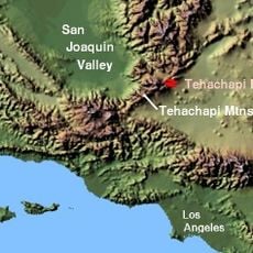
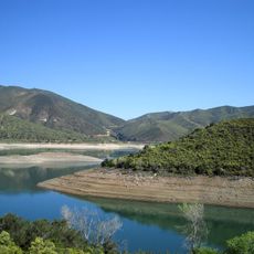
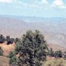
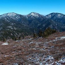
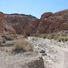
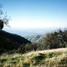
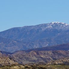
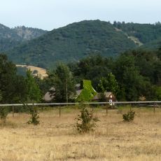
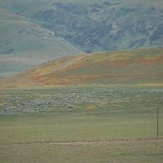
Oak Creek Pass is a mountain pass in the Tehachapi Mountains that rises to an elevation of 4820 feet (1469 m) and connects the city of Tehachapi to the Mojave Desert. The pass cuts through mountainous terrain with steep slopes and offers views of the surrounding mountain ranges.

History

Father Francisco Garcés navigated through Oak Creek Pass in 1776 while returning from his exploration of the San Joaquin Valley to the Mojave region. This pass remained the main connection between the San Joaquin Valley and the Mojave Desert until the railroad through Tehachapi Pass was built in 1876.

Culture

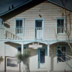
The pass is marked as California Historical Landmark number 97, commemorating the routes that early travelers used through this mountain region. This designation shows how important the location was for early exploration and exchange between different areas.

Practical

You reach Oak Creek Pass by taking Tehachapi Willow Springs Road, located about 7 kilometers south of Tehachapi Boulevard in Kern County. The road is usually accessible, but visitors should check weather conditions and road conditions, especially during winter months.

Did you know?

Before the railroad was built in 1876, this pass served as the only practical route between two major regions for a long time. Once the rail network opened, it lost its role as the main route and became less traveled.

Location
GPS coordinates
35.06100,-118.38900
Latest update
December 14, 2025 17:42

AroundUs brings together thousands of curated places, local tips, and hidden gems, enriched daily by 60,000 contributors worldwide. Discover all places nearby (California).

Around this place
Tehachapi Loop
United States of America

Tehachapi Loop

20.6 km
Willow Springs International Motorsports Park
United States of America

Willow Springs International Motorsports Park

23.6 km
Red Rock Canyon State Park
United States of America

Red Rock Canyon State Park

50.2 km
California Correctional Institution
United States of America

California Correctional Institution

17.3 km
Antelope Valley California Poppy Reserve State Natural Reserve
United States of America

Antelope Valley California Poppy Reserve State Natural Reserve

37.1 km
Rogers Dry Lake
United States of America

Rogers Dry Lake

53.5 km
Tehachapi Pass
United States of America

Tehachapi Pass

10.7 km
Jawbone Canyon
United States of America

Jawbone Canyon

42.8 km
Cesar E. Chavez National Monument
United States of America

Cesar E. Chavez National Monument

24.2 km
Shea's Castle
United States of America

Shea's Castle

40.5 km
Bouquet Reservoir
United States of America

Bouquet Reservoir

53.3 km
Arthur B. Ripley Desert Woodland State Park
United States of America

Arthur B. Ripley Desert Woodland State Park

35.2 km
Bright Star Wilderness
United States of America

Bright Star Wilderness

51.3 km
Double Mountain
United States of America

Double Mountain

9.4 km
Last Chance Canyon
United States of America

Last Chance Canyon

55.5 km
Bear Mountain
United States of America

Bear Mountain

27.8 km
Burnt Peak
United States of America

Burnt Peak

45.5 km
ESMoA
United States of America

ESMoA

7.4 km
Fairmont Butte
United States of America

Fairmont Butte

34.8 km
Western Hotel
United States of America

Western Hotel

46.4 km
Errea House
United States of America

Errea House

9.3 km
Courtlandt Gross House
United States of America

Courtlandt Gross House

12.8 km
Willow Springs Canyon
United States of America

Willow Springs Canyon

39.3 km
Tehachapi Depot Museum
United States of America

Tehachapi Depot Museum

9.6 km
Mournig Cloak Ranch and Botanical Gardens
United States of America

Mournig Cloak Ranch and Botanical Gardens

9.6 km
4 Island Lake Beach
United States of America

4 Island Lake Beach

26.9 km
High Desert Lanes Bowling Center
United States of America

High Desert Lanes Bowling Center

45.3 km
Elyze Clifford Interpretive Center
United States of America

Elyze Clifford Interpretive Center

47.3 km
Show the full map
« Oak Creek Pass - Mountain pass and California Historical Landmark in Kern County, United States » is provided by Around Us (aroundus.com). Images and texts are derived from Wikimedia project under a Creative Commons license. You are allowed to copy, distribute, and modify copies of this page, under the conditions set by the license, as long as this note is clearly visible.

Discover hidden gems everywhere you go!

From secret cafés to breathtaking viewpoints, skip the crowded tourist spots and find places that match your style. Our app makes it easy with voice search, smart filtering, route optimization, and insider tips from travelers worldwide. Download now for the complete mobile experience.

Around Us App Screenshot

A unique approach to discovering new places

Le Figaro

All the places worth exploring

France Info

A tailor-made excursion in just a few clicks

20 Minutes

Around Us
Travel Guide & Maps
Download

Send to your phone

QR Code
1

Open the camera app on your mobile.

2

Point at the QR code with your camera. A notification will appear.

3

Tap the notification to open the link.