Rogers Dry Lake

Log in to your account

AroundUs is a community-driven map of interesting places, built by curious explorers like you. It grows with every review, story, and photo you share.
Connect to save your favorite spots, contribute locations, and create personalized routes.
By continuing, you accept our Terms and Conditions and our Privacy Policy
Add to collection
Map
Suggest a change
Share

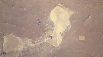
Rogers Dry Lake, Salt pan and aviation facility in Mojave Desert, California, US.

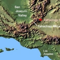
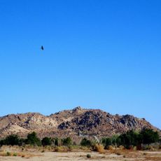
Rogers Dry Lake is a salt pan and military aviation facility in the Mojave Desert within Kern County, California. The flat expanse sits at around 700 meters elevation and covers more than 160 square kilometers.

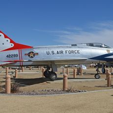
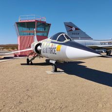
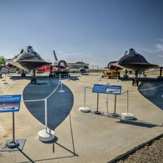
The Army began using the area as a bombing range in the 1930s. Over time, it grew into Edwards Air Force Base, a center for test flights and aerospace development.

The name recalls early rancher Cliff Rogers, who owned land here in the 19th century. The white expanse appears almost like an endless runway under the California sky.

The hard surface remains usable for landings and departures year-round unless rare rains leave it wet. The best views come from the edge of the air base, where public roads run nearby.

A huge compass rose is painted directly on the surface and helps test pilots orient themselves during high-speed runs. More than 300 days a year, weather conditions allow flight trials.

Location: Kern County

Elevation above the sea: 694 m

GPS coordinates: 34.92194,-117.82750

Latest update: December 5, 2025 22:30

Photos
Around this place
Willow Springs International Motorsports Park
United States of America

Willow Springs International Motorsports Park

40.2 km
Red Rock Canyon State Park
United States of America

Red Rock Canyon State Park

52.4 km
Antelope Valley California Poppy Reserve State Natural Reserve
United States of America

Antelope Valley California Poppy Reserve State Natural Reserve

56.2 km
Burro Schmidt Tunnel
United States of America

Burro Schmidt Tunnel

54.5 km
Tehachapi Pass
United States of America

Tehachapi Pass

46.1 km
Devil's Punchbowl
United States of America

Devil's Punchbowl

57.1 km
Scaled Composites Triumph
United States of America

Scaled Composites Triumph

42.8 km
Jawbone Canyon
United States of America

Jawbone Canyon

47 km
Joe Davies Heritage Airpark
United States of America

Joe Davies Heritage Airpark

42.8 km
Shea's Castle
United States of America

Shea's Castle

57.5 km
Antelope Valley Indian Museum State Historic Park
United States of America

Antelope Valley Indian Museum State Historic Park

30.3 km
Saddleback Butte State Park
United States of America

Saddleback Butte State Park

27.7 km
Dry Town Water Park
United States of America

Dry Town Water Park

45.8 km
Littlerock Dam
United States of America

Littlerock Dam

51.7 km
Last Chance Canyon
United States of America

Last Chance Canyon

50.2 km
ESMoA
United States of America

ESMoA

51.7 km
Desert Lighthouse
United States of America

Desert Lighthouse

56.2 km
Fairmont Butte
United States of America

Fairmont Butte

56.4 km
Western Hotel
United States of America

Western Hotel

37.8 km
Errea House
United States of America

Errea House

61 km
Willow Springs Canyon
United States of America

Willow Springs Canyon

53.7 km
Rio Tinto Borax Mine Visitor Center
United States of America

Rio Tinto Borax Mine Visitor Center

17.5 km
Blackbird Airpark
United States of America

Blackbird Airpark

42.7 km
Moah:cedar
United States of America

Moah:cedar

37.9 km
Elyze Clifford Interpretive Center
United States of America

Elyze Clifford Interpretive Center

43.8 km
Century Circle
United States of America

Century Circle

15.9 km
Blackbird Airpark
United States of America

Blackbird Airpark

42.7 km
Armstrong Aircraft Operations Facility
United States of America

Armstrong Aircraft Operations Facility

41.3 km
Show the full map
Reviews

Visited this place? Tap the stars to rate it and share your experience / photos with the community! Try now! You can cancel it anytime.

« Rogers Dry Lake - Salt pan and aviation facility in Mojave Desert, California, US » is provided by Around Us (aroundus.com). Images and texts are derived from Wikimedia project under a Creative Commons license. You are allowed to copy, distribute, and modify copies of this page, under the conditions set by the license, as long as this note is clearly visible.

Discover hidden gems everywhere you go!

From secret cafés to breathtaking viewpoints, skip the crowded tourist spots and find places that match your style. Our app makes it easy with voice search, smart filtering, route optimization, and insider tips from travelers worldwide. Download now for the complete mobile experience.

Around Us App Screenshot

A unique approach to discovering new places

Le Figaro

All the places worth exploring

France Info

A tailor-made excursion in just a few clicks

20 Minutes