Enable Location

We need your location to show you interesting places around you

Discover nearby places

Find interesting locations and hidden gems around you

Precise directions

Get accurate directions and distances to places

Your location is never shared with other users. It's only used when you tap the location button.

Fairmont Butte

Log in to your account

Start exploring — it's free

Trusted by travelers worldwide

Continue with Google
Continue with Apple
or

We will send you a code to connect

By continuing, you accept our Terms and Conditions and our Privacy Policy

Check your inbox

We've sent a pincode in your inbox. Please enter the code below.

Fairmont Butte

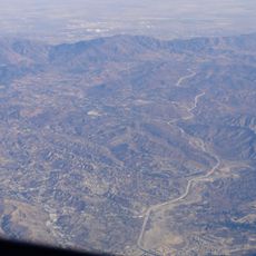
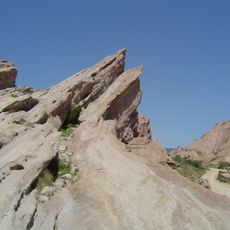
Fairmont Butte, Volcanic butte in Antelope Valley, Los Angeles County, US

Description

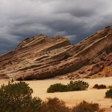
Fairmont Butte is a volcanic formation in Antelope Valley with steep cliffs that rise roughly 430 feet above the surrounding plain. The rock is composed of volcanic tuff, a light-colored porous stone that appears across this desert landscape.

History

Los Angeles City administration opened a quarry at the site in the early 1900s to mine volcanic tuff for cement production. This industrial use shaped the landscape for decades before the area eventually became protected as a nature reserve.

Culture

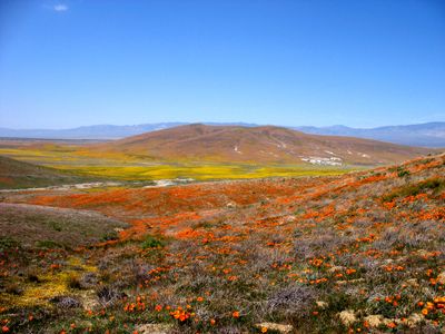
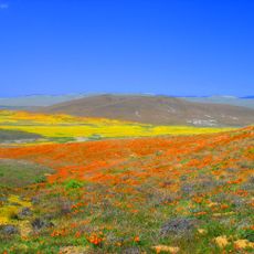
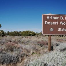
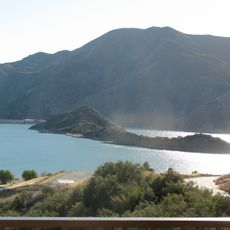
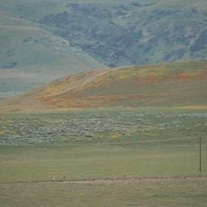
The butte sits within the California Poppy Reserve, where spring wildflowers paint the valley in bright colors that draw nature lovers to the area. Today it remains a favored spot for hikers and those seeking open landscapes beyond urban sprawl.

Practical

The site sits within a protected reserve with marked trails that offer views from different angles along the butte's perimeter. Visiting early in the day works best, as temperatures are cooler and the area is less crowded during morning hours.

Did you know?

The volcanic tuff composition here resembles European materials like German Trass and Italian Pozzolana, which made it exceptionally valuable for cement manufacturing. This geological match with well-known European deposits was why early 1900s mining efforts were justified in this remote desert location.

GPS coordinates
34.74890,-118.40800
Latest update
December 14, 2025 16:40

AroundUs brings together thousands of curated places, local tips, and hidden gems, enriched daily by 60,000 contributors worldwide. Discover all places nearby (Los Angeles County).

Around this place
Willow Springs International Motorsports Park
United States of America

Willow Springs International Motorsports Park

19.2 km
Pyramid Lake
United States of America

Pyramid Lake

34.6 km
Antelope Valley California Poppy Reserve State Natural Reserve
United States of America

Antelope Valley California Poppy Reserve State Natural Reserve

2.7 km
Castaic Lake
United States of America

Castaic Lake

30.3 km
Shambala Preserve
United States of America

Shambala Preserve

37.2 km
Scaled Composites Triumph
United States of America

Scaled Composites Triumph

33.4 km
Joe Davies Heritage Airpark
United States of America

Joe Davies Heritage Airpark

33.5 km
Soledad Canyon
United States of America

Soledad Canyon

38.1 km
Shea's Castle
United States of America

Shea's Castle

5.9 km
Los Angeles Air Route Traffic Control Center
United States of America

Los Angeles Air Route Traffic Control Center

33.9 km
Bouquet Reservoir
United States of America

Bouquet Reservoir

18.8 km
Arthur B. Ripley Desert Woodland State Park
United States of America

Arthur B. Ripley Desert Woodland State Park

8.8 km
Castaic Lake State Recreation Area
United States of America

Castaic Lake State Recreation Area

30.3 km
Dry Town Water Park
United States of America

Dry Town Water Park

38.4 km
Double Mountain
United States of America

Double Mountain

32.5 km
Dry Canyon Reservoir
United States of America

Dry Canyon Reservoir

31.5 km
Burnt Peak
United States of America

Burnt Peak

17.1 km
Vista del Lago
United States of America

Vista del Lago

33.7 km
Western Hotel
United States of America

Western Hotel

25.2 km
Willow Springs Canyon
United States of America

Willow Springs Canyon

6.5 km
Vasquez Rocks
United States of America

Vasquez Rocks

31.1 km
Blackbird Airpark
United States of America

Blackbird Airpark

33.7 km
Moah:cedar
United States of America

Moah:cedar

25.2 km
Elyze Clifford Interpretive Center
United States of America

Elyze Clifford Interpretive Center

21.6 km
Blackbird Airpark
United States of America

Blackbird Airpark

33.7 km
Vasquez Rocks Park
United States of America

Vasquez Rocks Park

31 km
Armstrong Aircraft Operations Facility
United States of America

Armstrong Aircraft Operations Facility

33.9 km
Lockheed A-12 Blackbird monument
United States of America

Lockheed A-12 Blackbird monument

33.7 km
Show the full map
« Fairmont Butte - Volcanic butte in Antelope Valley, Los Angeles County, US » is provided by Around Us (aroundus.com). Images and texts are derived from Wikimedia project under a Creative Commons license. You are allowed to copy, distribute, and modify copies of this page, under the conditions set by the license, as long as this note is clearly visible.

Discover hidden gems everywhere you go!

From secret cafés to breathtaking viewpoints, skip the crowded tourist spots and find places that match your style. Our app makes it easy with voice search, smart filtering, route optimization, and insider tips from travelers worldwide. Download now for the complete mobile experience.

Around Us App Screenshot

A unique approach to discovering new places

Le Figaro

All the places worth exploring

France Info

A tailor-made excursion in just a few clicks

20 Minutes

Around Us
Travel Guide & Maps
Download

Send to your phone

QR Code
1

Open the camera app on your mobile.

2

Point at the QR code with your camera. A notification will appear.

3

Tap the notification to open the link.