Enable Location

We need your location to show you interesting places around you

Discover nearby places

Find interesting locations and hidden gems around you

Precise directions

Get accurate directions and distances to places

Your location is never shared with other users. It's only used when you tap the location button.

Double Mountain

Log in to your account

Start exploring — it's free

Trusted by 62,467 travelers worldwide

Continue with Google
Continue with Apple
or

We will send you a code to connect

By continuing, you accept our Terms and Conditions and our Privacy Policy

Check your inbox

We've sent a pincode in your inbox. Please enter the code below.

Double Mountain

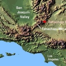
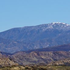
Double Mountain, Mountain summit in Tehachapi Mountains, California, US

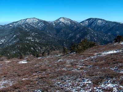
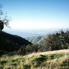
Double Mountain is a summit in California's Tehachapi Mountains characterized by two prominent peaks of comparable height. The twin ridges create a distinctive silhouette visible from various approach trails in the range.

The mountain earned its name from the twin summits, which served as navigation landmarks for travelers crossing Tehachapi Pass during early settlement periods. The distinctive dual-peak formation made it a recognizable reference point along historical trade routes.

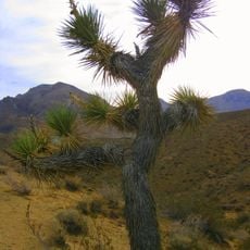
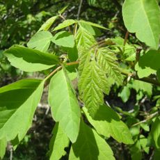
The mountain's eastern slopes contain populations of the rare Alvord oak, a natural hybrid species that scientists study for botanical research.

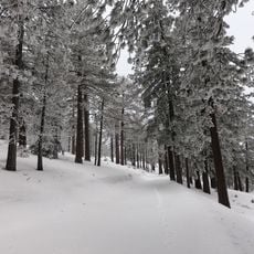
Winter brings significant snowfall to the area, so checking weather forecasts and bringing appropriate cold-weather gear is essential before visiting. Prepare for variable conditions and pay special attention to visibility and ground stability at higher elevations.

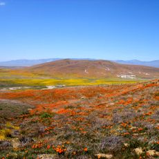
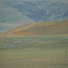
The elevation gain from base to summit creates several distinct climate zones with different plant communities on the same mountain. As you climb, you observe how vegetation and weather conditions shift noticeably, revealing the ecological diversity packed into a short vertical distance.

The community of curious travelers

AroundUs brings together thousands of curated places, local tips, and hidden gems, enriched daily by 60,000 contributors worldwide.

Start exploring
Location
GPS coordinates
35.03330,-118.48675
Latest update
December 12, 2025 14:21
Around this place
Tehachapi Loop
United States of America

Tehachapi Loop

19.2 km
Willow Springs International Motorsports Park
United States of America

Willow Springs International Motorsports Park

26.9 km
Pyramid Lake
United States of America

Pyramid Lake

50.2 km
California Correctional Institution
United States of America

California Correctional Institution

11.4 km
Antelope Valley California Poppy Reserve State Natural Reserve
United States of America

Antelope Valley California Poppy Reserve State Natural Reserve

35.1 km
Tehachapi Pass
United States of America

Tehachapi Pass

20.1 km
Weedpatch Camp
United States of America

Weedpatch Camp

48.8 km
Jawbone Canyon
United States of America

Jawbone Canyon

51.7 km
Cesar E. Chavez National Monument
United States of America

Cesar E. Chavez National Monument

22.6 km
Shea's Castle
United States of America

Shea's Castle

38.3 km
Bouquet Reservoir
United States of America

Bouquet Reservoir

51.2 km
Arthur B. Ripley Desert Woodland State Park
United States of America

Arthur B. Ripley Desert Woodland State Park

30.5 km
Frazier Mountain
United States of America

Frazier Mountain

52.6 km
Bear Mountain
United States of America

Bear Mountain

23.6 km
Burnt Peak
United States of America

Burnt Peak

39.9 km
ESMoA
United States of America

ESMoA

16 km
Vista del Lago
United States of America

Vista del Lago

48.3 km
Fairmont Butte
United States of America

Fairmont Butte

32.5 km
Western Hotel
United States of America

Western Hotel

49 km
Errea House
United States of America

Errea House

11.3 km
Courtlandt Gross House
United States of America

Courtlandt Gross House

7.1 km
Willow Springs Canyon
United States of America

Willow Springs Canyon

38 km
Tehachapi Depot Museum
United States of America

Tehachapi Depot Museum

11.6 km
Mournig Cloak Ranch and Botanical Gardens
United States of America

Mournig Cloak Ranch and Botanical Gardens

11.5 km
Moah:cedar
United States of America

Moah:cedar

49 km
Elyze Clifford Interpretive Center
United States of America

Elyze Clifford Interpretive Center

48.7 km
Century Circle
United States of America

Century Circle

48.7 km
Frazier Park Branch Library
United States of America

Frazier Park Branch Library

48.4 km
Show the full map
« Double Mountain - Mountain summit in Tehachapi Mountains, California, US » is provided by Around Us (aroundus.com). Images and texts are derived from Wikimedia project under a Creative Commons license. You are allowed to copy, distribute, and modify copies of this page, under the conditions set by the license, as long as this note is clearly visible.

Discover hidden gems everywhere you go!

From secret cafés to breathtaking viewpoints, skip the crowded tourist spots and find places that match your style. Our app makes it easy with voice search, smart filtering, route optimization, and insider tips from travelers worldwide. Download now for the complete mobile experience.

Around Us App Screenshot

A unique approach to discovering new places

Le Figaro

All the places worth exploring

France Info

A tailor-made excursion in just a few clicks

20 Minutes

Around Us
Travel Guide & Maps
Download

Send to your phone

QR Code
1

Open the camera app on your mobile.

2

Point at the QR code with your camera. A notification will appear.

3

Tap the notification to open the link.