Enable Location

We need your location to show you interesting places around you

Discover nearby places

Find interesting locations and hidden gems around you

Precise directions

Get accurate directions and distances to places

Your location is never shared with other users. It's only used when you tap the location button.

Saddleback Butte State Park

Log in to your account

Start exploring — it's free

Trusted by 62,060 travelers worldwide

Continue with Google
Continue with Apple
or

We will send you a code to connect

By continuing, you accept our Terms and Conditions and our Privacy Policy

Check your inbox

We've sent a pincode in your inbox. Please enter the code below.

Saddleback Butte State Park

Saddleback Butte State Park, Desert conservation area in Hi Vista, United States

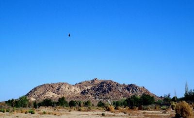
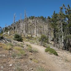
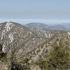
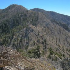
This state park covers 2,955 acres of Mojave Desert terrain with a striking volcanic butte that rises to 3,651 feet. The landscape features open desert expanses, rocky outcrops, and typical desert plants connected by numerous hiking trails.

The California Department of Parks and Recreation established this protected area in 1960 to safeguard the native desert ecosystem. The creation reflected growing efforts to preserve the valley's unique landscape for future generations.

Native Americans lived in this region for generations, and their presence is still visible through artifacts scattered across the landscape. Walking through the park today, you can sense the deep connection these communities had to the land.

The park is open year-round with hiking trails for different fitness levels, plus camping and picnic facilities throughout the grounds. Bring plenty of water and prepare for hot, dry conditions, especially during summer months.

The park holds one of California's largest concentrations of Joshua Trees, whose distinctive silhouettes shape the desert horizon. These trees are perfectly adapted to the harsh desert environment and create striking views especially during sunrise and sunset.

The community of curious travelers

AroundUs brings together thousands of curated places, local tips, and hidden gems, enriched daily by 60,000 contributors worldwide.

Start exploring
Location
Inception
1960
GPS coordinates
34.67430,-117.79900
Latest update
December 9, 2025 18:47
Around this place
Angeles National Forest
United States of America

Angeles National Forest

48.8 km
Rogers Dry Lake
United States of America

Rogers Dry Lake

27.7 km
Devil's Punchbowl
United States of America

Devil's Punchbowl

29.8 km
Crystal Lake Recreation Area
United States of America

Crystal Lake Recreation Area

39 km
Scaled Composites Triumph
United States of America

Scaled Composites Triumph

27.7 km
San Gabriel Mountains National Monument
United States of America

San Gabriel Mountains National Monument

39.9 km
Mount Baden-Powell
United States of America

Mount Baden-Powell

35.3 km
Joe Davies Heritage Airpark
United States of America

Joe Davies Heritage Airpark

27.7 km
Los Angeles Air Route Traffic Control Center
United States of America

Los Angeles Air Route Traffic Control Center

27.2 km
Antelope Valley Indian Museum State Historic Park
United States of America

Antelope Valley Indian Museum State Historic Park

5.3 km
Table Mountain Observatory
United States of America

Table Mountain Observatory

34.3 km
Dry Town Water Park
United States of America

Dry Town Water Park

27.2 km
Littlerock Dam
United States of America

Littlerock Dam

29.3 km
Iron Mountain
United States of America

Iron Mountain

43.7 km
Mount Islip
United States of America

Mount Islip

36.8 km
Mount Burnham
United States of America

Mount Burnham

35.1 km
United States of America

Waterman Mountain

39.7 km
Throop Peak
United States of America

Throop Peak

36.1 km
Windy Gap Trail
United States of America

Windy Gap Trail

36.9 km
Western Hotel
United States of America

Western Hotel

31.2 km
Rio Tinto Borax Mine Visitor Center
United States of America

Rio Tinto Borax Mine Visitor Center

40.9 km
Blackbird Airpark
United States of America

Blackbird Airpark

27.5 km
Moah:cedar
United States of America

Moah:cedar

31.3 km
Elyze Clifford Interpretive Center
United States of America

Elyze Clifford Interpretive Center

36.1 km
Century Circle
United States of America

Century Circle

28.1 km
Blackbird Airpark
United States of America

Blackbird Airpark

27.5 km
Armstrong Aircraft Operations Facility
United States of America

Armstrong Aircraft Operations Facility

26.4 km
Lockheed A-12 Blackbird monument
United States of America

Lockheed A-12 Blackbird monument

27.5 km
Show the full map
« Saddleback Butte State Park - Desert conservation area in Hi Vista, United States » is provided by Around Us (aroundus.com). Images and texts are derived from Wikimedia project under a Creative Commons license. You are allowed to copy, distribute, and modify copies of this page, under the conditions set by the license, as long as this note is clearly visible.

Discover hidden gems everywhere you go!

From secret cafés to breathtaking viewpoints, skip the crowded tourist spots and find places that match your style. Our app makes it easy with voice search, smart filtering, route optimization, and insider tips from travelers worldwide. Download now for the complete mobile experience.

Around Us App Screenshot

A unique approach to discovering new places

Le Figaro

All the places worth exploring

France Info

A tailor-made excursion in just a few clicks

20 Minutes

Around Us
Travel Guide & Maps
Download

Send to your phone

QR Code
1

Open the camera app on your mobile.

2

Point at the QR code with your camera. A notification will appear.

3

Tap the notification to open the link.