·

Enable Location

We need your location to show you interesting places around you

Discover nearby places

Find interesting locations and hidden gems around you

Precise directions

Get accurate directions and distances to places

Your location is never shared with other users. It's only used when you tap the location button.

Wawona Covered Bridge

Log in to your account

Start exploring — it's free

Trusted by 62,647 travelers worldwide

Continue with Google
Continue with Apple
or

We will send you a code to connect

By continuing, you accept our Terms and Conditions and our Privacy Policy

Check your inbox

We've sent a pincode in your inbox. Please enter the code below.

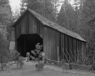
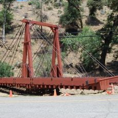
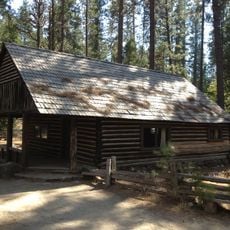
Wawona Covered Bridge, Covered bridge in Wawona, United States.

The Wawona Covered Bridge is a wooden structure that crosses the South Fork of the Merced River in Mariposa County. It features a timber frame with walls and a covered design that provide shelter over the water.

The bridge was built in 1868 by Galen Clark, the first guardian of Yosemite Grant. The covering and walls were added in 1878 by the Washburn brothers to protect the crossing.

The bridge displays New England-style walls and a steep roof that reflect the heritage of Vermont-born builders. Visitors walking across can see how eastern building traditions were adapted to this Sierra location.

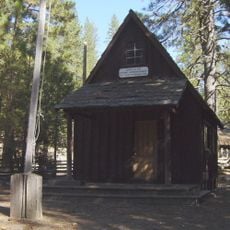
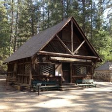
The bridge is open to pedestrians and part of the Pioneer Yosemite History Center complex. You can walk across at a relaxed pace and take time to notice the river below and surrounding forest.

Only about a dozen covered bridges like this one remain standing in California today. This rarity makes it a notable example of a building style that was once far more common throughout North America.

The community of curious travelers

AroundUs brings together thousands of curated places, local tips, and hidden gems, enriched daily by 60,000 contributors worldwide.

Start exploring
Location
Inception
1868
Part of
Yosemite History Center
GPS coordinates
37.53861,-119.65594
Latest update
December 14, 2025 15:00
Around this place
Wawona Tree
United States of America

Wawona Tree

6 km
Grizzly Giant
United States of America

Grizzly Giant

6.2 km
Wawona Hotel
United States of America

Wawona Hotel

215 m
Yosemite Mountain Sugar Pine Railroad
United States of America

Yosemite Mountain Sugar Pine Railroad

9.6 km
Nelder Grove
United States of America

Nelder Grove

13.4 km
Chilnualna Falls
United States of America

Chilnualna Falls

4.4 km
Fresno Dome
United States of America

Fresno Dome

14.2 km
Silver Strand Falls
United States of America

Silver Strand Falls

18.5 km
Hetch Hetchy Railroad 6
United States of America

Hetch Hetchy Railroad 6

19 km
McGurk Cabin
United States of America

McGurk Cabin

15.7 km
Henness Ridge Fire Lookout
United States of America

Henness Ridge Fire Lookout

12.6 km
Acting Superintendent's Headquarters
United States of America

Acting Superintendent's Headquarters

91 m
Bagby Stationhouse, Water Tanks and Turntable
United States of America

Bagby Stationhouse, Water Tanks and Turntable

19 km
Yosemite Transportation Company Office
United States of America

Yosemite Transportation Company Office

52 m
Yosemite History Center
United States of America

Yosemite History Center

31 m
Hodgdon Homestead Cabin
United States of America

Hodgdon Homestead Cabin

71 m
Chris Jorgensen Studio
United States of America

Chris Jorgensen Studio

45 m
Buck Camp Patrol Cabin
United States of America

Buck Camp Patrol Cabin

14.9 km
Mariposa Grove Museum
United States of America

Mariposa Grove Museum

5.8 km
Dewey Point
United States of America

Dewey Point

18.4 km
Wawona Visitor Center
United States of America

Wawona Visitor Center

158 m
Yosemite Valley Railroad Caboose No. 15
United States of America

Yosemite Valley Railroad Caboose No. 15

19 km
The Wawona Hotel and Studio
United States of America

The Wawona Hotel and Studio

263 m
Ranger Patrol Cabin
United States of America

Ranger Patrol Cabin

71 m
Arch Rock
United States of America

Arch Rock

17.8 km
Arch Rock Entrance Station
United States of America

Arch Rock Entrance Station

17.7 km
Signal Peak Lookout
United States of America

Signal Peak Lookout

7.5 km
South Entrance Office
United States of America

South Entrance Office

4.1 km
Show the full map
« Wawona Covered Bridge - Covered bridge in Wawona, United States » is provided by Around Us (aroundus.com). Images and texts are derived from Wikimedia project under a Creative Commons license. You are allowed to copy, distribute, and modify copies of this page, under the conditions set by the license, as long as this note is clearly visible.

Discover hidden gems everywhere you go!

From secret cafés to breathtaking viewpoints, skip the crowded tourist spots and find places that match your style. Our app makes it easy with voice search, smart filtering, route optimization, and insider tips from travelers worldwide. Download now for the complete mobile experience.

Around Us App Screenshot

A unique approach to discovering new places

Le Figaro

All the places worth exploring

France Info

A tailor-made excursion in just a few clicks

20 Minutes

Around Us
Travel Guide & Maps
Download

Send to your phone

QR Code
1

Open the camera app on your mobile.

2

Point at the QR code with your camera. A notification will appear.

3

Tap the notification to open the link.