Chest opened
+${chestReward.xp} XP
Explorer
NOUVEAU ×${chestReward.collectible.quantity}
tapez pour fermer
Chest locked

Open chests in the app

Around Us is built for your phone — chests unlock when you walk, explore and capture nearby places.

Enable Location

We need your location to show you interesting places around you

Discover nearby places

Find interesting locations and hidden gems around you

Precise directions

Get accurate directions and distances to places

Your location is never shared with other users. It's only used when you tap the location button.

Bishop

Log in to your account

Start exploring — it's free

Trusted by 72,876 travelers worldwide

Continue with Google
Continue with Apple
or

We will send you a code to connect

By continuing, you accept our Terms and Conditions and our Privacy Policy

Check your inbox

We've sent a pincode in your inbox. Please enter the code below.

Discussion Reviews 4 Photos
112k Popularity

Bishop, Commercial center in Inyo County, California, United States

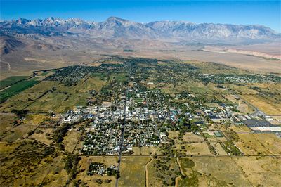
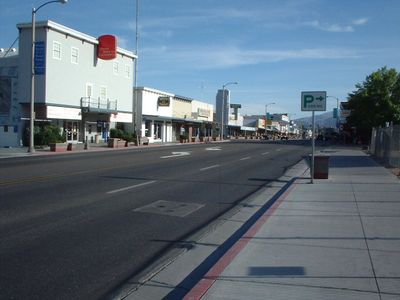
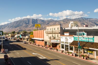
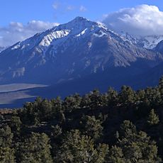
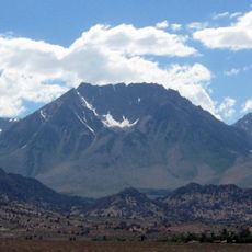
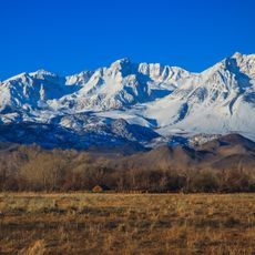
Bishop is a service center in the northern Owens Valley at 4,150 feet (1,265 meters), located between the Sierra Nevada and the White Mountains in California, USA. Buildings line wide streets surrounded by sagebrush flats and dry slopes, with steep peaks rising to the west.

Samuel Addison Bishop established a cattle ranch here in 1861 to supply beef to nearby mining camps, laying the foundation for later settlement. Over the following decades, the area grew into a supply hub for ranchers and travelers along the eastern Sierra slope.

Local shops along the main street sell handmade leather goods and pottery, reflecting a community shaped by the surrounding mountains and desert. Small galleries feature paintings and photographs that capture the dry basin light and distant peaks.

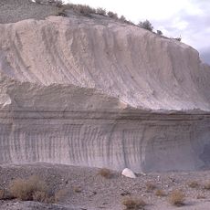
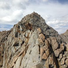
Trails and climbing sites in the surrounding area are best accessed in spring and fall, when temperatures are moderate and snow has not yet closed higher elevations. The town itself has several shops that rent gear and offer local maps.

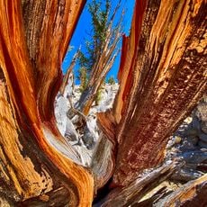
More than 2,000 boulders spread across different formations in the wider area draw climbers from many countries. Some of these blocks carry names given by early ascenders and now appear in climbing guides worldwide.

The community of curious travelers

AroundUs brings together thousands of curated places, local tips, and hidden gems, enriched daily by 60,000 contributors worldwide.

Start exploring
Location
Inception
1861
GPS coordinates
37.36350,-118.39510
Latest update
December 14, 2025 00:25
Around this place
Methuselah
United States of America

Methuselah

19.4 km
Owens Valley Radio Observatory
United States of America

Owens Valley Radio Observatory

17.6 km
Mount Tom
United States of America

Mount Tom

23.3 km
Bishop Tuff
United States of America

Bishop Tuff

17.8 km
Combined Array for Research in Millimeter-wave Astronomy
United States of America

Combined Array for Research in Millimeter-wave Astronomy

24.2 km
United States of America

Keough Hot Springs

12.3 km
Owens Valley Solar Array
United States of America

Owens Valley Solar Array

17.4 km
Basin Mountain
United States of America

Basin Mountain

24.5 km
OVRO 40 meter Telescope
United States of America

OVRO 40 meter Telescope

17.5 km
Mount Emerson
United States of America

Mount Emerson

26.6 km
United States of America

Fish Slough Area of Critical Environmental Concern

11.8 km
Mayfield Canyon
United States of America

Mayfield Canyon

23.3 km
OVRO VLBA station
United States of America

OVRO VLBA station

18 km
Brewster VLBA station
United States of America

Brewster VLBA station

18 km
C-BASS North
United States of America

C-BASS North

17.6 km
United States of America

Jawbone Canyon

22.6 km
Bishop Branch Library
United States of America

Bishop Branch Library

131 m
United States of America

Mollie Gibson Canyon

22 km
United States of America

Chalk Bluff

8.4 km
United States of America

Sherwin Grade Southbound Vista Point

25.3 km
United States of America

Sherwin Grade Northbound Vista Point

24.4 km
United States of America

Bishop Golf Club

2.5 km
United States of America

Inyo National Forest

23.3 km
United States of America

Scenic viewpoint

20.1 km
United States of America

Sierra View Vista Point

18.5 km
United States of America

Scenic viewpoint

18.4 km
United States of America

Mine

23.8 km
United States of America

Mine

23.5 km
Show the full map
Reviews
Share your experience

No review yet

Discussions
Start a discussion...

No discussion yet

« Bishop - Commercial center in Inyo County, California, United States » is provided by Around Us (aroundus.com). Images and texts are derived from Wikimedia project under a Creative Commons license. You are allowed to copy, distribute, and modify copies of this page, under the conditions set by the license, as long as this note is clearly visible.

Discover hidden gems everywhere you go!

From secret cafés to breathtaking viewpoints, skip the crowded tourist spots and find places that match your style. Our app makes it easy with voice search, smart filtering, route optimization, and insider tips from travelers worldwide. Download now for the complete mobile experience.

Around Us App Screenshot

A unique approach to discovering new places

Le Figaro

All the places worth exploring

France Info

A tailor-made excursion in just a few clicks

20 Minutes

Around Us
Travel Guide & Maps
Download

Send to your phone

QR Code
1

Open the camera app on your mobile.

2

Point at the QR code with your camera. A notification will appear.

3

Tap the notification to open the link.