Caliente

Log in to your account

AroundUs is a community-driven map of interesting places, built by curious explorers like you. It grows with every review, story, and photo you share.
Connect to save your favorite spots, contribute locations, and create personalized routes.
By continuing, you accept our Terms and Conditions and our Privacy Policy
Add to collection
Map
Suggest a change
Share

Caliente, Railroad city in Lincoln County, Nevada, United States.

Caliente is a small city in southeastern Nevada at about 4,400 feet (1,340 meters) elevation, known for its Spanish-influenced architecture and cottonwood trees. The city has public parks, a swimming pool, and trails that connect to nearby mountain areas.

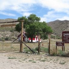
The city began in 1901 when a landowner allowed railroad construction through his property, creating an important transportation hub. This early railroad connection brought rapid growth and shaped its development.

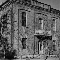
The old railroad depot reflects how the train shaped daily life here and remains a gathering place that celebrates that heritage. Local buildings still show the Spanish architectural influences that arrived with the railroad era.

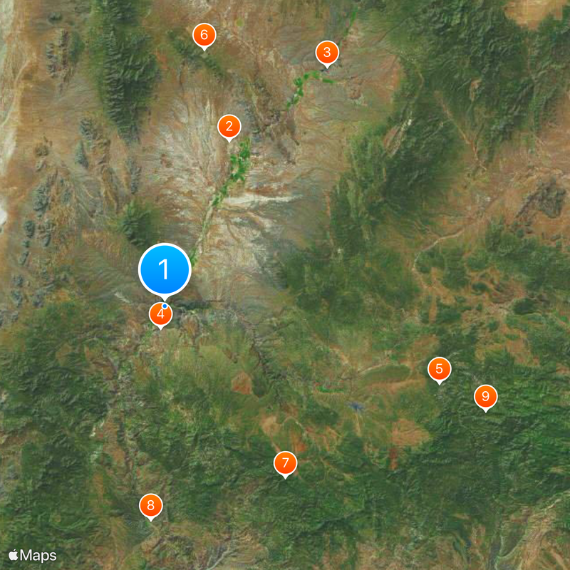
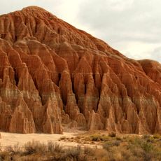
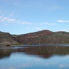
The city offers good conditions for outdoor activities with parks, trails, and a swimming pool for recreation. Its location near mountain areas and a nearby state park makes it a practical base for exploring the region.

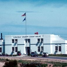
Despite its young founding, the city's 1923 railroad depot still stands as a central landmark that houses municipal services and local heritage. This preserved building remains the heart of how residents connect with their past.

Location: Lincoln County

Inception: 1901

Elevation above the sea: 1,343 m

Website: https://cityofcaliente.com

GPS coordinates: 37.61528,-114.51417

Latest update: December 7, 2025 09:23

Photos
Around this place
Snow Canyon State Park
United States of America

Snow Canyon State Park

89.8 km
Tikaboo Peak
United States of America

Tikaboo Peak

80.5 km
Righteous Branch of the Church of Jesus Christ of Latter-day Saints
United States of America

Righteous Branch of the Church of Jesus Christ of Latter-day Saints

62.3 km
Cathedral Gorge State Park
United States of America

Cathedral Gorge State Park

24.4 km
Basin and Range National Monument
United States of America

Basin and Range National Monument

87.3 km
Tuacahn
United States of America

Tuacahn

89.2 km
Gunlock State Park
United States of America

Gunlock State Park

77 km
Santa Clara Volcano
United States of America

Santa Clara Volcano

88.1 km
Mountain Meadows
United States of America

Mountain Meadows

78.5 km
Echo Canyon State Park
United States of America

Echo Canyon State Park

39.7 km
Pahranagat National Wildlife Refuge
United States of America

Pahranagat National Wildlife Refuge

64.4 km
Beaver Dam Wash National Conservation Area
United States of America

Beaver Dam Wash National Conservation Area

79.8 km
Kershaw–Ryan State Park
United States of America

Kershaw–Ryan State Park

3 km
Pine Valley Chapel and Tithing Office
United States of America

Pine Valley Chapel and Tithing Office

91.7 km
Spring Valley State Park
United States of America

Spring Valley State Park

57.4 km
Jacob Hamblin House
United States of America

Jacob Hamblin House

92.7 km
Lincoln County Courthouse
United States of America

Lincoln County Courthouse

35.6 km
Bristol Wells Town Site
United States of America

Bristol Wells Town Site

56.9 km
Clover Mountains Wilderness
United States of America

Clover Mountains Wilderness

28.7 km
Weepah Spring Wilderness
United States of America

Weepah Spring Wilderness

66.2 km
Elgin Schoolhouse State Historic Site
United States of America

Elgin Schoolhouse State Historic Site

29.4 km
Red Mountain Wilderness
United States of America

Red Mountain Wilderness

82.9 km
Padre Canyon
United States of America

Padre Canyon

89.8 km
1938 Lincoln County Courthouse
United States of America

1938 Lincoln County Courthouse

36.2 km
Gem Theatre
United States of America

Gem Theatre

35.5 km
Davidson Peak
United States of America

Davidson Peak

81.8 km
Mountain Meadows Massacre Site
United States of America

Mountain Meadows Massacre Site

78.4 km
Gunlock Reservoir
United States of America

Gunlock Reservoir

76.4 km
Show the full map
Reviews

Visited this place? Tap the stars to rate it and share your experience / photos with the community! Try now! You can cancel it anytime.

« Caliente - Railroad city in Lincoln County, Nevada, United States » is provided by Around Us (aroundus.com). Images and texts are derived from Wikimedia project under a Creative Commons license. You are allowed to copy, distribute, and modify copies of this page, under the conditions set by the license, as long as this note is clearly visible.

Discover hidden gems everywhere you go!

From secret cafés to breathtaking viewpoints, skip the crowded tourist spots and find places that match your style. Our app makes it easy with voice search, smart filtering, route optimization, and insider tips from travelers worldwide. Download now for the complete mobile experience.

Around Us App Screenshot

A unique approach to discovering new places

Le Figaro

All the places worth exploring

France Info

A tailor-made excursion in just a few clicks

20 Minutes