Enable Location

We need your location to show you interesting places around you

Discover nearby places

Find interesting locations and hidden gems around you

Precise directions

Get accurate directions and distances to places

Your location is never shared with other users. It's only used when you tap the location button.

Log in to your account

Start exploring — it's free

Trusted by 62,180 travelers worldwide

Continue with Google
Continue with Apple
or

We will send you a code to connect

By continuing, you accept our Terms and Conditions and our Privacy Policy

Check your inbox

We've sent a pincode in your inbox. Please enter the code below.

Doc's Pass Wilderness

Doc's Pass Wilderness, US Wilderness Area in Washington County, Utah

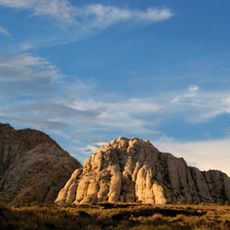
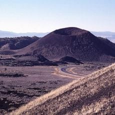
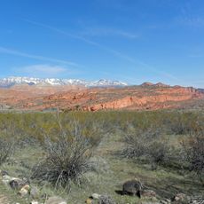
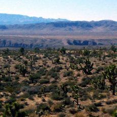
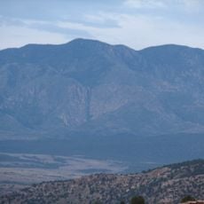
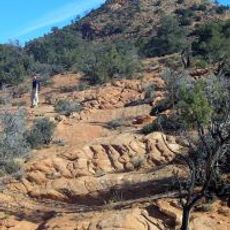
Doc's Pass Wilderness is a protected area in Washington County featuring the Bull Valley Mountains with deep canyons carved by ancient forces. The steep walls show layers of volcanic rock and ash deposits that create the dramatic landscape visible throughout the region.

Congress officially designated this land as a wilderness area in 2009 through federal legislation. The protection came to preserve the natural landscape and keep its wild character for the future.

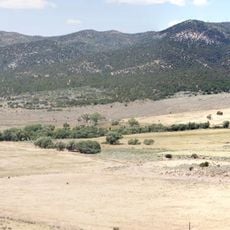
The land is home to elk and mountain lions that roam through the canyons and rocky slopes of the Bull Valley Mountains. Visitors can observe how these animals move through the landscape and shape the natural ecosystem of this remote desert region.

The main access route heads northwest from the town of Gunlock via Motoqua Road to reach the wilderness area. Visitors should bring plenty of water and wear sturdy hiking boots since the terrain is rocky and the slopes are steep.

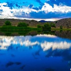
The Beaver Dam Wash runs free through the canyons for about 5 miles, creating a green corridor of willows and cottonwood trees in the middle of the dry desert. This flowing stream is one of the few reliable water sources that shape the ecological life of the entire region.

The community of curious travelers

AroundUs brings together thousands of curated places, local tips, and hidden gems, enriched daily by 60,000 contributors worldwide.

Start exploring
Location
GPS coordinates
37.39430,-114.02200
Latest update
December 14, 2025 14:24
Around this place
Snow Canyon State Park
United States of America

Snow Canyon State Park

39.9 km
Righteous Branch of the Church of Jesus Christ of Latter-day Saints
United States of America

Righteous Branch of the Church of Jesus Christ of Latter-day Saints

39.4 km
Tuacahn
United States of America

Tuacahn

39.4 km
Gunlock State Park
United States of America

Gunlock State Park

27.1 km
Santa Clara Volcano
United States of America

Santa Clara Volcano

38.3 km
Red Cliffs National Conservation Area
United States of America

Red Cliffs National Conservation Area

49.2 km
Mountain Meadows
United States of America

Mountain Meadows

34.7 km
Brigham Young Winter Home and Office
United States of America

Brigham Young Winter Home and Office

49.9 km
Beaver Dam Wash National Conservation Area
United States of America

Beaver Dam Wash National Conservation Area

37.6 km
Kershaw–Ryan State Park
United States of America

Kershaw–Ryan State Park

49.1 km
Signal Peak
United States of America

Signal Peak

47.7 km
Pine Valley Chapel and Tithing Office
United States of America

Pine Valley Chapel and Tithing Office

44.9 km
Jacob Hamblin House
United States of America

Jacob Hamblin House

43.3 km
Clover Mountains Wilderness
United States of America

Clover Mountains Wilderness

27 km
Elgin Schoolhouse State Historic Site
United States of America

Elgin Schoolhouse State Historic Site

45.7 km
Red Mountain Wilderness
United States of America

Red Mountain Wilderness

33 km
United States of America

Padre Canyon

40 km
St. George Opera House
United States of America

St. George Opera House

50.1 km
Brigham and Amelia Young Home

Brigham and Amelia Young Home

49.9 km
Thomas Judd House
United States of America

Thomas Judd House

50.1 km
George and Bertha Graff House
United States of America

George and Bertha Graff House

44 km
Orson Pratt House
United States of America

Orson Pratt House

50.2 km
Hans George Hafen House
United States of America

Hans George Hafen House

43.8 km
William F. Butler House
United States of America

William F. Butler House

50.1 km
Frederick, Jr., and Mary F. Reber House
United States of America

Frederick, Jr., and Mary F. Reber House

43.3 km
Frederick and Anna Maria Reber House
United States of America

Frederick and Anna Maria Reber House

43.8 km
Mountain Meadows Massacre Site
United States of America

Mountain Meadows Massacre Site

34.6 km
Gunlock Reservoir
United States of America

Gunlock Reservoir

26.5 km
Show the full map
« Doc's Pass Wilderness - US Wilderness Area in Washington County, Utah » is provided by Around Us (aroundus.com). Images and texts are derived from Wikimedia project under a Creative Commons license. You are allowed to copy, distribute, and modify copies of this page, under the conditions set by the license, as long as this note is clearly visible.

Discover hidden gems everywhere you go!

From secret cafés to breathtaking viewpoints, skip the crowded tourist spots and find places that match your style. Our app makes it easy with voice search, smart filtering, route optimization, and insider tips from travelers worldwide. Download now for the complete mobile experience.

Around Us App Screenshot

A unique approach to discovering new places

Le Figaro

All the places worth exploring

France Info

A tailor-made excursion in just a few clicks

20 Minutes

Around Us
Travel Guide & Maps
Download

Send to your phone

QR Code
1

Open the camera app on your mobile.

2

Point at the QR code with your camera. A notification will appear.

3

Tap the notification to open the link.