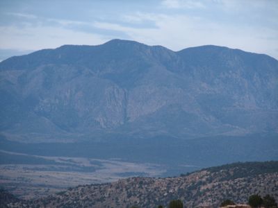
Signal Peak, Mountain summit in Washington County, United States.
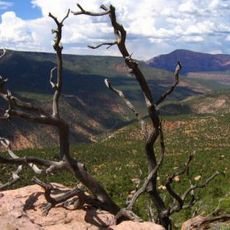
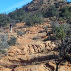
Signal Peak is a mountain summit in Washington County located in southern Utah that rises to about 5,100 feet above sea level. The peak stands out as a prominent landmark in the surrounding terrain due to its elevation and distinctive shape.
The peak played a strategic role during World War II when navigation aids were positioned at the site to assist military operations. A fire observation tower was later constructed at the location to monitor the surrounding forest lands.
The peak lies within Yakama Nation territory, and the landscape holds meaning for the people whose ancestors have lived and traveled through these mountains for generations.
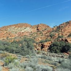
The trail to the summit is suitable for hikers with moderate fitness levels and passes through several different elevations and forest zones. Visitors should bring appropriate gear and supplies, as the route takes several hours to complete.
A fire observation tower stands at the summit, having been relocated from another location to serve this peak. The tower represents a piece of heritage fire management infrastructure that remains functional and visible to hikers.
Location: Washington County
GPS coordinates: 37.31970,-113.49162
Latest update: December 12, 2025 12:06
Snow Canyon State Park
18.5 km
Tuacahn
20.7 km
Santa Clara Volcano
13.8 km
Quail Creek State Park
17 km
Red Cliffs National Conservation Area
19 km
Mountain Meadows
21.9 km
Pine Valley Chapel and Tithing Office
8.3 km
Blackridge Wilderness
23.7 km
Cottonwood Canyon Wilderness
12.7 km
Hurricane Canal
24.2 km
Hurricane-LaVerkin Bridge
24.4 km
Red Mountain Wilderness
20.5 km
Elephant Arch
15.9 km
Wells Fargo and Company Express Building
13.3 kmPadre Canyon
20.9 km
St. George Opera House
24.5 km
John Steele House
19.6 km
Naegle Winery
19 km
Robert D. Covington House
20.6 km
Thomas Forsyth House
19.8 km
Washington Relief Society Hall
21.2 km
Leeds Tithing Office
14.7 km
Hurricane Valley Heritage Park Museum
24 km
Mountain Meadows Massacre Site
21.9 km
Quail Creek Reservoir
18.2 km
Cottontown Village
21.1 km
Toquerville Hall
19.7 km
Petrified Sand Dunes
18 kmVisited this place? Tap the stars to rate it and share your experience / photos with the community! Try now! You can cancel it anytime.
Discover hidden gems everywhere you go!
From secret cafés to breathtaking viewpoints, skip the crowded tourist spots and find places that match your style. Our app makes it easy with voice search, smart filtering, route optimization, and insider tips from travelers worldwide. Download now for the complete mobile experience.
A unique approach to discovering new places❞
— Le Figaro
All the places worth exploring❞
— France Info
A tailor-made excursion in just a few clicks❞
— 20 Minutes