Hurricane Canal

Log in to your account

AroundUs is a community-driven map of interesting places, built by curious explorers like you. It grows with every review, story, and photo you share.
Connect to save your favorite spots, contribute locations, and create personalized routes.
Continue with Google
Continue with Apple
Continue with X
Continue with Facebook
Continue with email
By continuing, you accept our Terms and Conditions and our Privacy Policy
Create an account
Add to collection
Map
Suggest a change
Share

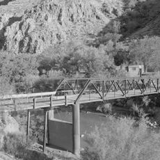
Hurricane Canal, Irrigation canal in Hurricane, Utah, United States.

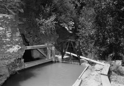
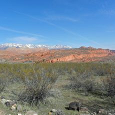
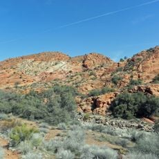
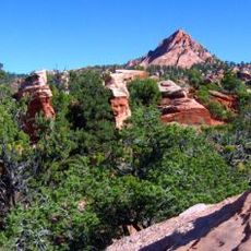
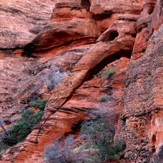
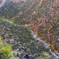
Hurricane Canal is an irrigation system that carries water through the Virgin River Canyon in southwestern Utah. The structure includes tunnels carved into rock and metal flumes that direct water across the desert terrain.

Settlers started hand-digging this canal in 1891 to divert water from the Virgin River. The project took roughly a decade to complete and allowed the Hurricane community to turn the surrounding desert into farmland.

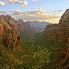
The canal shaped how the community developed and how people lived with the desert around them. Walking along it today, you can see the marks of their work and understand why water meant everything to life here.

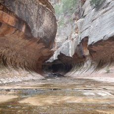
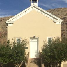
The canal is partly accessible to visitors who want to see the engineering work up close. Wear sturdy shoes and be prepared for uneven paths along the route.

Old concrete cisterns still stand along the canal, reminders of times when water was precious in this region. Most of the original tunnels remain intact and can be explored by those walking the path.

Location: Washington County

GPS coordinates: 37.18460,-113.27800

Latest update: December 14, 2025 12:27

Photos
Around this place
Zion Canyon
United States of America

Zion Canyon

23.7 km
Sand Hollow State Park
United States of America

Sand Hollow State Park

11.6 km
The Subway
United States of America

The Subway

24.4 km
Quail Creek State Park
United States of America

Quail Creek State Park

9.5 km
Red Cliffs National Conservation Area
United States of America

Red Cliffs National Conservation Area

24.7 km
Signal Peak
United States of America

Signal Peak

24.2 km
Hurricane Mesa
United States of America

Hurricane Mesa

8.6 km
Blackridge Wilderness
United States of America

Blackridge Wilderness

17.8 km
Cottonwood Canyon Wilderness
United States of America

Cottonwood Canyon Wilderness

17.7 km
Red Butte Wilderness
United States of America

Red Butte Wilderness

22.4 km
Hurricane-LaVerkin Bridge
United States of America

Hurricane-LaVerkin Bridge

888 m
Elephant Arch
United States of America

Elephant Arch

19.2 km
Towers of the Virgin
United States of America

Towers of the Virgin

23.7 km
Wells Fargo and Company Express Building
United States of America

Wells Fargo and Company Express Building

11 km
Rockville Bridge (Rockville, Utah)
United States of America

Rockville Bridge (Rockville, Utah)

21.5 km
John Steele House
United States of America

John Steele House

7.9 km
Naegle Winery
United States of America

Naegle Winery

7.3 km
Robert D. Covington House
United States of America

Robert D. Covington House

21 km
Thomas Forsyth House
United States of America

Thomas Forsyth House

7.6 km
Washington Relief Society Hall
United States of America

Washington Relief Society Hall

22 km
Leeds Tithing Office
United States of America

Leeds Tithing Office

9.4 km
James Jepson Jr. House
United States of America

James Jepson Jr. House

8.4 km
Hurricane Valley Heritage Park Museum
United States of America

Hurricane Valley Heritage Park Museum

1.3 km
Quail Creek Reservoir
United States of America

Quail Creek Reservoir

10.3 km
Cottontown Village
United States of America

Cottontown Village

21.9 km
Great West Canyon
United States of America

Great West Canyon

18.9 km
Herbert & Lillian Christensen House
United States of America

Herbert & Lillian Christensen House

24.6 km
Toquerville Hall
United States of America

Toquerville Hall

7.8 km
Show the full map
Reviews

Visited this place? Tap the stars to rate it and share your experience / photos with the community! Try now! You can cancel it anytime.

« Hurricane Canal - Irrigation canal in Hurricane, Utah, United States » is provided by Around Us (aroundus.com). Images and texts are derived from Wikimedia project under a Creative Commons license. You are allowed to copy, distribute, and modify copies of this page, under the conditions set by the license, as long as this note is clearly visible.

Discover hidden gems everywhere you go!

From secret cafés to breathtaking viewpoints, skip the crowded tourist spots and find places that match your style. Our app makes it easy with voice search, smart filtering, route optimization, and insider tips from travelers worldwide. Download now for the complete mobile experience.

Around Us App Screenshot

A unique approach to discovering new places

Le Figaro

All the places worth exploring

France Info

A tailor-made excursion in just a few clicks

20 Minutes