Chest opened
+${chestReward.xp} XP
Explorer
NOUVEAU ×${chestReward.collectible.quantity}
tapez pour fermer

See the monuments around you in AR Open chests in the app

Around Us is built for your phone — point your camera at the streets and discover the monuments and places around you in augmented reality. Around Us is built for your phone — chests unlock when you walk, explore and capture nearby places.

Enable Location

We need your location to show you interesting places around you

Discover nearby places

Find interesting locations and hidden gems around you

Precise directions

Get accurate directions and distances to places

Your location is never shared with other users. It's only used when you tap the location button.

Sand Hollow State Park

Log in to your account

Start exploring — it's free

Trusted by 86,897 travelers worldwide

Continue with Google
Continue with Apple
or

We will send you a code to connect

By continuing, you accept our Terms and Conditions and our Privacy Policy

Check your inbox

We've sent a pincode in your inbox. Please enter the code below.

Sand Hollow State Park
Discussion Reviews 1 Photos
16.9k Popularity

Sand Hollow State Park, State park in Washington County, Utah.

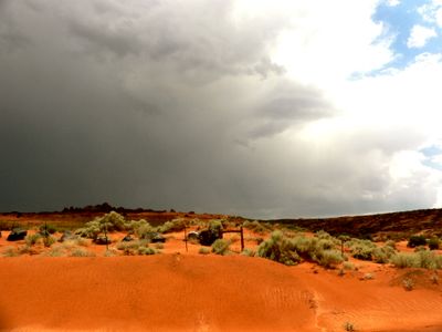
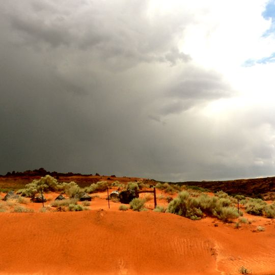
Sand Hollow State Park is a protected area in Washington County in southern Utah that spreads around an artificial reservoir. The grounds show rust-red sandstone cliffs reaching down to the shoreline and a large water basin that extends between desert hills.

The grounds started filling with water in 2002 after a dam was built for storage. The park opened officially as a recreation site one year later.

This body of water draws motorhome travelers who settle along the shores and stay for days, while the boat ramps fill on weekends. Divers return regularly to visit the submerged targets and take underwater photographs.

The camping areas sit on the west side of the reservoir and offer access to restrooms and showers. Those staying for just one day can buy a permit online for water activities and drive straight to the shoreline zone.

Divers can find an old Volkswagen bus and a twin-engine Cessna 320 airplane underwater, both placed there on purpose. These objects sit at different depths and serve as reference points for diving exercises.

The community of curious travelers

AroundUs brings together thousands of curated places, local tips, and hidden gems, enriched daily by 60,000 contributors worldwide.

Start exploring
Inception
2003
GPS coordinates
37.11560,-113.37600
Latest update
September 12, 2026 02:44
Around this place
St. George Utah Temple
United States of America

St. George Utah Temple

11.2 mi
Quail Creek State Park
United States of America

Quail Creek State Park

5.1 mi
Red Cliffs National Conservation Area
United States of America

Red Cliffs National Conservation Area

8.3 mi
Cottonwood Canyon Wilderness
United States of America

Cottonwood Canyon Wilderness

8.3 mi
Webb Hill
United States of America

Webb Hill

11.4 mi
Hurricane Canal
United States of America

Hurricane Canal

7.2 mi
Hurricane-LaVerkin Bridge
United States of America

Hurricane-LaVerkin Bridge

7.8 mi
Elephant Arch
United States of America

Elephant Arch

7.8 mi
Wells Fargo and Company Express Building
United States of America

Wells Fargo and Company Express Building

9.5 mi
St. George Children's Museum
United States of America

St. George Children's Museum

11.5 mi
St. George Opera House
United States of America

St. George Opera House

11.4 mi
Old Washington County Courthouse
United States of America

Old Washington County Courthouse

11.3 mi
John Steele House
United States of America

John Steele House

10.9 mi
Naegle Winery
United States of America

Naegle Winery

10.2 mi
Robert D. Covington House
United States of America

Robert D. Covington House

7.3 mi
Thomas Judd House
United States of America

Thomas Judd House

11.5 mi
Thomas Forsyth House
United States of America

Thomas Forsyth House

10.7 mi
Orson Pratt House
United States of America

Orson Pratt House

11.5 mi
Washington Relief Society Hall
United States of America

Washington Relief Society Hall

7.8 mi
Leeds Tithing Office
United States of America

Leeds Tithing Office

8.4 mi
Hurricane Valley Heritage Park Museum
United States of America

Hurricane Valley Heritage Park Museum

6.4 mi
Elephant Arch
United States of America

Elephant Arch

7.8 mi
Quail Creek Reservoir
United States of America

Quail Creek Reservoir

4.3 mi
Cottontown Village
United States of America

Cottontown Village

7.8 mi
Main Building of Dixie College
United States of America

Main Building of Dixie College

11.4 mi
Toquerville Hall
United States of America

Toquerville Hall

10.9 mi
Pioneer Courthouse
United States of America

Pioneer Courthouse

11.3 mi
Little Black Mountain Petroglyph Site
United States of America

Little Black Mountain Petroglyph Site

11.6 mi
Show the full map
Reviews
Share your experience

No review yet

Discussions
Start a discussion...

No discussion yet

« Sand Hollow State Park - State park in Washington County, Utah » is provided by Around Us (aroundus.com). Images and texts are derived from Wikimedia project under a Creative Commons license. You are allowed to copy, distribute, and modify copies of this page, under the conditions set by the license, as long as this note is clearly visible.

Discover hidden gems everywhere you go!

From secret cafés to breathtaking viewpoints, skip the crowded tourist spots and find places that match your style. Our app makes it easy with voice search, smart filtering, route optimization, and insider tips from travelers worldwide. Download now for the complete mobile experience.

Around Us App Screenshot

A unique approach to discovering new places

Le Figaro

All the places worth exploring

France Info

A tailor-made excursion in just a few clicks

20 Minutes

Around Us
Travel Guide & Maps
Download

Send to your phone

QR Code
1

Open the camera app on your mobile.

2

Point at the QR code with your camera. A notification will appear.

3

Tap the notification to open the link.