Hurricane Mesa

Log in to your account

AroundUs is a community-driven map of interesting places, built by curious explorers like you. It grows with every review, story, and photo you share.
Connect to save your favorite spots, contribute locations, and create personalized routes.
By continuing, you accept our Terms and Conditions and our Privacy Policy
Add to collection
Map
Suggest a change
Share

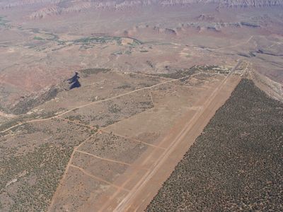
Hurricane Mesa, Summit and test facility in Washington County, United States

Hurricane Mesa is a high plateau in Washington County featuring a test track and research installations across its elevated surface. The site spans considerable space and serves various scientific purposes.

The U.S. Air Force established the test facility in the 1950s, making it a center for aircraft research. This early phase shaped the site's role in aviation technology development.

The facility marks a significant chapter in American aerospace development, contributing to aviation safety through extensive ejection seat testing programs.

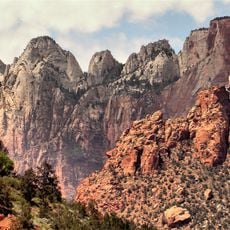
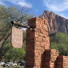
The site lies west of Virgin and is accessible via Highway 9 between LaVerkin and Zion National Park. Visitors should check accessibility in advance, as the facility is not always open to the public.

The location hosted high-speed experiments that set records in vehicle technology. These tests helped explore new boundaries in safety and performance engineering.

Location: Washington County

Elevation above the sea: 1,586 m

GPS coordinates: 37.24026,-113.21134

Latest update: December 12, 2025 14:20

Photos
Around this place
Zion Canyon
United States of America

Zion Canyon

19.6 km
Sand Hollow State Park
United States of America

Sand Hollow State Park

20.1 km
The Subway
United States of America

The Subway

16.2 km
Quail Creek State Park
United States of America

Quail Creek State Park

16.3 km
Zion Wilderness
United States of America

Zion Wilderness

17.6 km
Blackridge Wilderness
United States of America

Blackridge Wilderness

11.1 km
Hurricane Canal
United States of America

Hurricane Canal

8.6 km
Red Butte Wilderness
United States of America

Red Butte Wilderness

14.2 km
Hurricane-LaVerkin Bridge
United States of America

Hurricane-LaVerkin Bridge

7.7 km
Towers of the Virgin
United States of America

Towers of the Virgin

17.2 km
Wells Fargo and Company Express Building
United States of America

Wells Fargo and Company Express Building

13.9 km
Rockville Bridge (Rockville, Utah)
United States of America

Rockville Bridge (Rockville, Utah)

17.9 km
John Steele House
United States of America

John Steele House

6.8 km
Naegle Winery
United States of America

Naegle Winery

7.6 km
Thomas Forsyth House
United States of America

Thomas Forsyth House

6.7 km
Leeds Tithing Office
United States of America

Leeds Tithing Office

13.4 km
James Jepson Jr. House
United States of America

James Jepson Jr. House

5.1 km
South Entrance Sign
United States of America

South Entrance Sign

20.2 km
Hurricane Valley Heritage Park Museum
United States of America

Hurricane Valley Heritage Park Museum

9.9 km
Oak Creek Historic District
United States of America

Oak Creek Historic District

20.3 km
Zion Canyon Visitor Center
United States of America

Zion Canyon Visitor Center

20.4 km
Quail Creek Reservoir
United States of America

Quail Creek Reservoir

17.6 km
South Campground
United States of America

South Campground

20.6 km
Watchman Campground
United States of America

Watchman Campground

20.5 km
The Streaked Wall
United States of America

The Streaked Wall

20.2 km
Watchman Campground Amphitheater
United States of America

Watchman Campground Amphitheater

20.2 km
Herbert & Lillian Christensen House
United States of America

Herbert & Lillian Christensen House

19.5 km
Toquerville Hall
United States of America

Toquerville Hall

6.7 km
Show the full map
Reviews

Visited this place? Tap the stars to rate it and share your experience / photos with the community! Try now! You can cancel it anytime.

« Hurricane Mesa - Summit and test facility in Washington County, United States » is provided by Around Us (aroundus.com). Images and texts are derived from Wikimedia project under a Creative Commons license. You are allowed to copy, distribute, and modify copies of this page, under the conditions set by the license, as long as this note is clearly visible.

Discover hidden gems everywhere you go!

From secret cafés to breathtaking viewpoints, skip the crowded tourist spots and find places that match your style. Our app makes it easy with voice search, smart filtering, route optimization, and insider tips from travelers worldwide. Download now for the complete mobile experience.

Around Us App Screenshot

A unique approach to discovering new places

Le Figaro

All the places worth exploring

France Info

A tailor-made excursion in just a few clicks

20 Minutes