Enable Location

We need your location to show you interesting places around you

Discover nearby places

Find interesting locations and hidden gems around you

Precise directions

Get accurate directions and distances to places

Your location is never shared with other users. It's only used when you tap the location button.

Marysvale Canyon

Log in to your account

Start exploring — it's free

Trusted by 62,473 travelers worldwide

Continue with Google
Continue with Apple
or

We will send you a code to connect

By continuing, you accept our Terms and Conditions and our Privacy Policy

Check your inbox

We've sent a pincode in your inbox. Please enter the code below.

Marysvale Canyon

Marysvale Canyon, canyon in Piute and Sevier counties in Utah, United States

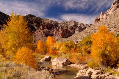
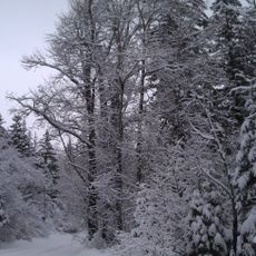
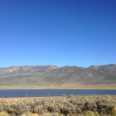
Marysvale Canyon, also called Sevier Canyon, is a narrow valley stretching through Piute and Sevier counties with the Sevier River flowing at its base. Canyon walls of reddish and gray stone rise steeply on both sides, while a network of hiking trails and a popular bike path provide access to activities like rafting, fishing, and camping.

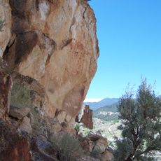
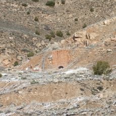
The valley was shaped long ago by flowing water and weathering, serving early settlers as a place for shelter and resources. A significant historical thread connects the area to gold discoveries in 1868 and a railroad line built later, with its tunnel still visible in the canyon today.

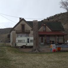
The canyon's name traces back to early settlers who found the valley fertile and welcoming. Today, visitors come here to experience quiet moments in nature, walking along trails and taking in views of the river and distant mountains.

The best time to visit is from late spring through early fall when weather is favorable for hiking and relaxation. Bring water, wear comfortable shoes with good grip, and take time to explore the surroundings at a slow pace.

Inside the canyon sits a railroad tunnel called Eagle Rock Tunnel, roughly 200 feet long, carved into the rock many years ago for a train line. Standing at the tunnel's entrance offers a glimpse into the past and invites visitors to imagine the trains that once traveled through these mountains.

The community of curious travelers

AroundUs brings together thousands of curated places, local tips, and hidden gems, enriched daily by 60,000 contributors worldwide.

Start exploring
Location
Location
GPS coordinates
38.51670,-112.26700
Latest update
February 9, 2026 11:06
Around this place
Mystic Hot Springs
United States of America

Mystic Hot Springs

18.9 km
Fremont Indian State Park and Museum
United States of America

Fremont Indian State Park and Museum

9 km
Delano Peak
United States of America

Delano Peak

18.8 km
Fort Cameron
United States of America

Fort Cameron

39.3 km
Frisco Charcoal Kilns
United States of America

Frisco Charcoal Kilns

6.3 km
Meeting Hall
United States of America

Meeting Hall

41.9 km
Piute County Courthouse
United States of America

Piute County Courthouse

31.4 km
Richfield Carnegie Library
United States of America

Richfield Carnegie Library

32.3 km
Beaver County Courthouse
United States of America

Beaver County Courthouse

42.1 km
Monroe Presbyterian Church
United States of America

Monroe Presbyterian Church

18.2 km
Jens Larson Jenson Lime Kiln
United States of America

Jens Larson Jenson Lime Kiln

34.6 km
Martin Johnson House
United States of America

Martin Johnson House

36 km
Elsinore White Rock Schoolhouse
United States of America

Elsinore White Rock Schoolhouse

21.5 km
Sarah Eliza Harris House
United States of America

Sarah Eliza Harris House

41.6 km
James Boyter House
United States of America

James Boyter House

42.2 km
John and Ella Morrill House
United States of America

John and Ella Morrill House

31.3 km
Soren Simonsen House
United States of America

Soren Simonsen House

18.2 km
Charles Dennis White House
United States of America

Charles Dennis White House

41.8 km
William Burt House
United States of America

William Burt House

41.6 km
Kanosh Tithing Office
United States of America

Kanosh Tithing Office

35 km
Monroe City Hall
United States of America

Monroe City Hall

18.1 km
Edward Bird House
United States of America

Edward Bird House

42.1 km
Alma Crosby House
United States of America

Alma Crosby House

42 km
Edward Fernley House
United States of America

Edward Fernley House

41.8 km
James Fennemore House
United States of America

James Fennemore House

42 km
Louis W. Harris House
United States of America

Louis W. Harris House

41.7 km
Bullion Canyon
United States of America

Bullion Canyon

11.3 km
Koosharem Reservoir
United States of America

Koosharem Reservoir

38.2 km
Show the full map
« Marysvale Canyon - canyon in Piute and Sevier counties in Utah, United States » is provided by Around Us (aroundus.com). Images and texts are derived from Wikimedia project under a Creative Commons license. You are allowed to copy, distribute, and modify copies of this page, under the conditions set by the license, as long as this note is clearly visible.

Discover hidden gems everywhere you go!

From secret cafés to breathtaking viewpoints, skip the crowded tourist spots and find places that match your style. Our app makes it easy with voice search, smart filtering, route optimization, and insider tips from travelers worldwide. Download now for the complete mobile experience.

Around Us App Screenshot

A unique approach to discovering new places

Le Figaro

All the places worth exploring

France Info

A tailor-made excursion in just a few clicks

20 Minutes

Around Us
Travel Guide & Maps
Download

Send to your phone

QR Code
1

Open the camera app on your mobile.

2

Point at the QR code with your camera. A notification will appear.

3

Tap the notification to open the link.