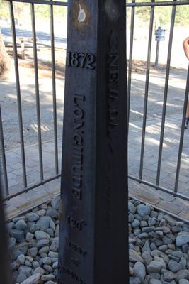
1872 California-Nevada State Boundary Marker, Political boundary marker in Washoe County and Sierra County, United States.
The 1872 California-Nevada State Boundary Marker is a cast iron obelisk placed on the state line between California and Nevada to mark the official division between the two territories. It stands within a small landscaped park area and is enclosed by a protective fence.
The obelisk was erected in 1872 under the direction of Alexey Von Schmidt, completing decades of survey work that had started in 1855. Its placement marked the end of the official border delineation process between California and Nevada.
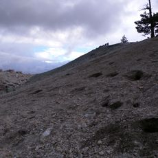
The marker makes the border between California and Nevada tangible for anyone who visits. It shows how territorial lines were once made visible for settlers and travelers crossing this mountain landscape.
The marker is enclosed within a fenced area that allows for comfortable viewing up close. A visit during the drier months is a good idea, as the surrounding mountain region can be hard to reach in winter.
The obelisk stands about 525 feet (160 meters) west of the 120-degree longitude line it was meant to mark. This offset is a direct result of how hard it was to take accurate measurements in rough mountain terrain with the tools available at the time.
The community of curious travelers
AroundUs brings together thousands of curated places, local tips, and hidden gems, enriched daily by 60,000 contributors worldwide.