Chest opened
+${chestReward.xp} XP
Explorer
NOUVEAU ×${chestReward.collectible.quantity}
tapez pour fermer

See the monuments around you in AR Open chests in the app

Around Us is built for your phone — point your camera at the streets and discover the monuments and places around you in augmented reality. Around Us is built for your phone — chests unlock when you walk, explore and capture nearby places.

Enable Location

We need your location to show you interesting places around you

Discover nearby places

Find interesting locations and hidden gems around you

Precise directions

Get accurate directions and distances to places

Your location is never shared with other users. It's only used when you tap the location button.

Log in to your account

Start exploring — it's free

Trusted by 85,029 travelers worldwide

Continue with Google
Continue with Apple
or

We will send you a code to connect

By continuing, you accept our Terms and Conditions and our Privacy Policy

Check your inbox

We've sent a pincode in your inbox. Please enter the code below.

Stampede Dam
Discussion Reviews Photo
2.7k Popularity

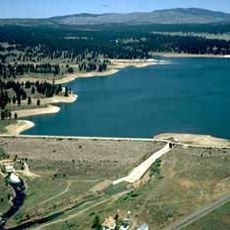
Stampede Dam, Embankment dam in Sierra County, California.

Stampede Dam is an embankment dam on the Little Truckee River in Sierra County that creates a large reservoir for water storage. The structure holds back water to form a lake surrounded by steep mountain terrain and forest.

The dam was completed in 1970 by the United States Bureau of Reclamation as part of a regional water management program. Its construction marked an important step in developing water infrastructure for the Sierra Nevada region.

The reservoir has become a popular fishing destination where people come to catch kokanee salmon and several trout species in the cool mountain water. This fishing tradition shapes how locals and visitors use the place throughout the year.

Visitors can view the dam and its reservoir from Stampede Vista Point, which provides clear observation areas and parking. The vista point is easy to reach and offers good spots for photographs and observation.

The dam was designed specifically to help endangered cui-ui fish spawn downstream and to boost fishing potential in the area. This ecological purpose sets it apart from many other water structures that focus only on water storage.

The community of curious travelers

AroundUs brings together thousands of curated places, local tips, and hidden gems, enriched daily by 60,000 contributors worldwide.
Start exploring
Location
GPS coordinates
39.47550,-120.10400
Latest update
August 30, 2026 22:26
Around this place
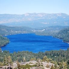
Donner Lake
United States of America

Donner Lake

13.6 mi
Boca Reservoir
United States of America

Boca Reservoir

5.9 mi
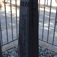
1872 California-Nevada State Boundary Marker
United States of America

1872 California-Nevada State Boundary Marker

6.4 mi
Castle Peak
United States of America

Castle Peak

15.1 mi
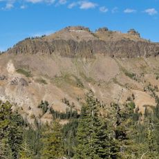
Crystal Peak
United States of America

Crystal Peak

5.7 mi
Reno Nevada Temple
United States of America

Reno Nevada Temple

11.7 mi
Lear Theatre
United States of America

Lear Theatre

15.5 mi
Greystone Castle
United States of America

Greystone Castle

15.4 mi
Luella Garvey House
United States of America

Luella Garvey House

15.5 mi
Francis G. Newlands Home
United States of America

Francis G. Newlands Home

15.5 mi
Kruger House
United States of America

Kruger House

11.3 mi
California Building
United States of America

California Building

14.8 mi
McKinley Park School
United States of America

McKinley Park School

15.3 mi
Bethel AME Church
United States of America

Bethel AME Church

15.5 mi
Hawkins House
United States of America

Hawkins House

15.6 mi
Borland-Clifford House
United States of America

Borland-Clifford House

15.6 mi
Pearl Upson House
United States of America

Pearl Upson House

15.3 mi
C. Clifton Young Federal Building and U.S. Courthouse
United States of America

C. Clifton Young Federal Building and U.S. Courthouse

15.1 mi
Nystrom Guest House
United States of America

Nystrom Guest House

15.6 mi
Humphrey House
United States of America

Humphrey House

15.6 mi
Newlands Historic District
United States of America

Newlands Historic District

15.4 mi
W.E. Barnard House
United States of America

W.E. Barnard House

15.4 mi
Joseph H. Gray House
United States of America

Joseph H. Gray House

15.6 mi
Patrick Ranch House
United States of America

Patrick Ranch House

15.5 mi
J. Clarence Kind House
United States of America

J. Clarence Kind House

15.3 mi
Commercial Row-Brickelltown Historic District
United States of America

Commercial Row-Brickelltown Historic District

11.2 mi
Miller-Rowe-Holgate House
United States of America

Miller-Rowe-Holgate House

15.4 mi
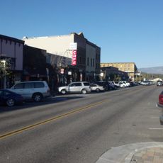
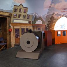
KidZone Museum
United States of America

KidZone Museum

12 mi
Show the full map
Reviews
Share your experience

No review yet

Discussions
Start a discussion...

No discussion yet

« Stampede Dam - Embankment dam in Sierra County, California » is provided by Around Us (aroundus.com). Images and texts are derived from Wikimedia project under a Creative Commons license. You are allowed to copy, distribute, and modify copies of this page, under the conditions set by the license, as long as this note is clearly visible.

Discover hidden gems everywhere you go!

From secret cafés to breathtaking viewpoints, skip the crowded tourist spots and find places that match your style. Our app makes it easy with voice search, smart filtering, route optimization, and insider tips from travelers worldwide. Download now for the complete mobile experience.
Around Us App Screenshot

A unique approach to discovering new places

Le Figaro

All the places worth exploring

France Info

A tailor-made excursion in just a few clicks

20 Minutes

Around Us
Travel Guide & Maps
Download

Send to your phone

QR Code
1

Open the camera app on your mobile.

2

Point at the QR code with your camera. A notification will appear.

3

Tap the notification to open the link.