Enable Location

We need your location to show you interesting places around you

Discover nearby places

Find interesting locations and hidden gems around you

Precise directions

Get accurate directions and distances to places

Your location is never shared with other users. It's only used when you tap the location button.

Castle Peak

Log in to your account

Start exploring — it's free

Trusted by 62,377 travelers worldwide

Continue with Google
Continue with Apple
or

We will send you a code to connect

By continuing, you accept our Terms and Conditions and our Privacy Policy

Check your inbox

We've sent a pincode in your inbox. Please enter the code below.

Castle Peak

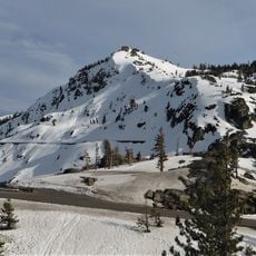
Castle Peak, Mountain summit in Nevada County, California

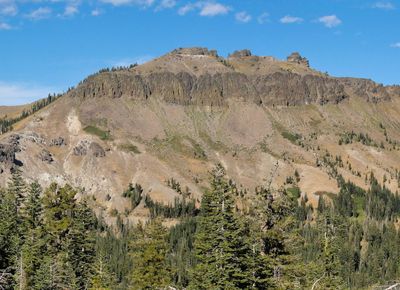
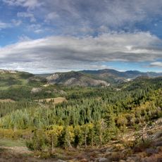
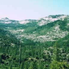
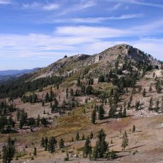
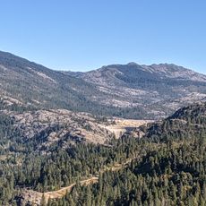
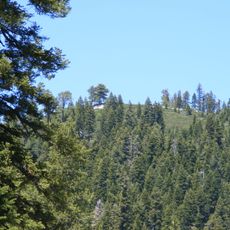
Castle Peak is a 9,103 foot summit in the Sierra Nevada featuring three prominent spires that rise above the surrounding landscape. The mountain displays both volcanic and granite rock formations across its slopes and ridges.

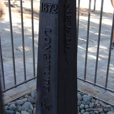
The peak was originally named Mount Stanford by the Whitney Survey between 1860 and 1874. Its current name comes from the distinctive three spires that resemble castle turrets.

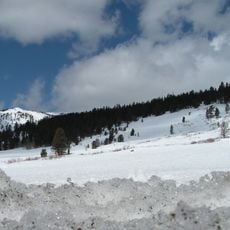
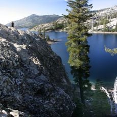
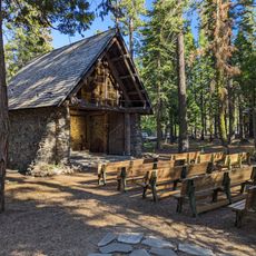
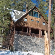
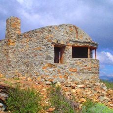
The Peter Grubb Ski Hut, constructed in 1938 near Castle Pass, functions as a Sierra Club facility offering overnight stays for outdoor enthusiasts.

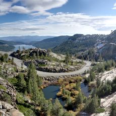
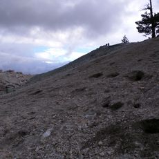
Access to the summit begins at Interstate 80 exit 176, with the hike combining moderate climbing through lower sections with steeper terrain near the top. A mountain shelter near Castle Pass provides overnight accommodation options for hikers.

The mountain sits at a geological boundary where volcanic rock transitions to granite, creating springs and meadows filled with wildflowers. This transition zone supports different plant and animal habitats within a small area.

The community of curious travelers

AroundUs brings together thousands of curated places, local tips, and hidden gems, enriched daily by 60,000 contributors worldwide.

Start exploring
Location
Location
Part of
Sierra Peaks Section Peaks List
GPS coordinates
39.36546,-120.34909
Latest update
December 11, 2025 18:11
Around this place
Donner Pass
United States of America

Donner Pass

6 km
Interstate 80 in California
United States of America

Interstate 80 in California

23.4 km
Donner Memorial State Park
United States of America

Donner Memorial State Park

10.5 km
Tahoe National Forest
United States of America

Tahoe National Forest

35.1 km
Emigrant Gap
United States of America

Emigrant Gap

28.2 km
Hell Hole Reservoir
United States of America

Hell Hole Reservoir

32 km
United States of America

Mount Pluto, California

22.7 km
French Meadows Reservoir
United States of America

French Meadows Reservoir

30.1 km
Boca Reservoir
United States of America

Boca Reservoir

22 km
1872 California-Nevada State Boundary Marker
United States of America

1872 California-Nevada State Boundary Marker

34.7 km
Crystal Peak
United States of America

Crystal Peak

31 km
Granite Chief Wilderness
United States of America

Granite Chief Wilderness

25.9 km
Granite Chief
United States of America

Granite Chief

19.4 km
Lake Spaulding Dam
United States of America

Lake Spaulding Dam

25.7 km
Donner Peak
United States of America

Donner Peak

7.1 km
Camp Robert L. Cole
United States of America

Camp Robert L. Cole

12.6 km
French Lake Reservoir
United States of America

French Lake Reservoir

17.7 km
Kruger House
United States of America

Kruger House

14.5 km
United States of America

Mount Lincoln

8.8 km
Watson Log Cabin
United States of America

Watson Log Cabin

28.2 km
Schroeder Mountain
United States of America

Schroeder Mountain

33 km
Chapel of the Transfiguration
United States of America

Chapel of the Transfiguration

29.3 km
Withers Log House
United States of America

Withers Log House

33.2 km
La Fleur du Lac
United States of America

La Fleur du Lac

33.3 km
Commercial Row-Brickelltown Historic District
United States of America

Commercial Row-Brickelltown Historic District

14.6 km
KidZone Museum
United States of America

KidZone Museum

12.5 km
Red Mountain Lookout
United States of America

Red Mountain Lookout

16.8 km
Kings Beach State Recreation Area
United States of America

Kings Beach State Recreation Area

31.2 km
Show the full map
« Castle Peak - Mountain summit in Nevada County, California » is provided by Around Us (aroundus.com). Images and texts are derived from Wikimedia project under a Creative Commons license. You are allowed to copy, distribute, and modify copies of this page, under the conditions set by the license, as long as this note is clearly visible.

Discover hidden gems everywhere you go!

From secret cafés to breathtaking viewpoints, skip the crowded tourist spots and find places that match your style. Our app makes it easy with voice search, smart filtering, route optimization, and insider tips from travelers worldwide. Download now for the complete mobile experience.

Around Us App Screenshot

A unique approach to discovering new places

Le Figaro

All the places worth exploring

France Info

A tailor-made excursion in just a few clicks

20 Minutes

Around Us
Travel Guide & Maps
Download

Send to your phone

QR Code
1

Open the camera app on your mobile.

2

Point at the QR code with your camera. A notification will appear.

3

Tap the notification to open the link.