Enable Location

We need your location to show you interesting places around you

Discover nearby places

Find interesting locations and hidden gems around you

Precise directions

Get accurate directions and distances to places

Your location is never shared with other users. It's only used when you tap the location button.

Donner Peak

Log in to your account

Start exploring — it's free

Trusted by 63,232 travelers worldwide

Continue with Google
Continue with Apple
or

We will send you a code to connect

By continuing, you accept our Terms and Conditions and our Privacy Policy

Check your inbox

We've sent a pincode in your inbox. Please enter the code below.

Donner Peak
Discussion Reviews 1 Photos
2.8k Popularity

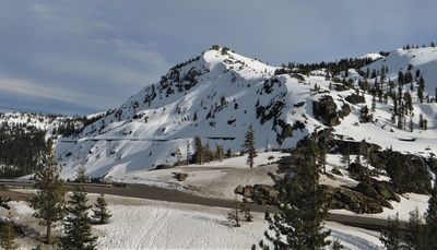
Donner Peak, Mountain summit in Placer County, California.

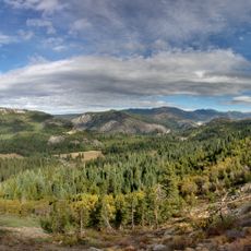
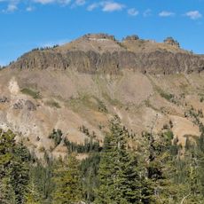
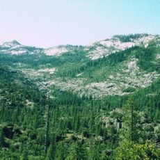
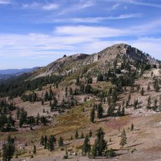
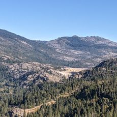
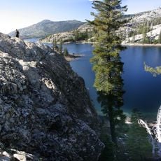
Donner Peak is a mountain summit in the Sierra Nevada, rising about one mile southeast of Donner Pass. The terrain offers hikers views of surrounding slopes and the high mountain landscape of the region.

In 1865, workers of the Central Pacific Railroad drilled tunnels through the northern cliff faces to establish a railroad route across the Sierra Nevada. This was a crucial step in connecting the West Coast with the rest of the country.

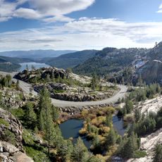
The Pacific Crest Trail passes along the western slope of Donner Peak, offering hikers panoramic views of the surrounding Sierra Nevada mountains.

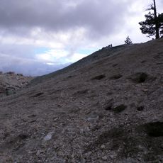
The ascent follows marked trails suitable for intermediate experience hikers and involves roughly 1,100 feet (335 meters) of elevation gain. Visitors should prepare for changing weather and bring sufficient water and supplies.

The summit receives over 10 meters of snowfall annually, making it one of the snowiest locations in continental United States. This extreme snow accumulation significantly complicated the construction of the historic railroad tunnels.

The community of curious travelers

AroundUs brings together thousands of curated places, local tips, and hidden gems, enriched daily by 60,000 contributors worldwide.

Start exploring
Location
GPS coordinates
39.30889,-120.31222
Latest update
December 12, 2025 14:26
Around this place
Donner Pass
United States of America

Donner Pass

1.1 km
Interstate 80 in California
United States of America

Interstate 80 in California

26 km
Donner Memorial State Park
United States of America

Donner Memorial State Park

6.2 km
Emigrant Gap
United States of America

Emigrant Gap

30.5 km
Hell Hole Reservoir
United States of America

Hell Hole Reservoir

26.4 km
Ed Z'berg Sugar Pine Point State Park
United States of America

Ed Z'berg Sugar Pine Point State Park

32.4 km
United States of America

Mount Pluto, California

16.7 km
French Meadows Reservoir
United States of America

French Meadows Reservoir

25.8 km
Boca Reservoir
United States of America

Boca Reservoir

20.8 km
Castle Peak
United States of America

Castle Peak

7.1 km
Crystal Peak
United States of America

Crystal Peak

33.7 km
Granite Chief Wilderness
United States of America

Granite Chief Wilderness

19.2 km
Granite Chief
United States of America

Granite Chief

12.5 km
Lake Spaulding Dam
United States of America

Lake Spaulding Dam

28.6 km
Camp Robert L. Cole
United States of America

Camp Robert L. Cole

16.4 km
French Lake Reservoir
United States of America

French Lake Reservoir

23.4 km
Kruger House
United States of America

Kruger House

10.8 km
United States of America

Mount Lincoln

2.7 km
Watson Log Cabin
United States of America

Watson Log Cabin

21.4 km
Chapel of the Transfiguration
United States of America

Chapel of the Transfiguration

22.4 km
Withers Log House
United States of America

Withers Log House

28 km
La Fleur du Lac
United States of America

La Fleur du Lac

26.3 km
Commercial Row-Brickelltown Historic District
United States of America

Commercial Row-Brickelltown Historic District

11 km
KidZone Museum
United States of America

KidZone Museum

8.6 km
Grand Lodge Casino
United States of America

Grand Lodge Casino

32.8 km
Burnt Cedar Beach
United States of America

Burnt Cedar Beach

30.4 km
Kings Beach State Recreation Area
United States of America

Kings Beach State Recreation Area

25.8 km
Red Mountain Lookout
United States of America

Red Mountain Lookout

19.9 km
Show the full map
Reviews
Share your experience

No review yet

Discussions
Start a discussion...

No discussion yet

« Donner Peak - Mountain summit in Placer County, California » is provided by Around Us (aroundus.com). Images and texts are derived from Wikimedia project under a Creative Commons license. You are allowed to copy, distribute, and modify copies of this page, under the conditions set by the license, as long as this note is clearly visible.

Discover hidden gems everywhere you go!

From secret cafés to breathtaking viewpoints, skip the crowded tourist spots and find places that match your style. Our app makes it easy with voice search, smart filtering, route optimization, and insider tips from travelers worldwide. Download now for the complete mobile experience.

Around Us App Screenshot

A unique approach to discovering new places

Le Figaro

All the places worth exploring

France Info

A tailor-made excursion in just a few clicks

20 Minutes

Around Us
Travel Guide & Maps
Download

Send to your phone

QR Code
1

Open the camera app on your mobile.

2

Point at the QR code with your camera. A notification will appear.

3

Tap the notification to open the link.