Enable Location

We need your location to show you interesting places around you

Discover nearby places

Find interesting locations and hidden gems around you

Precise directions

Get accurate directions and distances to places

Your location is never shared with other users. It's only used when you tap the location button.

Tahoe National Forest

Log in to your account

Start exploring — it's free

Trusted by 62,372 travelers worldwide

Continue with Google
Continue with Apple
or

We will send you a code to connect

By continuing, you accept our Terms and Conditions and our Privacy Policy

Check your inbox

We've sent a pincode in your inbox. Please enter the code below.

Tahoe National Forest

Tahoe National Forest, Protected forest in Sierra Nevada, California, United States.

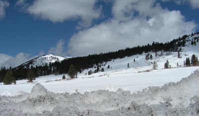
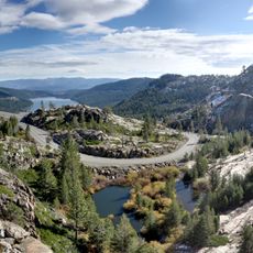
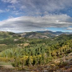
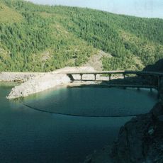
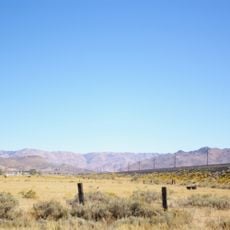
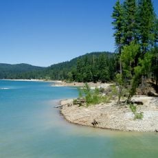
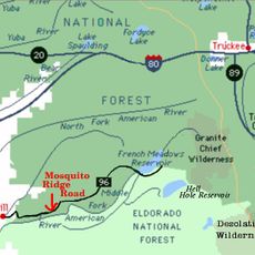
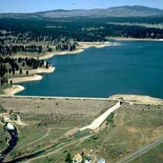
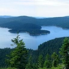
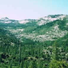
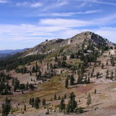
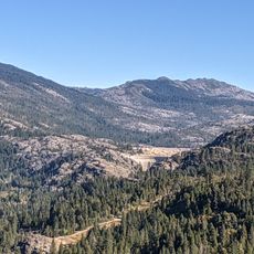
Tahoe National Forest spreads across mountain terrain with meadows, lakes, and rivers throughout the Sierra Nevada region. The landscape features diverse ecosystems that support varied outdoor activities year-round.

The area was established as Tahoe National Forest in 1905 when President Theodore Roosevelt transferred forest reserves to the U.S. Forest Service. This action marked a turning point in protecting these lands for future generations.

The Washoe Native American people lived here for centuries, relying on the lake and forests for food and materials they gathered. Their presence shaped how this landscape is understood and valued today.

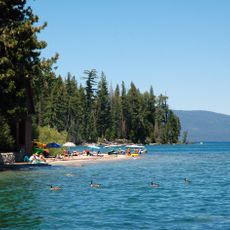
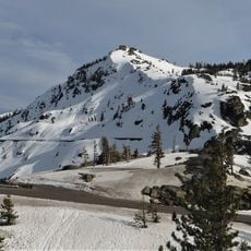
The forest has numerous campgrounds and trails open throughout the year, though winter snow may limit access to higher elevations. Visitors should prepare for changing conditions and varying altitudes before planning their activities.

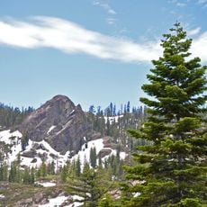
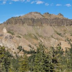
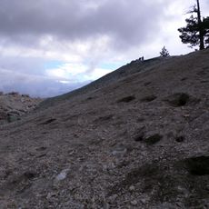
The peaks within the forest offer views that extend far beyond the immediate landscape, yet many visitors miss these vantage points. These overlooks reveal the vast scale of the high mountain terrain that surrounds them.

The community of curious travelers

AroundUs brings together thousands of curated places, local tips, and hidden gems, enriched daily by 60,000 contributors worldwide.

Start exploring
Operator
United States Forest Service
GPS coordinates
39.51207,-120.71020
Latest update
December 7, 2025 19:30
Around this place
Donner Pass
United States of America

Donner Pass

39.9 km
Interstate 80 in California
United States of America

Interstate 80 in California

23.2 km
Donner Memorial State Park
United States of America

Donner Memorial State Park

45.6 km
Empire Mine State Historic Park
United States of America

Empire Mine State Historic Park

44.7 km
New Bullards Bar Reservoir
United States of America

New Bullards Bar Reservoir

39.3 km
Emigrant Gap
United States of America

Emigrant Gap

23.6 km
Hell Hole Reservoir
United States of America

Hell Hole Reservoir

55.3 km
New Bullards Bar Dam
United States of America

New Bullards Bar Dam

39.5 km
Beckwourth Pass
United States of America

Beckwourth Pass

60.3 km
Scotts Flat Reservoir
United States of America

Scotts Flat Reservoir

32.7 km
Ed Z'berg Sugar Pine Point State Park
United States of America

Ed Z'berg Sugar Pine Point State Park

71.6 km
Plumas-Eureka State Park
United States of America

Plumas-Eureka State Park

27.7 km
Sugar Pine Reservoir
United States of America

Sugar Pine Reservoir

42.7 km
Home of Lola Montez
United States of America

Home of Lola Montez

44.8 km
United States of America

Mount Pluto, California

57.6 km
French Meadows Reservoir
United States of America

French Meadows Reservoir

49.2 km
Boca Reservoir
United States of America

Boca Reservoir

54.6 km
Castle Peak
United States of America

Castle Peak

35.1 km
Crystal Peak
United States of America

Crystal Peak

53.6 km
United States of America

Placer County Big Trees Grove

51.8 km
North Star House
United States of America

North Star House

47.4 km
Little Grass Valley Reservoir
United States of America

Little Grass Valley Reservoir

34.1 km
Granite Chief Wilderness
United States of America

Granite Chief Wilderness

55.3 km
Granite Chief
United States of America

Granite Chief

50.5 km
Nevada City Downtown Historic District
United States of America

Nevada City Downtown Historic District

38.4 km
Lake Spaulding Dam
United States of America

Lake Spaulding Dam

21.4 km
Donner Peak
United States of America

Donner Peak

41 km
Mount Saint Mary's Convent and Academy
United States of America

Mount Saint Mary's Convent and Academy

45.2 km
Show the full map
« Tahoe National Forest - Protected forest in Sierra Nevada, California, United States » is provided by Around Us (aroundus.com). Images and texts are derived from Wikimedia project under a Creative Commons license. You are allowed to copy, distribute, and modify copies of this page, under the conditions set by the license, as long as this note is clearly visible.

Discover hidden gems everywhere you go!

From secret cafés to breathtaking viewpoints, skip the crowded tourist spots and find places that match your style. Our app makes it easy with voice search, smart filtering, route optimization, and insider tips from travelers worldwide. Download now for the complete mobile experience.

Around Us App Screenshot

A unique approach to discovering new places

Le Figaro

All the places worth exploring

France Info

A tailor-made excursion in just a few clicks

20 Minutes

Around Us
Travel Guide & Maps
Download

Send to your phone

QR Code
1

Open the camera app on your mobile.

2

Point at the QR code with your camera. A notification will appear.

3

Tap the notification to open the link.