Chest opened
+${chestReward.xp} XP
Explorer
NOUVEAU ×${chestReward.collectible.quantity}
tapez pour fermer

See the monuments around you in AR Open chests in the app

Around Us is built for your phone — point your camera at the streets and discover the monuments and places around you in augmented reality. Around Us is built for your phone — chests unlock when you walk, explore and capture nearby places.

•

Enable Location

We need your location to show you interesting places around you

Discover nearby places

Find interesting locations and hidden gems around you

Precise directions

Get accurate directions and distances to places

Your location is never shared with other users. It's only used when you tap the location button.

Mount Van Cott

Log in to your account

Start exploring — it's free

Trusted by 93,676 travelers worldwide

Continue with Google
Continue with Apple
or

We will send you a code to connect

By continuing, you accept our Terms and Conditions and our Privacy Policy

Check your inbox

We've sent a pincode in your inbox. Please enter the code below.

Mount Van Cott, mountain in the Wasatch Range, Salt Lake County, Utah, United States

Mount Van Cott is a mountain in Salt Lake County near Salt Lake City with a popular hiking trail to its summit. The peak forms a gentle ridge along a larger ridgeline and offers wide views of the city, the Great Salt Lake, and surrounding mountain ranges from the top.

The mountain is named after Lucy May Van Cott, the first dean of women at the University of Utah, who served from 1907 to 1931. She was the daughter of John Van Cott. The name links the peak to the university directly east of it.

The mountain carries the name of Lucy May Van Cott, daughter of John Van Cott and dean of women at the University of Utah from 1907 to 1931. The name ties the slope above campus to the university whose students climb it from the east side.

Most summit trails branch off the Bonneville Shoreline Trail, reached directly from the east side of the University of Utah. The most obvious route follows the scar on the southwestern flank. Trails are unmarked but in good condition, and the west-side approach is the easiest, with clearer paths.

The most obvious trail to the summit is a scar visible on the mountain's southwestern flank, branching off the Bonneville Shoreline Trail. Trails are unmarked but in good condition, and the west-side approach is generally the clearest. The summit looks over the Salt Lake Valley from North Salt Lake to Point of the Mountain and Draper, with Antelope Island and the Oquirrh Range to the north and west.

The community of curious travelers

AroundUs brings together thousands of curated places, local tips, and hidden gems, enriched daily by 93,676 contributors worldwide.

Start exploring
Location
GPS coordinates
40.78177,-111.82421
Latest update
October 29, 2026 08:24
Around this place
Fort Douglas
United States of America

Fort Douglas

1.2 mi
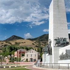
This Is the Place Heritage Park
United States of America

This Is the Place Heritage Park

2 mi
Natural History Museum of Utah
United States of America

Natural History Museum of Utah

1.2 mi
S J Quinney College of Law
United States of America

S J Quinney College of Law

2 mi
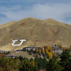
Block U
United States of America

Block U

0.8 mi
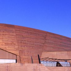
Rice–Eccles Stadium
United States of America

Rice–Eccles Stadium

2 mi
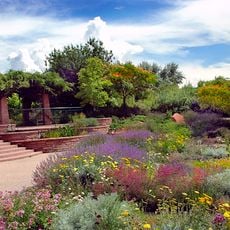
Red Butte Garden and Arboretum
United States of America

Red Butte Garden and Arboretum

1 mi
Utah Museum of Fine Arts
United States of America

Utah Museum of Fine Arts

1.8 mi
Kingsbury Hall
United States of America

Kingsbury Hall

1.8 mi
Pioneer Theatre Company
United States of America

Pioneer Theatre Company

1.9 mi
Kanzeon Zen Center
United States of America

Kanzeon Zen Center

1.8 mi
This Is The Place Heritage Park
United States of America

This Is The Place Heritage Park

2.1 mi
University of Utah Circle
United States of America

University of Utah Circle

1.8 mi
Carlson Hall
United States of America

Carlson Hall

2 mi
George S. Eccles 2002 Legacy Bridge
United States of America

George S. Eccles 2002 Legacy Bridge

1.3 mi
Emery County Cabin
United States of America

Emery County Cabin

1.9 mi
Carl M. Neuhausen House
United States of America

Carl M. Neuhausen House

1.8 mi
Hyrum T. Covey House
United States of America

Hyrum T. Covey House

1.9 mi
Charles Baldwin House
United States of America

Charles Baldwin House

2 mi
Almon A. Covey House
United States of America

Almon A. Covey House

1.9 mi
Firestation No. 8
United States of America

Firestation No. 8

2 mi
University Neighborhood Historic District
United States of America

University Neighborhood Historic District

2.1 mi
William A. Nelden House
United States of America

William A. Nelden House

2 mi
Cluff Apartments
United States of America

Cluff Apartments

1.9 mi
Walter C. Lyne House
United States of America

Walter C. Lyne House

1.9 mi
James G. McAllister House
United States of America

James G. McAllister House

2.1 mi
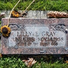
Lilly E. Gray: Victim of the Beast
United States of America

Lilly E. Gray: Victim of the Beast

1.6 mi
Living Room Trail
United States of America

Living Room Trail

1.5 mi
Show the full map
Reviews
Share your experience

No review yet

Discussions
Start a discussion...

No discussion yet

« Mount Van Cott - mountain in the Wasatch Range, Salt Lake County, Utah, United States » is provided by Around Us (aroundus.com). Images and texts are derived from Wikimedia project under a Creative Commons license. You are allowed to copy, distribute, and modify copies of this page, under the conditions set by the license, as long as this note is clearly visible.

Discover hidden gems everywhere you go!

From secret cafés to breathtaking viewpoints, skip the crowded tourist spots and find places that match your style. Our app makes it easy with voice search, smart filtering, route optimization, and insider tips from travelers worldwide. Download now for the complete mobile experience.

Around Us App Screenshot
❝

A unique approach to discovering new places❞

— Le Figaro

❝

All the places worth exploring❞

— France Info

❝

A tailor-made excursion in just a few clicks❞

— 20 Minutes

Around Us
Travel Guide & Maps
Download

Send to your phone

QR Code
1

Open the camera app on your mobile.

2

Point at the QR code with your camera. A notification will appear.

3

Tap the notification to open the link.