Fremont Island, Protected island in Great Salt Lake, Utah
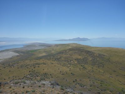
Fremont Island is an island in the Great Salt Lake in Utah, covering approximately 2,943 acres and standing as the third largest landmass in the lake. The island features sparse vegetation and natural rock formations that shape its austere landscape.
Military explorer John C. Fremont mapped this area in 1843 during an expedition. The current name became official during Howard Stansbury's survey of the region in 1850.
The Western Shoshone held this land in their traditional geography, calling it Mo'ko-mom-bitc. This connection represents their long presence in the region before European arrival.
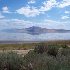
The island is accessible only by flat-bottom boats due to very shallow surrounding waters ranging from 1 to 2 feet deep. Visitors should expect challenging navigation conditions and plan around tidal patterns.
Kit Carson carved a cross into the rock during an 1843 exploration journey that remains visible today. This marking stands as one of the few physical traces left by early European expeditions in the area.
The community of curious travelers
AroundUs brings together thousands of curated places, local tips, and hidden gems, enriched daily by 60,000 contributors worldwide.