Enable Location

We need your location to show you interesting places around you

Discover nearby places

Find interesting locations and hidden gems around you

Precise directions

Get accurate directions and distances to places

Your location is never shared with other users. It's only used when you tap the location button.

Log in to your account

Start exploring — it's free

Trusted by 61,972 travelers worldwide

Continue with Google
Continue with Apple
or

We will send you a code to connect

By continuing, you accept our Terms and Conditions and our Privacy Policy

Check your inbox

We've sent a pincode in your inbox. Please enter the code below.

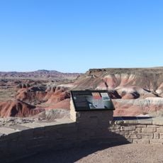
Ganado, Census-designated place in Apache County, Arizona.

Ganado is a community in the Navajo Nation in northeastern Arizona, situated at an elevation of about 6,400 feet. The area has schools from elementary through high school and a hospital that provides medical care for the region.

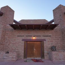
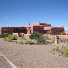
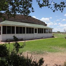
The Hubbell Trading Post was established in 1878 and is now a National Historic Site that documents trade between Navajo residents and American settlers. This building shows an important period in the history of exchange between these communities.

The community is known for the Ganado red weaving tradition, a textile style developed by local Navajo artisans with geometric patterns and characteristic color combinations. Visitors can find these handcrafted textiles throughout the region and see how this craft holds an important place in daily life here.

The place has several schools for different grade levels and a hospital for medical care. Visitors should keep in mind that the high elevation in the region can affect the weather and physical exertion.

Northern Arizona University and Diné College operate satellite campuses here, making it an educational hub within the Navajo Nation. This presence of higher education institutions offers residents and visitors opportunities for learning and cultural exchange.

The community of curious travelers

AroundUs brings together thousands of curated places, local tips, and hidden gems, enriched daily by 60,000 contributors worldwide.

Start exploring
Location
GPS coordinates
35.70250,-109.55300
Latest update
December 7, 2025 20:48
Around this place
Navajo Nation Council Chamber
United States of America

Navajo Nation Council Chamber

45.5 km
Awatovi Ruins
United States of America

Awatovi Ruins

65.5 km
Painted Desert Inn
United States of America

Painted Desert Inn

72.1 km
Navajo Nation Zoological and Botanical Park
United States of America

Navajo Nation Zoological and Botanical Park

45.6 km
Navajo Nation Museum
United States of America

Navajo Nation Museum

45.4 km
Painted Desert Community Complex Historic District
United States of America

Painted Desert Community Complex Historic District

73.6 km
Allentown Bridge
United States of America

Allentown Bridge

59.2 km
Querino Canyon Bridge
United States of America

Querino Canyon Bridge

54.1 km
McKinley County Courthouse
United States of America

McKinley County Courthouse

76 km
El Morro Theater
United States of America

El Morro Theater

75.3 km
Chief Theatre
United States of America

Chief Theatre

75.8 km
Gallup Commercial Historic District
United States of America

Gallup Commercial Historic District

75.7 km
White House Ruins
United States of America

White House Ruins

48.6 km
United States Post Office
United States of America

United States Post Office

76 km
Lebanon Lodge No. 22
United States of America

Lebanon Lodge No. 22

76.1 km
Mummy Cave Ruins
United States of America

Mummy Cave Ruins

61.6 km
Navajo Nation Museum
United States of America

Navajo Nation Museum

45.6 km
Antelope House
United States of America

Antelope House

51.6 km
Hubbell Home
United States of America

Hubbell Home

924 m
Petrified Forest National Wilderness Area
United States of America

Petrified Forest National Wilderness Area

67.8 km
Gallup Cultural Center
United States of America

Gallup Cultural Center

76 km
Window Rock
United States of America

Window Rock

45.6 km
Chinde Point
United States of America

Chinde Point

72 km
Painted Desert Visitor Center
United States of America

Painted Desert Visitor Center

73.9 km
Tiponi Point
United States of America

Tiponi Point

73.1 km
Whipple Point
United States of America

Whipple Point

74.2 km
Canyon de Chelly National Monument Visitor Center
United States of America

Canyon de Chelly National Monument Visitor Center

50.2 km
Route 66 Pullout
United States of America

Route 66 Pullout

76 km
Show the full map
« Ganado - Census-designated place in Apache County, Arizona » is provided by Around Us (aroundus.com). Images and texts are derived from Wikimedia project under a Creative Commons license. You are allowed to copy, distribute, and modify copies of this page, under the conditions set by the license, as long as this note is clearly visible.

Discover hidden gems everywhere you go!

From secret cafés to breathtaking viewpoints, skip the crowded tourist spots and find places that match your style. Our app makes it easy with voice search, smart filtering, route optimization, and insider tips from travelers worldwide. Download now for the complete mobile experience.

Around Us App Screenshot

A unique approach to discovering new places

Le Figaro

All the places worth exploring

France Info

A tailor-made excursion in just a few clicks

20 Minutes

Around Us
Travel Guide & Maps
Download

Send to your phone

QR Code
1

Open the camera app on your mobile.

2

Point at the QR code with your camera. A notification will appear.

3

Tap the notification to open the link.