Enable Location

We need your location to show you interesting places around you

Discover nearby places

Find interesting locations and hidden gems around you

Precise directions

Get accurate directions and distances to places

Your location is never shared with other users. It's only used when you tap the location button.

Awatovi Ruins

Log in to your account

Start exploring — it's free

Trusted by 61,578 travelers worldwide

Continue with Google
Continue with Apple
or

We will send you a code to connect

By continuing, you accept our Terms and Conditions and our Privacy Policy

Check your inbox

We've sent a pincode in your inbox. Please enter the code below.

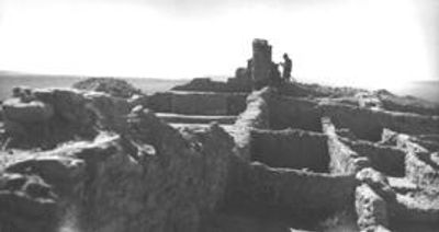
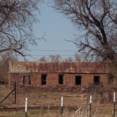
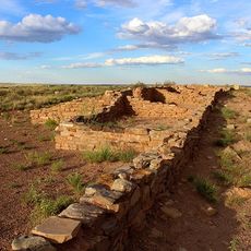
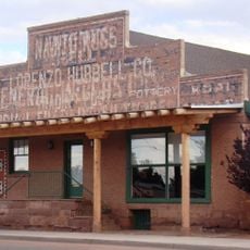
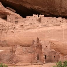
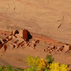
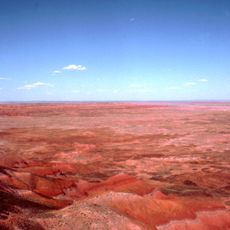
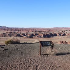
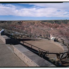
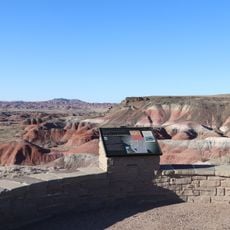
Awatovi Ruins, Archaeological site on Hopi Reservation, Arizona, US.

Description

Awatovi Ruins is an archaeological complex containing remains of Pueblo structures and a 17th-century Spanish mission in northeastern Arizona. The site shows the physical layout of residential areas, ceremonial spaces, and colonial religious buildings that reveal how this settlement was organized and used.

History

Spanish explorers reached this Pueblo settlement in the 1540s and established a Catholic mission to convert the Hopi people. The settlement was inhabited for centuries before being abandoned around 1700, likely due to conflicts and religious tension.

Culture

The pueblo features preserved kivas and ceremonial chambers where archaeologists uncovered painted murals depicting traditional Hopi religious practices and daily activities.

Practical

The site remains closed to the public due to its location on the Hopi Reservation and the need for protection and ongoing research. Visitors interested in the site should inquire with the Hopi cultural authorities about any permitted access or guided tours they may offer.

Did you know?

Excavations in the 1930s uncovered three Franciscan church structures, some extending beyond 100 feet in length. The digs also revealed more than 1,300 residential rooms, showing how densely populated this settlement once was.

Location
Location
GPS coordinates
35.71861,-110.27694
Latest update
December 9, 2025 18:40

AroundUs brings together thousands of curated places, local tips, and hidden gems, enriched daily by 60,000 contributors worldwide. Discover all places nearby (Navajo County).

Around this place
Standin' on the Corner Park
United States of America

Standin' on the Corner Park

86.3 km
Wigwam Motel
United States of America

Wigwam Motel

91.4 km
Roden Crater
United States of America

Roden Crater

94.7 km
Grand Falls
United States of America

Grand Falls

89.7 km
Chevelon Creek Bridge
United States of America

Chevelon Creek Bridge

91.5 km
Homolovi State Park
United States of America

Homolovi State Park

83.5 km
Painted Desert Inn
United States of America

Painted Desert Inn

83.4 km
Meteor City, Arizona
United States of America

Meteor City, Arizona

91.6 km
La Posada Historic District
United States of America

La Posada Historic District

86.4 km
Brigham City
United States of America

Brigham City

83.9 km
Arizona Rancho
United States of America

Arizona Rancho

91.8 km
Puerco Ruin and Petroglyphs
United States of America

Puerco Ruin and Petroglyphs

93.7 km
Painted Desert Community Complex Historic District
United States of America

Painted Desert Community Complex Historic District

85.3 km
Lorenzo Hubbell Trading Post and Warehouse
United States of America

Lorenzo Hubbell Trading Post and Warehouse

86.4 km
White House Ruins
United States of America

White House Ruins

86.2 km
Antelope House
United States of America

Antelope House

89.5 km
Hubbell Home
United States of America

Hubbell Home

64.9 km
Petrified Forest National Wilderness Area
United States of America

Petrified Forest National Wilderness Area

77.7 km
Chinde Point
United States of America

Chinde Point

82.8 km
Painted Desert Visitor Center
United States of America

Painted Desert Visitor Center

85.5 km
Tiponi Point
United States of America

Tiponi Point

84.9 km
Whipple Point
United States of America

Whipple Point

84.6 km
Canyon de Chelly National Monument Visitor Center
United States of America

Canyon de Chelly National Monument Visitor Center

82.2 km
Tawa Point
United States of America

Tawa Point

83.9 km
Route 66 Pullout
United States of America

Route 66 Pullout

85.7 km
Lacey Point
United States of America

Lacey Point

84.7 km
Obed Road Bridge
United States of America

Obed Road Bridge

86.6 km
Old Jack's Canyon Bridge
United States of America

Old Jack's Canyon Bridge

89.5 km
Show the full map
« Awatovi Ruins - Archaeological site on Hopi Reservation, Arizona, US » is provided by Around Us (aroundus.com). Images and texts are derived from Wikimedia project under a Creative Commons license. You are allowed to copy, distribute, and modify copies of this page, under the conditions set by the license, as long as this note is clearly visible.

Discover hidden gems everywhere you go!

From secret cafés to breathtaking viewpoints, skip the crowded tourist spots and find places that match your style. Our app makes it easy with voice search, smart filtering, route optimization, and insider tips from travelers worldwide. Download now for the complete mobile experience.

Around Us App Screenshot

A unique approach to discovering new places

Le Figaro

All the places worth exploring

France Info

A tailor-made excursion in just a few clicks

20 Minutes

Around Us
Travel Guide & Maps
Download

Send to your phone

QR Code
1

Open the camera app on your mobile.

2

Point at the QR code with your camera. A notification will appear.

3

Tap the notification to open the link.