Chest opened
+${chestReward.xp} XP
Explorer
NOUVEAU ×${chestReward.collectible.quantity}
tapez pour fermer
Chest locked

Open chests in the app

Around Us is built for your phone — chests unlock when you walk, explore and capture nearby places.

Enable Location

We need your location to show you interesting places around you

Discover nearby places

Find interesting locations and hidden gems around you

Precise directions

Get accurate directions and distances to places

Your location is never shared with other users. It's only used when you tap the location button.

Log in to your account

Start exploring — it's free

Trusted by 72,950 travelers worldwide

Continue with Google
Continue with Apple
or

We will send you a code to connect

By continuing, you accept our Terms and Conditions and our Privacy Policy

Check your inbox

We've sent a pincode in your inbox. Please enter the code below.

Northeast Arizona
Discussion Reviews Photo
4.9k Popularity

Northeast Arizona, Desert region in Arizona, United States

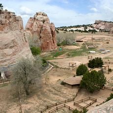
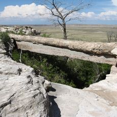
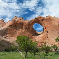
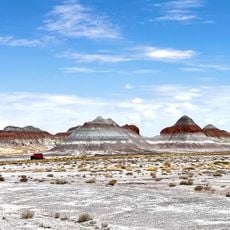
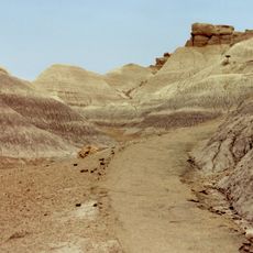
Northeast Arizona is an elevated plateau region with expansive desert landscapes, dramatic mesas, and several national parks spread across its territory. The terrain shifts between rust-colored badlands, evergreen forests at higher elevations, and wide-open grasslands dotted with buttes.

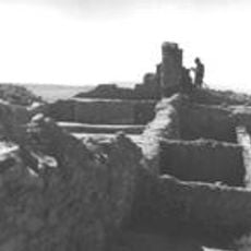
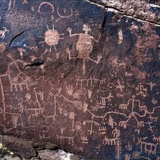
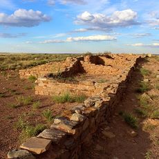
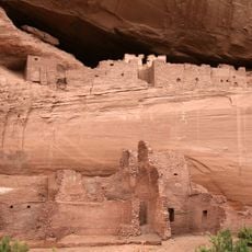
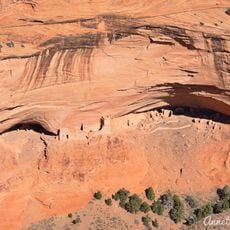
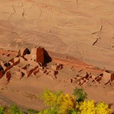
Ancestral Pueblo cultures built settlements here centuries ago before the Navajo and Apache migrated into the region around the 1400s. This shift established the demographic foundation that continues to define the area today.

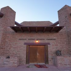
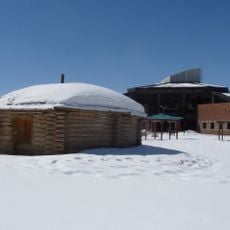
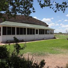
The Navajo Nation dominates this land, and their traditions shape daily life through weaving, jewelry making, and ceremonial practices visible in community spaces. Visitors see indigenous arts sold at markets and encounter stories of these peoples through local guides and galleries throughout the region.

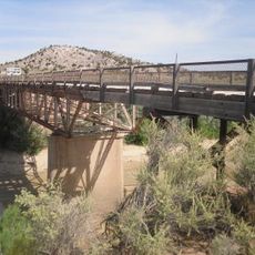
Traveling here requires your own vehicle, as public transportation is sparse between scattered attractions across the region. Roads connect the main sites, but expect long drives and significant distances between destinations.

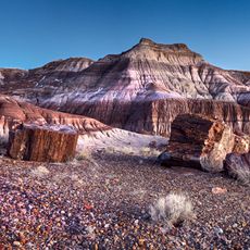
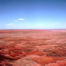
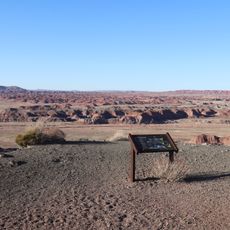
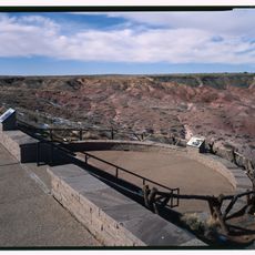
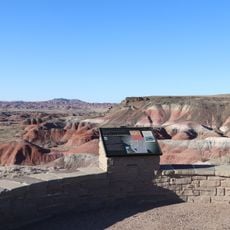
The Painted Desert displays layers of red, orange, and purple rocks that reveal millions of years of geological time. This colorful banding comes from different sediment deposits laid down in an ancient lake and river system.

The community of curious travelers

AroundUs brings together thousands of curated places, local tips, and hidden gems, enriched daily by 60,000 contributors worldwide.

Start exploring
Location
GPS coordinates
35.65000,-109.83000
Latest update
December 10, 2025 20:02
Around this place
Navajo Nation Council Chamber
United States of America

Navajo Nation Council Chamber

70.6 km
Awatovi Ruins
United States of America

Awatovi Ruins

41.1 km
Painted Desert Inn
United States of America

Painted Desert Inn

63.1 km
Navajo Nation Zoological and Botanical Park
United States of America

Navajo Nation Zoological and Botanical Park

70.5 km
Navajo Nation Museum
United States of America

Navajo Nation Museum

70.3 km
Newspaper Rock Petroglyphs Archeological District
United States of America

Newspaper Rock Petroglyphs Archeological District

76.6 km
Puerco Ruin and Petroglyphs
United States of America

Puerco Ruin and Petroglyphs

75.2 km
Painted Desert Community Complex Historic District
United States of America

Painted Desert Community Complex Historic District

64.9 km
Allentown Bridge
United States of America

Allentown Bridge

73.7 km
Querino Canyon Bridge
United States of America

Querino Canyon Bridge

66.2 km
White House Ruins
United States of America

White House Ruins

62.9 km
Agate Bridge
United States of America

Agate Bridge

84.4 km
Jasper Forest
United States of America

Jasper Forest

84.4 km
Mummy Cave Ruins
United States of America

Mummy Cave Ruins

77.6 km
Navajo Nation Museum
United States of America

Navajo Nation Museum

70.5 km
Antelope House
United States of America

Antelope House

66.3 km
Hubbell Home
United States of America

Hubbell Home

25.4 km
Petrified Forest National Wilderness Area
United States of America

Petrified Forest National Wilderness Area

57.7 km
Window Rock
United States of America

Window Rock

70.7 km
The Tepees South Pullout
United States of America

The Tepees South Pullout

78.7 km
Chinde Point
United States of America

Chinde Point

62.8 km
Tiponi Point
United States of America

Tiponi Point

64.5 km
Blue Mesa Trail
United States of America

Blue Mesa Trail

79.4 km
Painted Desert Visitor Center
United States of America

Painted Desert Visitor Center

65.2 km
Whipple Point
United States of America

Whipple Point

65 km
Tawa Point
United States of America

Tawa Point

63.5 km
Canyon de Chelly National Monument Visitor Center
United States of America

Canyon de Chelly National Monument Visitor Center

61.9 km
Route 66 Pullout
United States of America

Route 66 Pullout

66.7 km
Show the full map
Reviews
Share your experience

No review yet

Discussions
Start a discussion...

No discussion yet

« Northeast Arizona - Desert region in Arizona, United States » is provided by Around Us (aroundus.com). Images and texts are derived from Wikimedia project under a Creative Commons license. You are allowed to copy, distribute, and modify copies of this page, under the conditions set by the license, as long as this note is clearly visible.

Discover hidden gems everywhere you go!

From secret cafés to breathtaking viewpoints, skip the crowded tourist spots and find places that match your style. Our app makes it easy with voice search, smart filtering, route optimization, and insider tips from travelers worldwide. Download now for the complete mobile experience.

Around Us App Screenshot

A unique approach to discovering new places

Le Figaro

All the places worth exploring

France Info

A tailor-made excursion in just a few clicks

20 Minutes

Around Us
Travel Guide & Maps
Download

Send to your phone

QR Code
1

Open the camera app on your mobile.

2

Point at the QR code with your camera. A notification will appear.

3

Tap the notification to open the link.