Enable Location

We need your location to show you interesting places around you

Discover nearby places

Find interesting locations and hidden gems around you

Precise directions

Get accurate directions and distances to places

Your location is never shared with other users. It's only used when you tap the location button.

Mexican Hat

Log in to your account

Join the adventure

Create your free account and start exploring (like 60k+ others)

We will send you a code to connect

or
Continue with Google
Continue with Apple
By continuing, you accept our Terms and Conditions and our Privacy Policy

Check your inbox

We've sent a pincode in your inbox. Please enter the code below.

Mexican Hat, Census-designated place in San Juan County, Utah, United States

Description

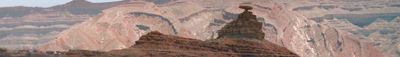
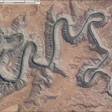
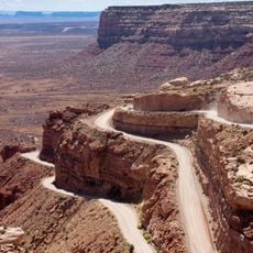
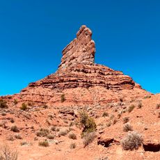
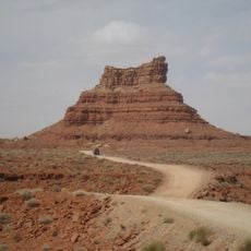
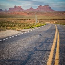
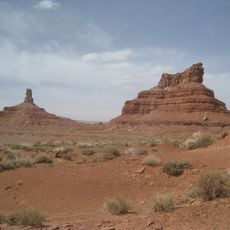
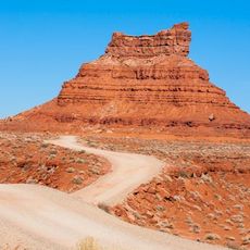
Mexican Hat is a small community in the Colorado Plateau high desert that sits along the San Juan River, surrounded by russet-colored rock formations. The setting features expansive arid landscapes with dramatic stone structures and wide open views that echo the approach to Monument Valley.

History

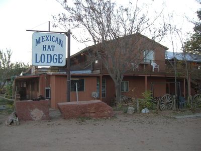
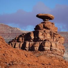
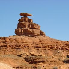
The settlement took its name from a natural rock formation that resembles a large sombrero rising at the community's edge. The place developed as a waypoint along early trade routes through this remote desert region.

Culture

The area sits near Navajo Nation lands and offers access to sacred sites and traditional communities that remain central to regional identity. Visitors encounter a landscape deeply woven into the heritage and ongoing presence of Native American peoples.

Practical

The area remains quite isolated with minimal services, so visitors should check supplies and gear before arrival. Spring and fall offer the best visiting conditions, avoiding summer heat extremes while road conditions remain most reliable.

Did you know?

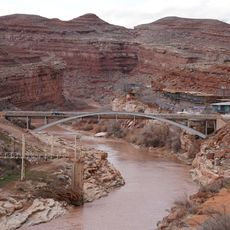
A bridge crossing the San Juan River carries the name of a local figure who served in an elite military unit. This detail ties the small community to a personal story of service that visitors might easily overlook when passing through.

Location
Elevation above the sea
1,294 m
GPS coordinates
37.16500,-109.86528
Latest update
December 20, 2025 12:18

AroundUs brings together thousands of curated places, local tips, and hidden gems, enriched daily by 60,000 contributors worldwide. Discover all places nearby (San Juan County).

« Mexican Hat - Census-designated place in San Juan County, Utah, United States » is provided by Around Us (aroundus.com). Images and texts are derived from Wikimedia project under a Creative Commons license. You are allowed to copy, distribute, and modify copies of this page, under the conditions set by the license, as long as this note is clearly visible.

Discover hidden gems everywhere you go!

From secret cafés to breathtaking viewpoints, skip the crowded tourist spots and find places that match your style. Our app makes it easy with voice search, smart filtering, route optimization, and insider tips from travelers worldwide. Download now for the complete mobile experience.

Around Us App Screenshot

A unique approach to discovering new places

Le Figaro

All the places worth exploring

France Info

A tailor-made excursion in just a few clicks

20 Minutes

Around Us
Travel Guide & Maps
Download

Send to your phone

QR Code
1

Open the camera app on your mobile.

2

Point at the QR code with your camera. A notification will appear.

3

Tap the notification to open the link.