Goblin Valley State Park

Log in to your account

AroundUs is a community-driven map of interesting places, built by curious explorers like you. It grows with every review, story, and photo you share.
Connect to save your favorite spots, contribute locations, and create personalized routes.
Continue with Google
Continue with Apple
Continue with X
Continue with Facebook
Continue with email
By continuing, you accept our Terms and Conditions and our Privacy Policy
Create an account
Add to collection
Map
Suggest a change
Share

Goblin Valley State Park, State park with rock formations in Emery County, United States

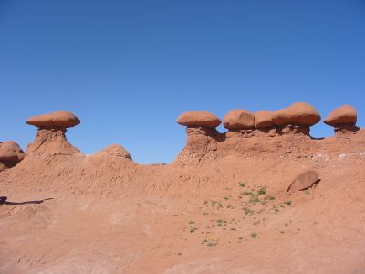
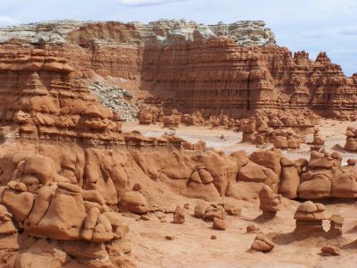
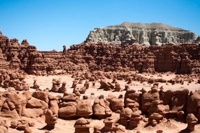
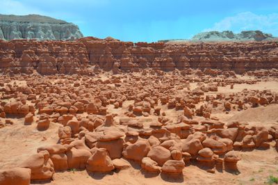
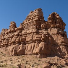
Goblin Valley State Park is a nature reserve in Emery County, Utah, where thousands of red sandstone spires spread across the desert floor. These towers carry rounded caps and look like mushroom-shaped formations or odd figures sculpted by wind and water over millions of years.

The area became known in the years after World War II, when travelers began to discover and photograph the geological shapes. Official protection as a state park followed in 1964, securing the preservation of the rock landscape for future generations.

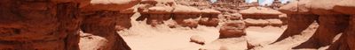
The name Goblin Valley refers to the fairytale creatures the rock shapes resemble, with rounded heads and squat bodies. Visitors walk directly among the stone columns and experience the sensation of moving through a maze of petrified figures.

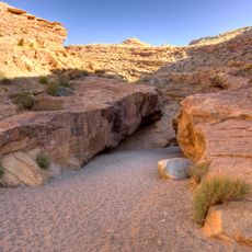
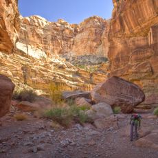
Camping areas sit near the entrance and provide starting points for hikes without fixed trails, where you walk freely among the rocks. Observation points at the edge of the valley offer an overview of the rock clusters before you descend into the formation.

The area has held International Dark Sky Park status for several years because light pollution here remains very low. The clear night sky allows you to see the Milky Way and distant star systems with the naked eye, making a visit worthwhile even after sunset.

Location: Emery County

Inception: 1964

Elevation above the sea: 1,517 m

Website: https://stateparks.utah.gov/stateparks/parks/goblin-valley

GPS coordinates: 38.56670,-110.71000

Latest update: December 17, 2025 08:27

Photos
Natural monuments in Utah: archaeological sites, rock formations, thermal springs

Utah preserves thousands of years of human history alongside some of North America's most varied geological landscapes. The region contains extensive rock art panels and Ancestral Pueblo ruins, including the 13th-century stone structures at Bears Ears National Monument and the 650-plus petroglyphs...

Reviews

Visited this place? Tap the stars to rate it and share your experience / photos with the community! Try now! You can cancel it anytime.

« Goblin Valley State Park - State park with rock formations in Emery County, United States » is provided by Around Us (aroundus.com). Images and texts are derived from Wikimedia project under a Creative Commons license. You are allowed to copy, distribute, and modify copies of this page, under the conditions set by the license, as long as this note is clearly visible.

Discover hidden gems everywhere you go!

From secret cafés to breathtaking viewpoints, skip the crowded tourist spots and find places that match your style. Our app makes it easy with voice search, smart filtering, route optimization, and insider tips from travelers worldwide. Download now for the complete mobile experience.

Around Us App Screenshot

A unique approach to discovering new places

Le Figaro

All the places worth exploring

France Info

A tailor-made excursion in just a few clicks

20 Minutes