Chest opened
+${chestReward.xp} XP
Explorer
NOUVEAU ×${chestReward.collectible.quantity}
tapez pour fermer
Chest locked

Open chests in the app

Around Us is built for your phone — chests unlock when you walk, explore and capture nearby places.

Enable Location

We need your location to show you interesting places around you

Discover nearby places

Find interesting locations and hidden gems around you

Precise directions

Get accurate directions and distances to places

Your location is never shared with other users. It's only used when you tap the location button.

Log in to your account

Start exploring — it's free

Trusted by 72,984 travelers worldwide

Continue with Google
Continue with Apple
or

We will send you a code to connect

By continuing, you accept our Terms and Conditions and our Privacy Policy

Check your inbox

We've sent a pincode in your inbox. Please enter the code below.

Animas-La Plata Water Project
Discussion Reviews Photo
2.8k Popularity

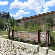
Animas-La Plata Water Project, Interbasin water transfer system in Colorado, US

The Animas-La Plata Water Project redirects water between two river basins using dams, pumping stations, and buried pipelines. It connects the Animas and La Plata basins, serving different geographic regions with water they would not naturally receive.

The project emerged after decades of negotiations between tribes, states, and federal agencies, with construction beginning in 2002. These agreements addressed long-standing water disputes in the Colorado River Basin affecting multiple jurisdictions.

The name "Animas" comes from Spanish meaning "souls," reflecting the river's deep cultural roots. Today the project shapes how communities here manage water and adapt to the needs of both tribal nations and farming regions.

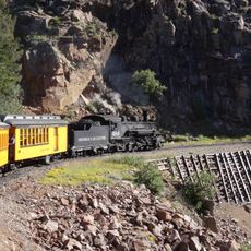
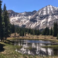
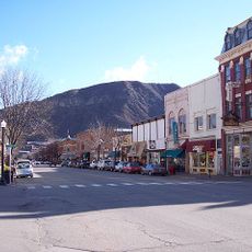
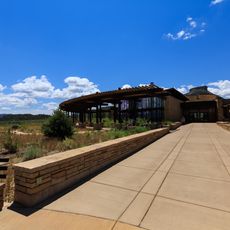
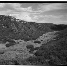
The project sits in a remote mountainous area of Colorado, so visitors need their own transportation to reach it. Most people explore it from nearby towns like Durango or Farmington, which offer access to various viewpoints around the reservoir.

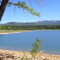
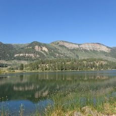
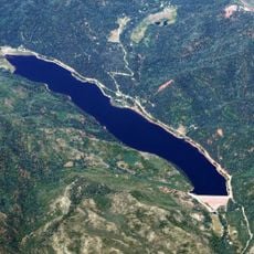
The heart of the system is Lake Nighthorse, created by an earthen dam completed in the late 2000s. The reservoir now dominates the landscape and demonstrates how engineering stores water in this mountainous region.

The community of curious travelers

AroundUs brings together thousands of curated places, local tips, and hidden gems, enriched daily by 60,000 contributors worldwide.

Start exploring
Location
GPS coordinates
37.21990,-107.89500
Latest update
December 12, 2025 14:26
Around this place
Durango and Silverton Narrow Gauge Railroad
United States of America

Durango and Silverton Narrow Gauge Railroad

8.9 km
Aztec Ruins National Monument
United States of America

Aztec Ruins National Monument

43.7 km
Hesperus Mountain
United States of America

Hesperus Mountain

30.4 km
Mancos State Park
United States of America

Mancos State Park

38.8 km
Strater Hotel
United States of America

Strater Hotel

5.8 km
Southern Ute Cultural Center and Museum
United States of America

Southern Ute Cultural Center and Museum

24.9 km
Main Avenue Historic District
United States of America

Main Avenue Historic District

6.1 km
Durango Discovery Museum
United States of America

Durango Discovery Museum

6.7 km
Labo Del Rio Bridge
United States of America

Labo Del Rio Bridge

46.3 km
Wrightsman House
United States of America

Wrightsman House

37.7 km
Aztec Ruins Administration Building-Museum
United States of America

Aztec Ruins Administration Building-Museum

43.9 km
American Hotel
United States of America

American Hotel

45.6 km
Mancos Theatre
United States of America

Mancos Theatre

37.6 km
Aztec Main Street Historic District
United States of America

Aztec Main Street Historic District

45.2 km
D.C. Ball House
United States of America

D.C. Ball House

44.9 km
Aztec Motor Company Building
United States of America

Aztec Motor Company Building

45.4 km
Bauer Bank Block
United States of America

Bauer Bank Block

37.6 km
Engleman-Thomas Building
United States of America

Engleman-Thomas Building

45.4 km
Mancos High School
United States of America

Mancos High School

37.9 km
Church Avenue-Lovers Lane Historic District
United States of America

Church Avenue-Lovers Lane Historic District

45.1 km
Haviland Lake
United States of America

Haviland Lake

35.9 km
Hillcrest Golf Club
United States of America

Hillcrest Golf Club

7.8 km
Mesa Verde Visitor and Research Center
United States of America

Mesa Verde Visitor and Research Center

47.2 km
Lemon Reservoir
United States of America

Lemon Reservoir

28.7 km
Aztec Museum
United States of America

Aztec Museum

45 km
Aztec Public Library
United States of America

Aztec Public Library

45.5 km
Prater Canyon
United States of America

Prater Canyon

47.6 km
Mesa Verde National Park Entrance Station
United States of America

Mesa Verde National Park Entrance Station

47.8 km
Show the full map
Reviews
Share your experience

No review yet

Discussions
Start a discussion...

No discussion yet

« Animas-La Plata Water Project - Interbasin water transfer system in Colorado, US » is provided by Around Us (aroundus.com). Images and texts are derived from Wikimedia project under a Creative Commons license. You are allowed to copy, distribute, and modify copies of this page, under the conditions set by the license, as long as this note is clearly visible.

Discover hidden gems everywhere you go!

From secret cafés to breathtaking viewpoints, skip the crowded tourist spots and find places that match your style. Our app makes it easy with voice search, smart filtering, route optimization, and insider tips from travelers worldwide. Download now for the complete mobile experience.

Around Us App Screenshot

A unique approach to discovering new places

Le Figaro

All the places worth exploring

France Info

A tailor-made excursion in just a few clicks

20 Minutes

Around Us
Travel Guide & Maps
Download

Send to your phone

QR Code
1

Open the camera app on your mobile.

2

Point at the QR code with your camera. A notification will appear.

3

Tap the notification to open the link.