Chest opened
+${chestReward.xp} XP
Explorer
NOUVEAU ×${chestReward.collectible.quantity}
tapez pour fermer
Chest locked

Open chests in the app

Around Us is built for your phone — chests unlock when you walk, explore and capture nearby places.

Enable Location

We need your location to show you interesting places around you

Discover nearby places

Find interesting locations and hidden gems around you

Precise directions

Get accurate directions and distances to places

Your location is never shared with other users. It's only used when you tap the location button.

Imogene Pass

Log in to your account

Start exploring — it's free

Trusted by 72,878 travelers worldwide

Continue with Google
Continue with Apple
or

We will send you a code to connect

By continuing, you accept our Terms and Conditions and our Privacy Policy

Check your inbox

We've sent a pincode in your inbox. Please enter the code below.

Imogene Pass
Discussion Reviews 1 Photos
11.6k Popularity

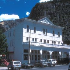
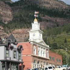
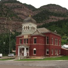
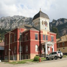
Imogene Pass, Mountain pass in San Juan Mountains, Colorado

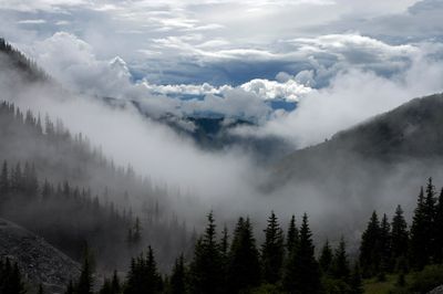
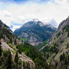
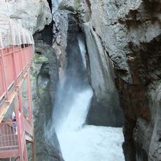
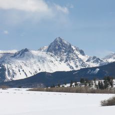
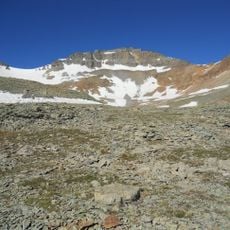
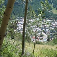
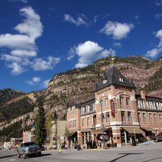
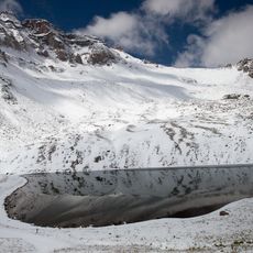
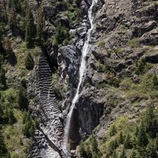
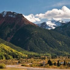
Imogene Pass is a mountain route through the San Juan Mountains that runs between Telluride and Ouray. The road climbs to roughly 3,900 meters and features steep, rocky terrain with sweeping views of the surrounding peaks.

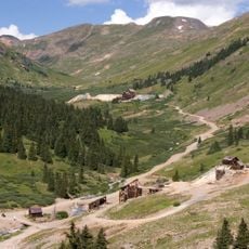
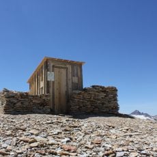
In 1904, the Colorado National Guard built Fort Peabody at the summit of the pass. The fort was constructed to help monitor mining activity during a major labor conflict in the region.

The Imogene Pass Run happens each year after Labor Day, drawing hundreds of runners to tackle the demanding mountain route between Ouray and Telluride. The race has become a key event in the mountain community's calendar.

Crossing this pass requires a four-wheel drive vehicle and an experienced driver to safely navigate the steep, rocky terrain. The best time to attempt the crossing is between June and early October, when snow has melted.

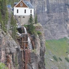
This area hosted one of the first long-distance alternating current power lines, which carried electricity from Telluride to the Camp Bird Mine. This engineering achievement was groundbreaking for power distribution in its era.

The community of curious travelers

AroundUs brings together thousands of curated places, local tips, and hidden gems, enriched daily by 60,000 contributors worldwide.

Start exploring
Location
Elevation above the sea
3,997 m
GPS coordinates
37.93220,-107.73600
Latest update
December 8, 2025 13:40
Around this place
Red Mountain Pass
United States of America

Red Mountain Pass

4.3 km
Mount Sneffels
United States of America

Mount Sneffels

9.4 km
Bridal Veil Falls
United States of America

Bridal Veil Falls

3.3 km
Animas Forks
United States of America

Animas Forks

14.8 km
Box Canyon
United States of America

Box Canyon

10.8 km
Smuggler-Union Hydroelectric Power Plant
United States of America

Smuggler-Union Hydroelectric Power Plant

3.2 km
St. Elmo Hotel
United States of America

St. Elmo Hotel

11.4 km
Mount Sneffels Wilderness
United States of America

Mount Sneffels Wilderness

14 km
Vermilion Peak
United States of America

Vermilion Peak

16.9 km
Telluride Historic District
United States of America

Telluride Historic District

6.4 km
Beaumont Hotel
United States of America

Beaumont Hotel

11.5 km
United States of America

Sultan Mountain

16.5 km
United States of America

Dallas Peak

9.9 km
Fort Peabody
United States of America

Fort Peabody

317 m
Gilpin Peak
United States of America

Gilpin Peak

7.9 km
United States of America

Teakettle Mountain

8 km
Western Hotel
United States of America

Western Hotel

11.7 km
Ouray City Hall and Walsh Library
United States of America

Ouray City Hall and Walsh Library

11.7 km
United States of America

Niagara Peak

18.4 km
Wright's Opera House
United States of America

Wright's Opera House

11.4 km
Ouray County Courthouse
United States of America

Ouray County Courthouse

11.6 km
Ouray Historic District
United States of America

Ouray Historic District

11.5 km
Bear Creek Falls
United States of America

Bear Creek Falls

10.1 km
Silverton Historic District
United States of America

Silverton Historic District

14.8 km
San Juan County Historical Society Mining Heritage Center
United States of America

San Juan County Historical Society Mining Heritage Center

14.6 km
Telluride Historical Museum
United States of America

Telluride Historical Museum

6.6 km
Million Dollar Highway
United States of America

Million Dollar Highway

3.6 km
San Juan County Courthouse
United States of America

San Juan County Courthouse

14.6 km
Show the full map
Reviews
Share your experience

No review yet

Discussions
Start a discussion...

No discussion yet

« Imogene Pass - Mountain pass in San Juan Mountains, Colorado » is provided by Around Us (aroundus.com). Images and texts are derived from Wikimedia project under a Creative Commons license. You are allowed to copy, distribute, and modify copies of this page, under the conditions set by the license, as long as this note is clearly visible.

Discover hidden gems everywhere you go!

From secret cafés to breathtaking viewpoints, skip the crowded tourist spots and find places that match your style. Our app makes it easy with voice search, smart filtering, route optimization, and insider tips from travelers worldwide. Download now for the complete mobile experience.

Around Us App Screenshot

A unique approach to discovering new places

Le Figaro

All the places worth exploring

France Info

A tailor-made excursion in just a few clicks

20 Minutes

Around Us
Travel Guide & Maps
Download

Send to your phone

QR Code
1

Open the camera app on your mobile.

2

Point at the QR code with your camera. A notification will appear.

3

Tap the notification to open the link.