Black Canyon of the Gunnison National Park
Black Canyon of the Gunnison National Park, National Park in Montrose County, United States
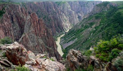
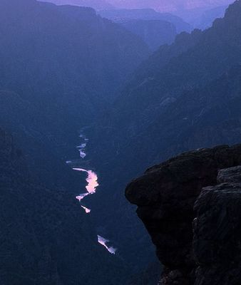
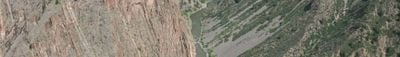
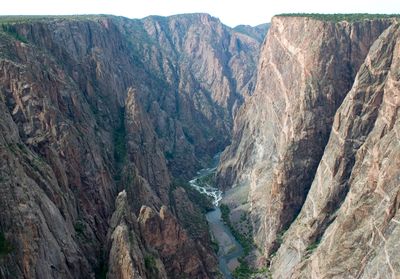
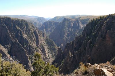
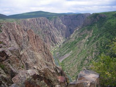
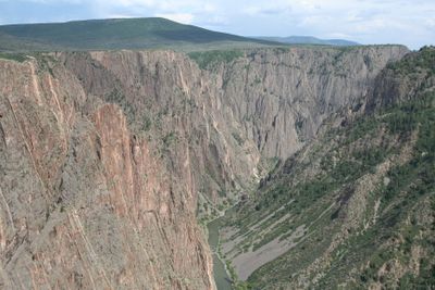
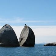
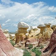
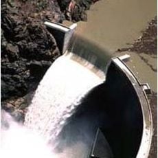
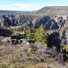
Black Canyon of the Gunnison National Park is a protected area in Montrose County, Colorado, that encloses a narrow, deep gorge carved from dark metamorphic rock. The Gunnison River flows at the bottom of this formation, which in some places measures only around 1,000 feet (300 meters) across while the walls rise more than 2,000 feet (610 meters).
The area was designated a national monument in 1933 to preserve the geological features of the gorge. Congress elevated it to national park status in 1999.
The name refers to the black, wet walls of gneiss and schist that remain in shadow for most of the day due to the narrow shape of the gorge. Visitors often follow short trails to overlooks that let them peer down into the depths from above.
South Rim remains open all year with paved roads and a visitor center, while North Rim operates seasonally and requires travel on unpaved roads. Short hikes to overlooks need little preparation, but trails descending to the river are very steep and suited only for experienced hikers.
The walls receive only about 30 minutes of sunlight per day in some sections due to the depth and narrow opening of the gorge. This darkness makes it one of the best places in North America to observe stars even during daylight hours.
Location: Montrose County
Inception: March 2, 1933
Operator: National Park Service
Website: https://nps.gov/blca
GPS coordinates: 38.56667,-107.71667
Latest update: December 12, 2025 17:56
The western United States protects some of North America's most diverse natural landscapes. From the layered canyons of Canyonlands in Utah to the white gypsum dunes of White Sands in New Mexico, this region spans multiple climate zones and geological formations. Visitors find national parks, Pueblo...
Colorado contains natural areas and historical sites located away from main roads and common routes. These places tell the story of the state's geology and human history through varied landscapes. Visitors will find sand dunes, waterfalls, rock formations, and remains from the mining era. Locations...
Crystal Dam
10.1 km
North Rim Road, Black Canyon of the Gunnison National Park
2.3 km
North Rim Road
3.4 km
Painted Wall
1.9 km
Chasm View Nature Trail
2 km
Black Canyon of the Gunnison Wilderness
2.7 km
South Rim Visitor Center
2.9 km
Spruce Tree Point
1.5 km
Red Rocks
7.8 km
Gunnison Point
2.9 km
Cedar Point Nature Trail
1.1 km
Kneeling Camel View
3.5 km
Painted Wall View
1.6 km
Island Peaks View
2.3 km
Rock Point
1.2 km
Serpent Point
2 km
Cross Fissures View
1.3 km
Sunset View
1.5 km
Balanced Rock View
2.1 km
Big Island View
2 km
Chasm View
1.7 km
Narrows View
2.1 km
Tomichi Point
3.2 km
Cedar Point
1.3 km
Warner Point
3 km
Narrows View
1.9 km
Big Island View
2 km
Gunnison Diversion Dam
7.5 kmVisited this place? Tap the stars to rate it and share your experience / photos with the community! Try now! You can cancel it anytime.
Discover hidden gems everywhere you go!
From secret cafés to breathtaking viewpoints, skip the crowded tourist spots and find places that match your style. Our app makes it easy with voice search, smart filtering, route optimization, and insider tips from travelers worldwide. Download now for the complete mobile experience.
A unique approach to discovering new places❞
— Le Figaro
All the places worth exploring❞
— France Info
A tailor-made excursion in just a few clicks❞
— 20 Minutes