See the monuments around you in AROpen chests in the app
Around Us is built for your phone — point your camera at the streets and discover the monuments and places around you in augmented reality.Around Us is built for your phone — chests unlock when you walk, explore and capture nearby places.
Colorado contains natural areas and historical sites located away from main roads and common routes. These places tell the story of the state's geology and human history through varied landscapes. Visitors will find sand dunes, waterfalls, rock formations, and remains from the mining era.
Locations like Paint Mines Interpretive Park display colored sand deposits, while Zapata Falls shows water dropping from cliffs. Bishop Castle presents hand-built stone structures in a forest setting, and Devil's Causeway features narrow rock bridges in wild terrain. The region also contains dinosaur tracks and fossils dating back millions of years.
These sites range from Great Sand Dunes, a large expanse of sand hills, to Black Canyon of the Gunnison with its steep rock walls. Abandoned mining towns like St. Elmo record the settlement history of the area. Mountain highways like Million Dollar Highway connect many of these locations, passing through different habitats and changing terrain.
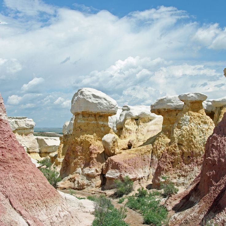
The Paint Mines Interpretive Park is a geological site with multicolored clay formations that represents one of Colorado's natural treasures in remote areas. Over time, erosion has carved natural columns and spires from the rock. The park displays the geological diversity of the state and attracts visitors seeking natural wonders away from crowded routes.
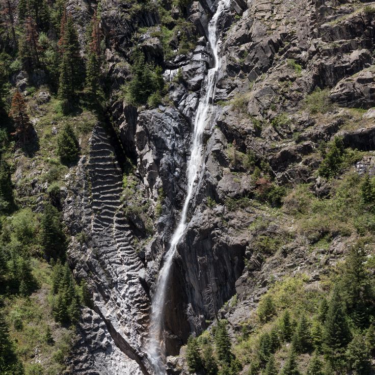
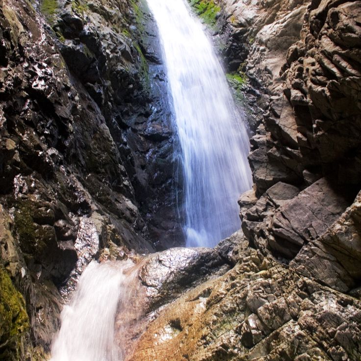
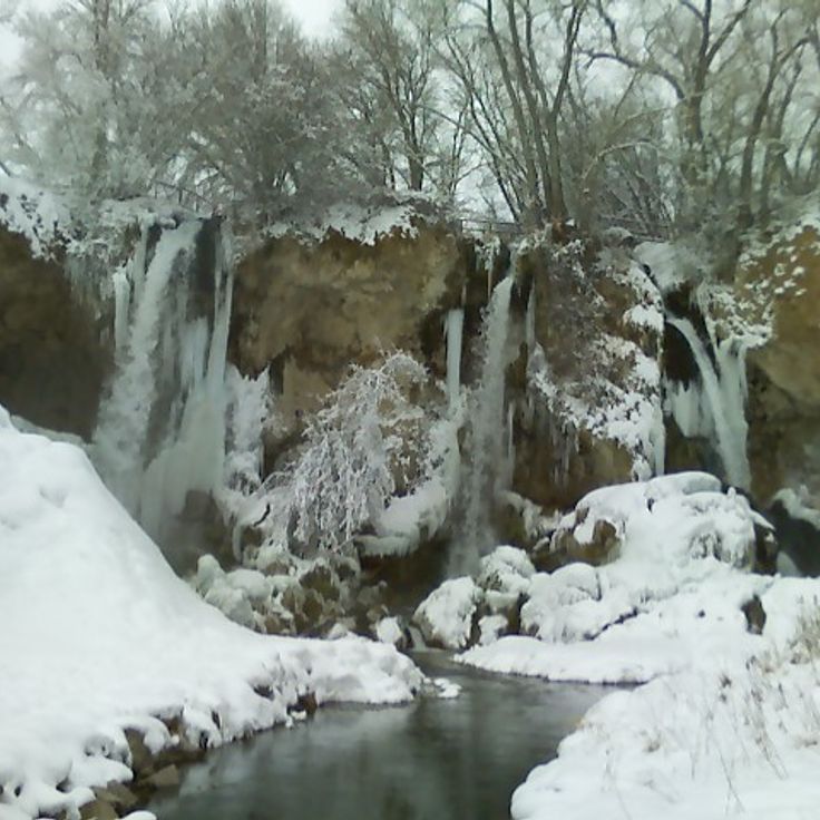
Zapata Falls is a waterfall in a remote part of Colorado that flows through a narrow rock crevice. During winter, the water forms large ice columns that look like natural sculptures. This place fits well with Colorado's wild natural areas and shows how varied the landscape of the state can be.
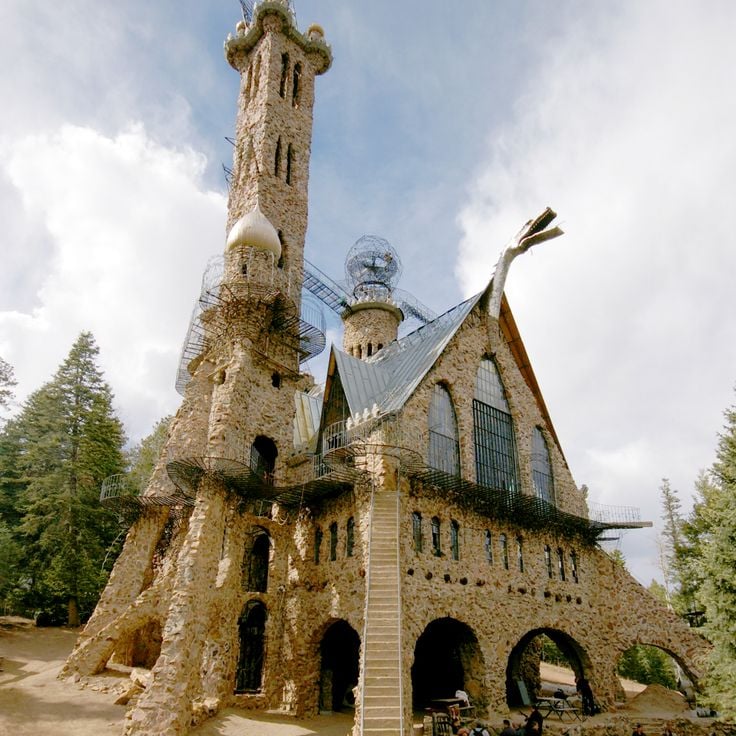
Bishop Castle is a remarkable place in this collection because one man built this stone structure over 60 years with his own hands. The castle features towers, bridges, and metal dragons perched on the roof, standing among the forest. It tells a story of persistence and individual creativity that fits within Colorado's natural and remote landscapes.
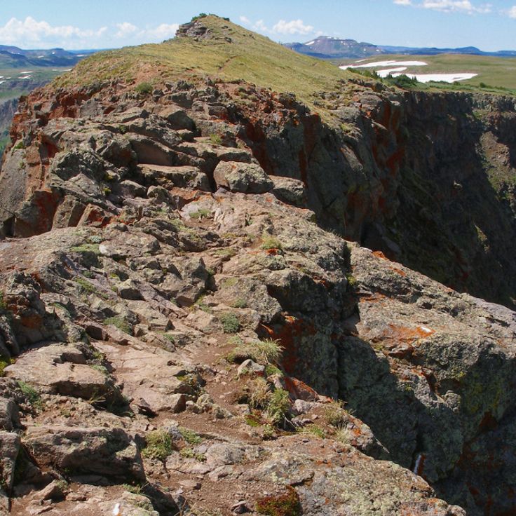
Devil's Causeway is a narrow rock bridge connecting two mountain peaks in Colorado's Flat Tops region, situated at a high elevation. This natural stone formation stretches about 50 feet long and measures just 3 feet wide, offering a raw glimpse into the wilderness landscape. The site exemplifies the remote natural areas featured in this collection, standing alongside sand formations, waterfalls, and other geological features found away from common routes. Devil's Causeway represents the kind of rugged, untamed terrain that defines many of Colorado's lesser-visited natural treasures.
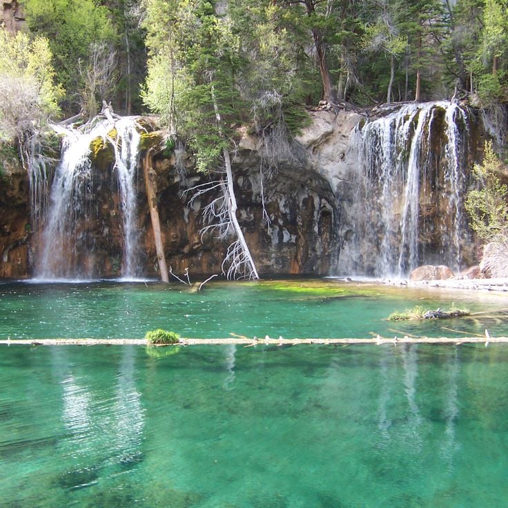
Hanging Lake is a mountain lake in Glenwood Canyon whose clear water feeds two waterfalls. This site fits within Colorado's collection of natural treasures and remote locations, sitting in rugged mountain terrain far from typical tourist routes. The trail to reach it climbs steeply through the forest, offering visitors an engaging outdoor experience in a quiet natural setting.
The Garden Park Fossil Area is a natural site in Cañon City and represents one of Colorado's natural treasures in remote locations. This area holds fossils from the Jurassic period, where scientists have uncovered several complete dinosaur skeletons. The site reveals the prehistoric past and shows how dinosaurs once inhabited this region.
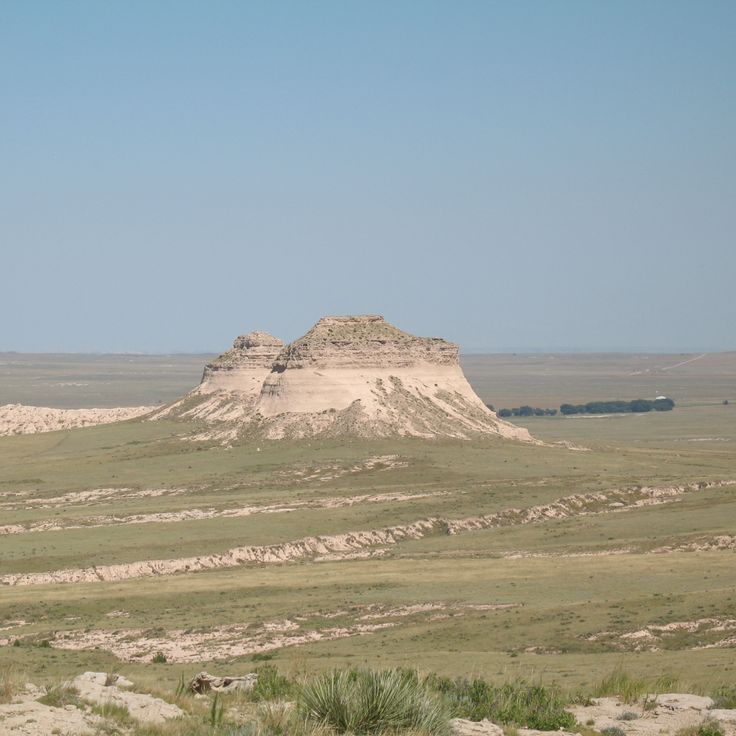
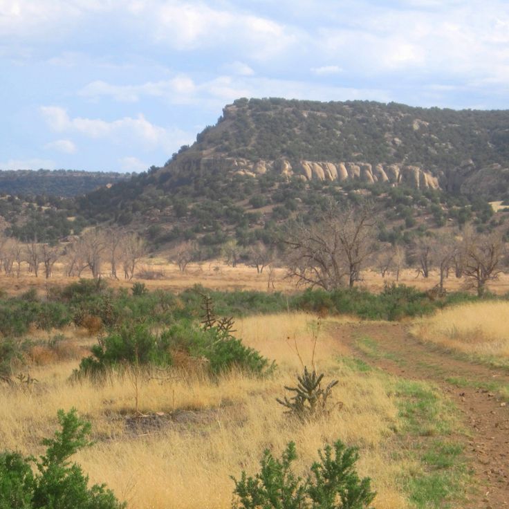
The Pawnee Buttes are two sandstone formations that rise about 300 feet above the prairie. These landmarks served as navigation points for indigenous peoples. They belong to Colorado's natural treasures found away from common routes and show how the landscape has guided people across generations.
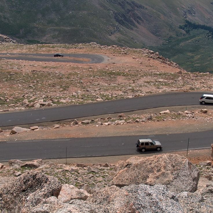
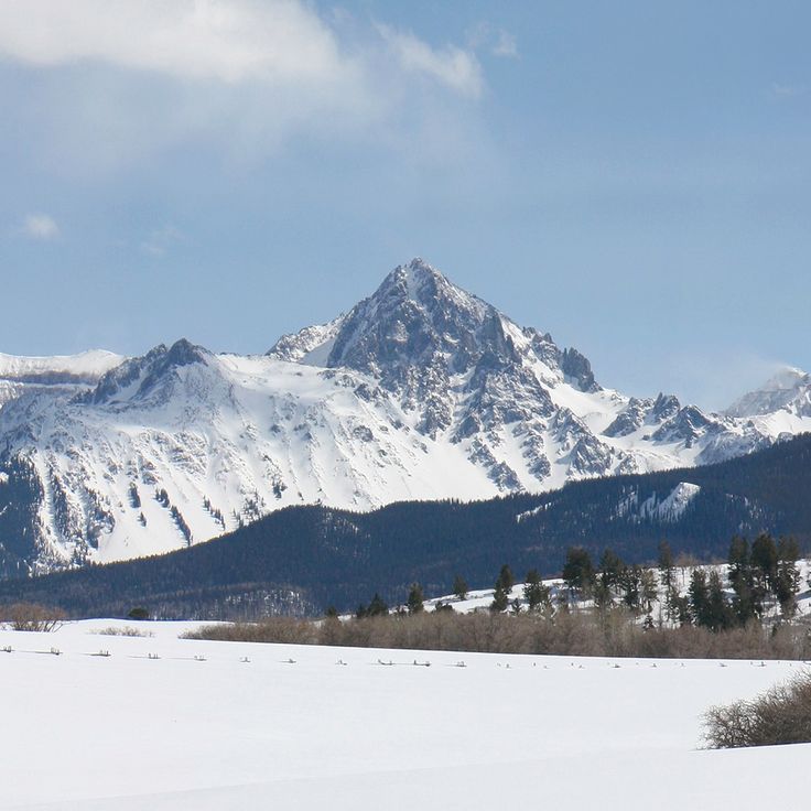
Mount Evans Scenic Byway is a road through the Rocky Mountains that winds through several vegetation zones and reaches an elevation of 14,130 feet. Like other remote locations across Colorado, it offers views of the surrounding peaks and reveals the state's natural variety from rock formations to abandoned settlements.
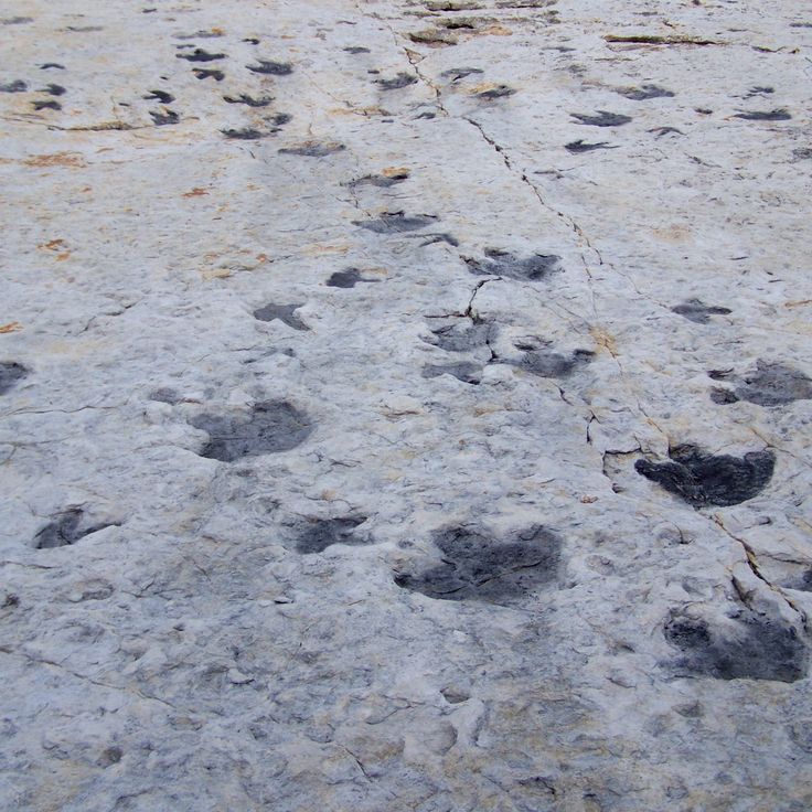
Dinosaur Ridge is a geological site in this collection of Colorado natural treasures that displays over 300 fossilized dinosaur footprints from the Cretaceous period along a mountain ridge. The location documents the prehistoric history of the region through the traces that dinosaurs left millions of years ago.
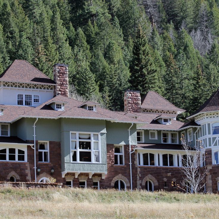
Redstone Castle is a 42-room residence built in 1902 by industrialist John Cleveland Osgood with Tudor-style architecture and original furnishings. Within Colorado's collection of natural treasures and remote locations, this castle demonstrates how wealthy industrialists of the era expressed their power through grand construction and craftsmanship in the wilderness.
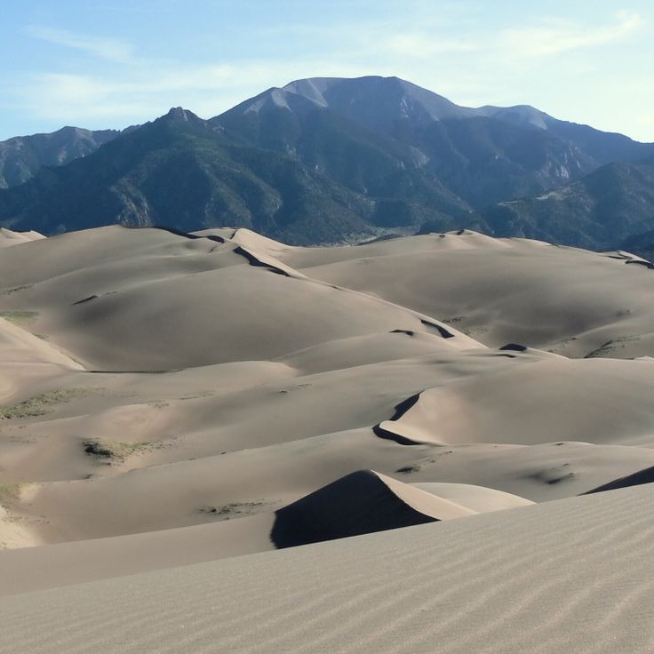
Great Sand Dunes National Park and Preserve is a nature reserve in Colorado's mountains that represents one of the state's significant natural treasures away from common routes. The park features towering sand dunes, alpine lakes, and pine forests that create a varied landscape. Visitors can hike the dunes, swim in the lakes, and explore the different environments that make this place distinctive.
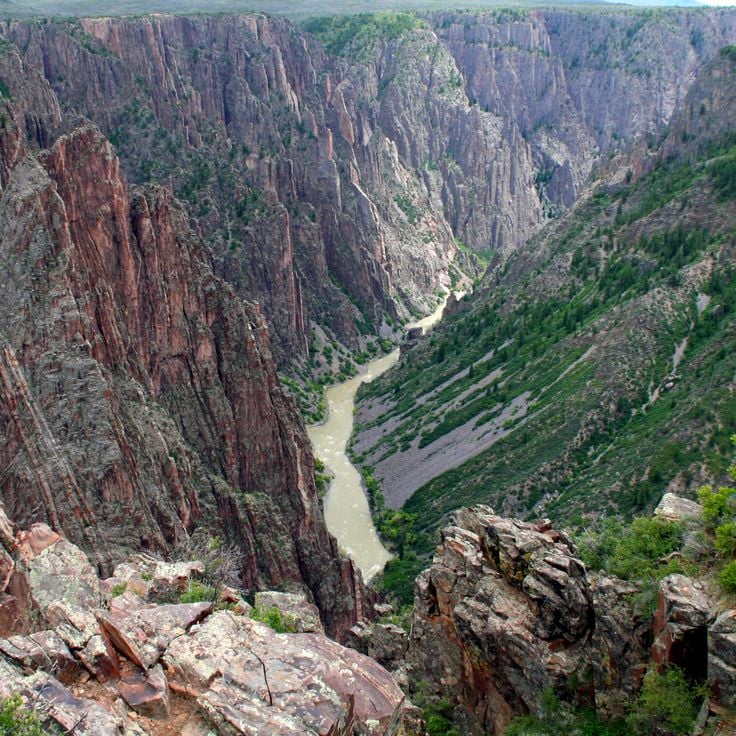
Black Canyon of the Gunnison is a deep gorge in Colorado's collection of natural treasures and remote locations. Sheer rock walls of gneiss and schist rise about 2000 feet high, shaped by the relentless cutting action of the Gunnison River over millions of years. This canyon stands alongside other geological wonders like the Zapata waterfalls and Devil's Causeway, telling the story of Colorado's ancient earth history.
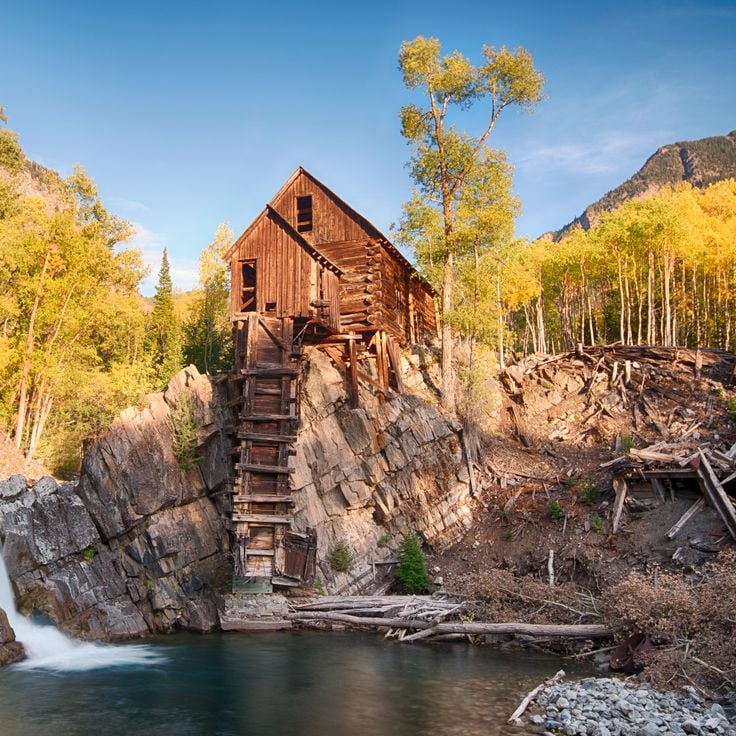
This wooden structure from 1892 stands on a rock outcrop above Crystal River. Originally used as a compressor house for silver mining operations, it fits into Colorado's rich history of mining activities and abandoned towns. The building displays late 19th-century craftsmanship and documents the mining era in the Rocky Mountains.
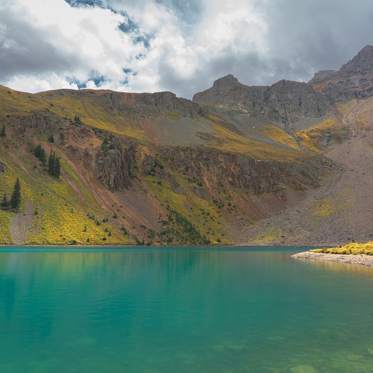
The Blue Lakes Trail is a mountain path in the San Juan Mountains that leads through alpine meadows to three lakes situated between 10,800 and 11,500 feet in elevation. The route offers views of Mount Sneffels peaks. This trail is part of Colorado's natural treasures and remote locations that lie away from common routes, giving visitors access to unspoiled landscapes.
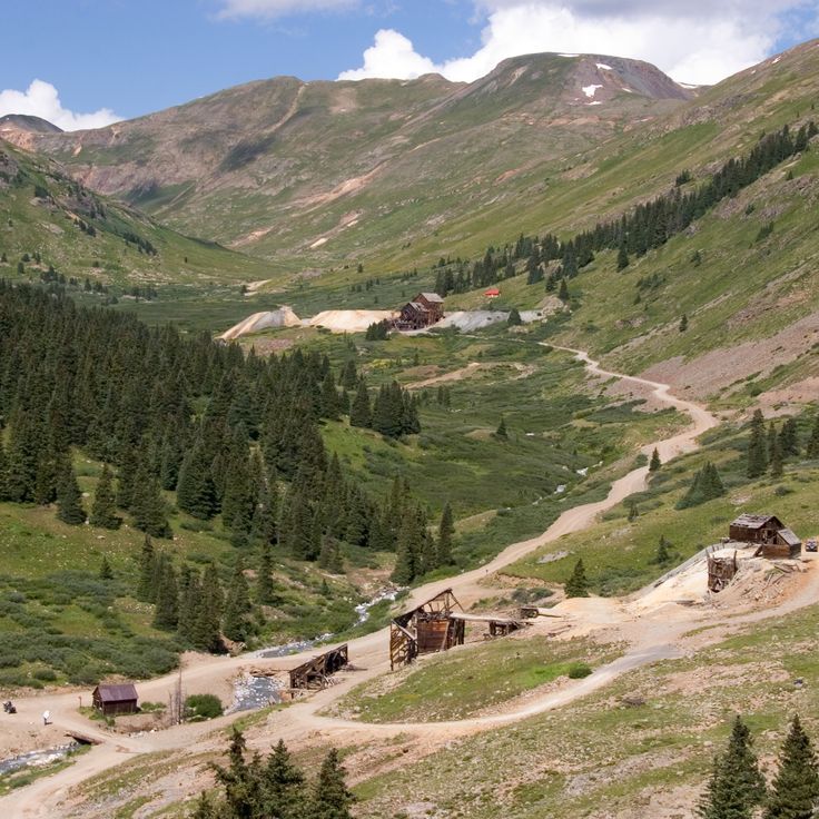
Animas Forks is an abandoned mining settlement from the 19th century located in San Juan County, part of Colorado's remote natural treasures and historical sites. Situated at 11,200 feet elevation, this former mining community sits deep in the mountain wilderness. Several wooden buildings remain standing, revealing how miners constructed their structures and organized daily life in this isolated high-altitude location.
Comanche Grassland is a large natural preserve in southeast Colorado that contributes to the state's collection of natural treasures and remote locations. The grassland holds dinosaur tracks, rock carvings, and archaeological sites that document about 12,000 years of human history. Visitors can explore the expansive prairie and encounter traces of the different cultures that shaped this landscape.
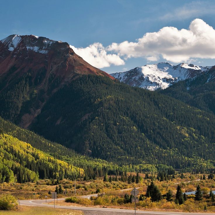
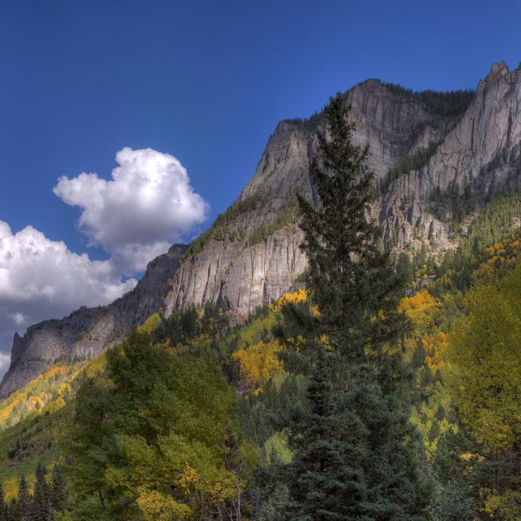
The Million Dollar Highway is a section of U.S. Route 550 that winds through steep mountain passes and showcases the San Juan Mountains. This route stands apart as one of Colorado's remote locations, cutting through terrain where cliffs rise sharply and valleys drop away. Travelers along this road experience tight curves, panoramic mountain views, and the raw landscape of high-altitude passes.
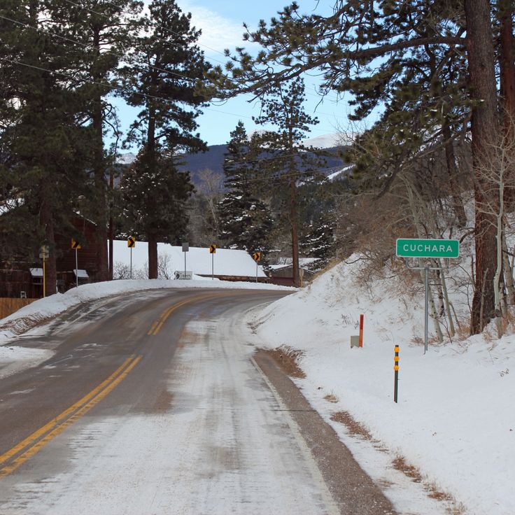
Cuchara Valley is part of Colorado's natural treasures and remote locations. The valley features hiking trails, historic mining sites and alpine landscapes in the Spanish Peaks. Visitors will find history and nature combined here, much like other places throughout the state from fossil discoveries to abandoned mining towns.
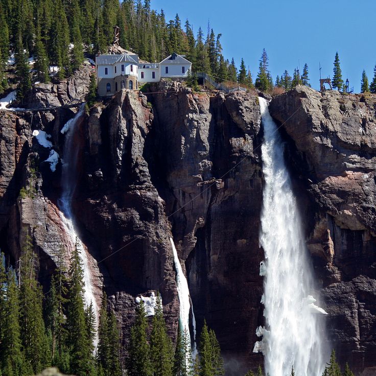
Bridal Veil Falls is a 365-foot waterfall in Box Canyon near Telluride, Colorado, representing the natural treasures and remote locations that define the state's landscape. At the top of the waterfall sits a historic power station, a relic from when the region was used to generate electricity. The falls showcase how water shaped both the land and local history. Visitors walking to this site experience the raw power of flowing water while discovering how people once harnessed nature for their needs.
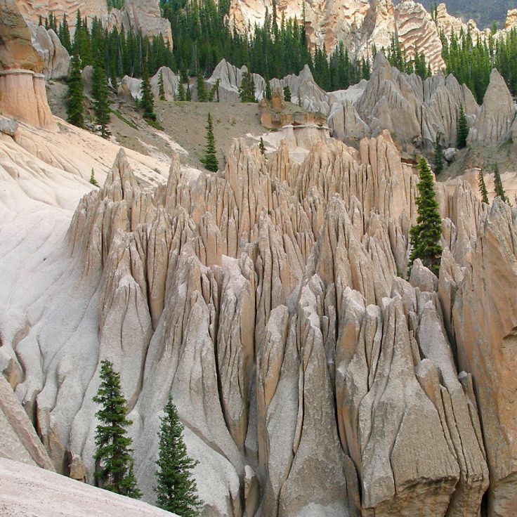
The Wheeler Geologic Area showcases white volcanic tuff rock formations that create distinctive columnar structures in the Colorado mountains. This natural site is part of Colorado's collection of remote locations and tells the story of the state's geological past through its remarkable rock formations.
This wilderness area is part of Colorado's natural treasures found away from common routes. Mount Sneffels Wilderness Area features mountain lakes and steep rock walls that draw mountaineers and hikers. The rocky terrain and alpine scenery create a landscape where visitors come to experience mountain adventure and connect with the outdoors.
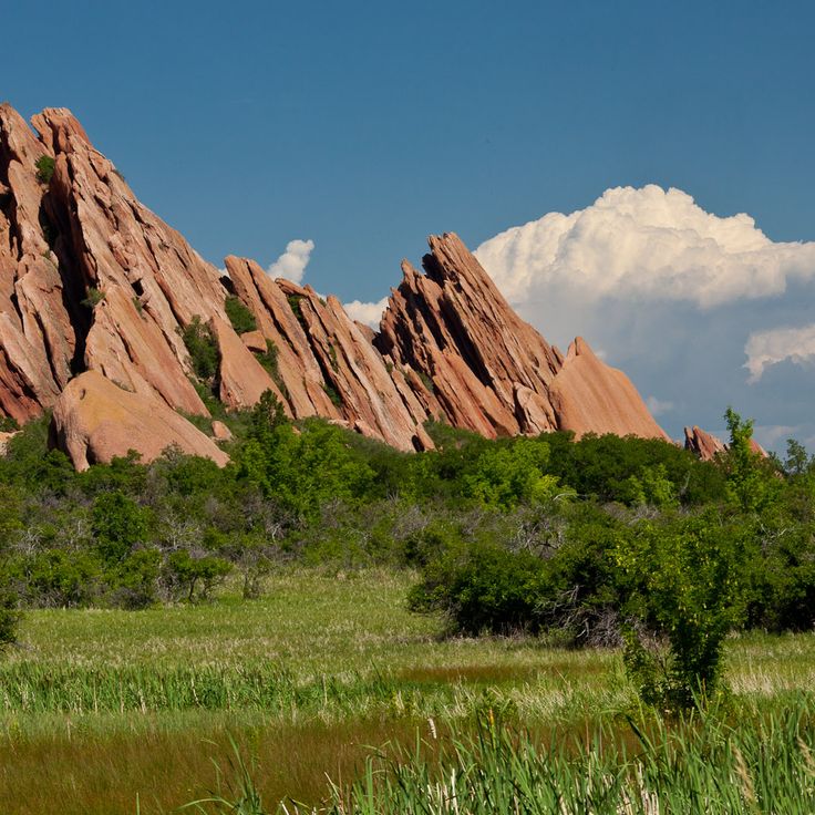
Roxborough State Park is part of Colorado's natural treasures and remote locations. The park features red sandstone formations and coniferous forests that invite geological observation. The landscape tells the story of the region's geological development and offers trails through forests and past distinctive rock formations.
Yankee Boy Basin is an alpine valley near Ouray with mountain meadows and flower fields. It stands among Colorado's natural treasures in remote locations and is accessible only by off-road vehicles. The landscape shows how the Rocky Mountains appear in their wild state, far from paved roads and common routes.
Horsethief Canyon near Fruita is part of Colorado's natural treasures found away from common routes. The canyon features hiking trails where visitors can find historical rock art and geological formations. Layers of stone tell the story of the landscape's long history. As you walk through narrow passages, you see how time has shaped the rocks and carved the canyon itself.
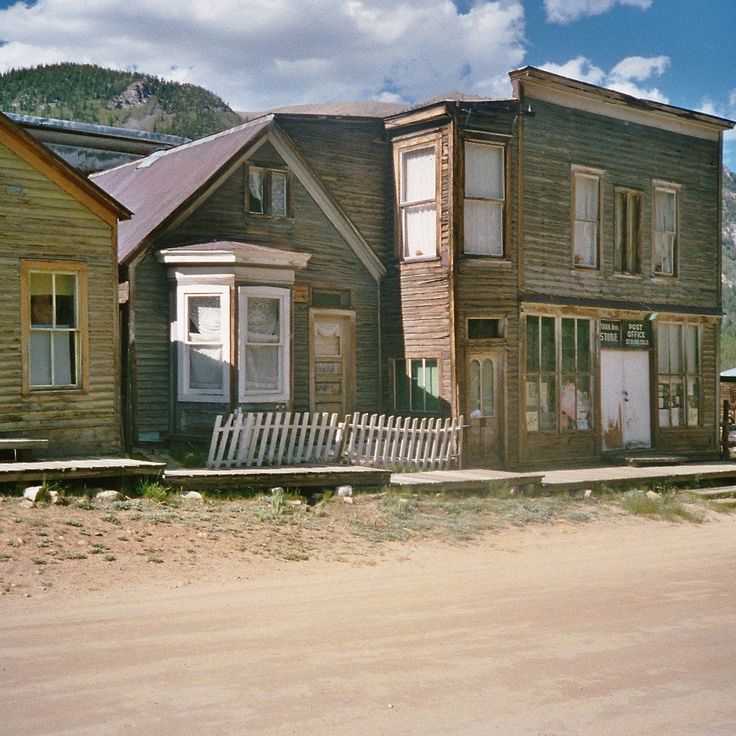
This abandoned mining settlement from the 1800s is part of Colorado's natural treasures and remote locations. St. Elmo Ghost Town preserves 24 historical buildings including a store, church, and schoolhouse that tell the story of life during the mining boom.
Trappers Lake in the Flat Tops is one of Colorado's natural treasures away from common routes. This mountain lake sits at 9,600 feet (2,926 meters) and is surrounded by conifer forests. Brook trout and golden trout live in its waters, making it a destination for fishing. The lake documents the state's outdoor heritage and wild character.
Rifle Falls State Park is part of Colorado's collection of natural treasures away from common routes. The park features three waterfalls that drop about 70 feet over limestone cliffs. You can explore limestone caves and walk through trails that wind through forested areas. The flowing water creates a green setting with trees and vegetation throughout the space.
Brown's Canyon National Monument is a wilderness area with rocky canyons that invites exploration and outdoor activity. The Arkansas River cuts through deep stone formations and offers whitewater rapids for paddlers. Narrow trails wind through forests of pine and juniper, where eagles and other wildlife appear along the banks. The monument shows how water and time have carved the landscape into dramatic forms. This place belongs to Colorado's collection of natural treasures and remote locations, standing apart from the state's more familiar destinations.
The Wild Animal Sanctuary is a rescue facility in Keenesburg that fits within Colorado's collection of natural treasures and remote locations. Spread across 720 acres, this sanctuary provides a home for lions, tigers, and bears rescued from poor conditions throughout North America. Visitors can observe these animals in settings that more closely resemble their natural habitats than conventional zoos.
Mount Princeton Hot Springs is a thermal complex with multiple pools heated between 85 and 105 degrees Fahrenheit, surrounded by mountain views near Nathrop. This site fits within Colorado's collection of natural areas away from common routes, where visitors can experience the warmth of geothermal waters and the solitude of the mountain landscape.
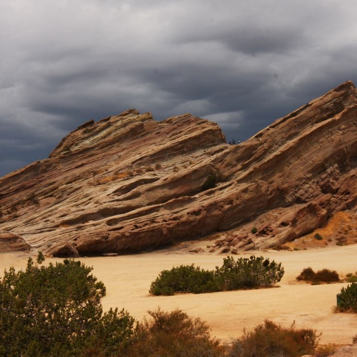
Vasquez Rocks in Winter Park is a natural area showcasing Miocene sandstone formations. Angular rocks rise from the earth across a broad landscape, revealing the geological layers beneath. As part of Colorado's remote natural treasures, this site documents the state's ancient geological history and offers a window into the processes that shaped the land over millions of years.
Bear Creek Falls is a waterfall about 80 feet high that flows through a gorge into the Uncompahgre River. Located near Ouray along US Route 550, this waterfall is part of Colorado's natural treasures found away from common tourist routes. You can see it directly from the highway without needing a long hike.
The Paint Mines Interpretive Park is a geological site with multicolored clay formations that represents one of Colorado's natural treasures in remote areas. Over time, erosion has carved natural columns and spires from the rock. The park displays the geological diversity of the state and attracts visitors seeking natural wonders away from crowded routes.
Zapata Falls is a waterfall in a remote part of Colorado that flows through a narrow rock crevice. During winter, the water forms large ice columns that look like natural sculptures. This place fits well with Colorado's wild natural areas and shows how varied the landscape of the state can be.
Bishop Castle is a remarkable place in this collection because one man built this stone structure over 60 years with his own hands. The castle features towers, bridges, and metal dragons perched on the roof, standing among the forest. It tells a story of persistence and individual creativity that fits within Colorado's natural and remote landscapes.
Devil's Causeway is a narrow rock bridge connecting two mountain peaks in Colorado's Flat Tops region, situated at a high elevation. This natural stone formation stretches about 50 feet long and measures just 3 feet wide, offering a raw glimpse into the wilderness landscape. The site exemplifies the remote natural areas featured in this collection, standing alongside sand formations, waterfalls, and other geological features found away from common routes. Devil's Causeway represents the kind of rugged, untamed terrain that defines many of Colorado's lesser-visited natural treasures.
Hanging Lake is a mountain lake in Glenwood Canyon whose clear water feeds two waterfalls. This site fits within Colorado's collection of natural treasures and remote locations, sitting in rugged mountain terrain far from typical tourist routes. The trail to reach it climbs steeply through the forest, offering visitors an engaging outdoor experience in a quiet natural setting.
The Garden Park Fossil Area is a natural site in Cañon City and represents one of Colorado's natural treasures in remote locations. This area holds fossils from the Jurassic period, where scientists have uncovered several complete dinosaur skeletons. The site reveals the prehistoric past and shows how dinosaurs once inhabited this region.
The Pawnee Buttes are two sandstone formations that rise about 300 feet above the prairie. These landmarks served as navigation points for indigenous peoples. They belong to Colorado's natural treasures found away from common routes and show how the landscape has guided people across generations.
Mount Evans Scenic Byway is a road through the Rocky Mountains that winds through several vegetation zones and reaches an elevation of 14,130 feet. Like other remote locations across Colorado, it offers views of the surrounding peaks and reveals the state's natural variety from rock formations to abandoned settlements.
Dinosaur Ridge is a geological site in this collection of Colorado natural treasures that displays over 300 fossilized dinosaur footprints from the Cretaceous period along a mountain ridge. The location documents the prehistoric history of the region through the traces that dinosaurs left millions of years ago.
Redstone Castle is a 42-room residence built in 1902 by industrialist John Cleveland Osgood with Tudor-style architecture and original furnishings. Within Colorado's collection of natural treasures and remote locations, this castle demonstrates how wealthy industrialists of the era expressed their power through grand construction and craftsmanship in the wilderness.
Great Sand Dunes National Park and Preserve is a nature reserve in Colorado's mountains that represents one of the state's significant natural treasures away from common routes. The park features towering sand dunes, alpine lakes, and pine forests that create a varied landscape. Visitors can hike the dunes, swim in the lakes, and explore the different environments that make this place distinctive.
Black Canyon of the Gunnison is a deep gorge in Colorado's collection of natural treasures and remote locations. Sheer rock walls of gneiss and schist rise about 2000 feet high, shaped by the relentless cutting action of the Gunnison River over millions of years. This canyon stands alongside other geological wonders like the Zapata waterfalls and Devil's Causeway, telling the story of Colorado's ancient earth history.
This wooden structure from 1892 stands on a rock outcrop above Crystal River. Originally used as a compressor house for silver mining operations, it fits into Colorado's rich history of mining activities and abandoned towns. The building displays late 19th-century craftsmanship and documents the mining era in the Rocky Mountains.
The Blue Lakes Trail is a mountain path in the San Juan Mountains that leads through alpine meadows to three lakes situated between 10,800 and 11,500 feet in elevation. The route offers views of Mount Sneffels peaks. This trail is part of Colorado's natural treasures and remote locations that lie away from common routes, giving visitors access to unspoiled landscapes.
Animas Forks is an abandoned mining settlement from the 19th century located in San Juan County, part of Colorado's remote natural treasures and historical sites. Situated at 11,200 feet elevation, this former mining community sits deep in the mountain wilderness. Several wooden buildings remain standing, revealing how miners constructed their structures and organized daily life in this isolated high-altitude location.
Comanche Grassland is a large natural preserve in southeast Colorado that contributes to the state's collection of natural treasures and remote locations. The grassland holds dinosaur tracks, rock carvings, and archaeological sites that document about 12,000 years of human history. Visitors can explore the expansive prairie and encounter traces of the different cultures that shaped this landscape.
The Million Dollar Highway is a section of U.S. Route 550 that winds through steep mountain passes and showcases the San Juan Mountains. This route stands apart as one of Colorado's remote locations, cutting through terrain where cliffs rise sharply and valleys drop away. Travelers along this road experience tight curves, panoramic mountain views, and the raw landscape of high-altitude passes.
Cuchara Valley is part of Colorado's natural treasures and remote locations. The valley features hiking trails, historic mining sites and alpine landscapes in the Spanish Peaks. Visitors will find history and nature combined here, much like other places throughout the state from fossil discoveries to abandoned mining towns.
Bridal Veil Falls is a 365-foot waterfall in Box Canyon near Telluride, Colorado, representing the natural treasures and remote locations that define the state's landscape. At the top of the waterfall sits a historic power station, a relic from when the region was used to generate electricity. The falls showcase how water shaped both the land and local history. Visitors walking to this site experience the raw power of flowing water while discovering how people once harnessed nature for their needs.
The Wheeler Geologic Area showcases white volcanic tuff rock formations that create distinctive columnar structures in the Colorado mountains. This natural site is part of Colorado's collection of remote locations and tells the story of the state's geological past through its remarkable rock formations.
This wilderness area is part of Colorado's natural treasures found away from common routes. Mount Sneffels Wilderness Area features mountain lakes and steep rock walls that draw mountaineers and hikers. The rocky terrain and alpine scenery create a landscape where visitors come to experience mountain adventure and connect with the outdoors.
Roxborough State Park is part of Colorado's natural treasures and remote locations. The park features red sandstone formations and coniferous forests that invite geological observation. The landscape tells the story of the region's geological development and offers trails through forests and past distinctive rock formations.
Yankee Boy Basin is an alpine valley near Ouray with mountain meadows and flower fields. It stands among Colorado's natural treasures in remote locations and is accessible only by off-road vehicles. The landscape shows how the Rocky Mountains appear in their wild state, far from paved roads and common routes.
Horsethief Canyon near Fruita is part of Colorado's natural treasures found away from common routes. The canyon features hiking trails where visitors can find historical rock art and geological formations. Layers of stone tell the story of the landscape's long history. As you walk through narrow passages, you see how time has shaped the rocks and carved the canyon itself.
This abandoned mining settlement from the 1800s is part of Colorado's natural treasures and remote locations. St. Elmo Ghost Town preserves 24 historical buildings including a store, church, and schoolhouse that tell the story of life during the mining boom.
Trappers Lake in the Flat Tops is one of Colorado's natural treasures away from common routes. This mountain lake sits at 9,600 feet (2,926 meters) and is surrounded by conifer forests. Brook trout and golden trout live in its waters, making it a destination for fishing. The lake documents the state's outdoor heritage and wild character.
Rifle Falls State Park is part of Colorado's collection of natural treasures away from common routes. The park features three waterfalls that drop about 70 feet over limestone cliffs. You can explore limestone caves and walk through trails that wind through forested areas. The flowing water creates a green setting with trees and vegetation throughout the space.
Brown's Canyon National Monument is a wilderness area with rocky canyons that invites exploration and outdoor activity. The Arkansas River cuts through deep stone formations and offers whitewater rapids for paddlers. Narrow trails wind through forests of pine and juniper, where eagles and other wildlife appear along the banks. The monument shows how water and time have carved the landscape into dramatic forms. This place belongs to Colorado's collection of natural treasures and remote locations, standing apart from the state's more familiar destinations.
The Wild Animal Sanctuary is a rescue facility in Keenesburg that fits within Colorado's collection of natural treasures and remote locations. Spread across 720 acres, this sanctuary provides a home for lions, tigers, and bears rescued from poor conditions throughout North America. Visitors can observe these animals in settings that more closely resemble their natural habitats than conventional zoos.
Mount Princeton Hot Springs is a thermal complex with multiple pools heated between 85 and 105 degrees Fahrenheit, surrounded by mountain views near Nathrop. This site fits within Colorado's collection of natural areas away from common routes, where visitors can experience the warmth of geothermal waters and the solitude of the mountain landscape.
Vasquez Rocks in Winter Park is a natural area showcasing Miocene sandstone formations. Angular rocks rise from the earth across a broad landscape, revealing the geological layers beneath. As part of Colorado's remote natural treasures, this site documents the state's ancient geological history and offers a window into the processes that shaped the land over millions of years.
Bear Creek Falls is a waterfall about 80 feet high that flows through a gorge into the Uncompahgre River. Located near Ouray along US Route 550, this waterfall is part of Colorado's natural treasures found away from common tourist routes. You can see it directly from the highway without needing a long hike.