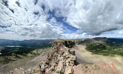
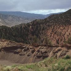
Devils Causeway, Mountain ridge in Flat Tops Wilderness Area, Colorado, United States
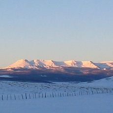
Devils Causeway is a narrow mountain ridge in the Flat Tops Wilderness Area sitting at around 12,300 feet elevation with steep drop-offs on both sides. The trail crosses a distinctive section where the path becomes only a few feet wide.
The ridge served as an important passage for Native American tribes moving through the Flat Tops Wilderness Area long before European settlement arrived. This ancient route connected different regions for hunting and trade.
The trail draws outdoor enthusiasts who share their experiences crossing the narrow path through photographs and stories with others. These moments have become part of how the hiking community remembers the place.
The round trip hike from Stillwater Reservoir covers several miles and requires sturdy footwear and navigation tools for staying on route. Visitors should prepare for sudden weather shifts at high elevation and bring layers for changing conditions.
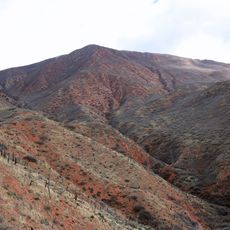
At its narrowest point the path is only about three feet wide, which forces many hikers to crawl across on hands and knees due to the exposure. This section is what makes the experience memorable for most visitors.
Location: Garfield County
Address: Devils Causeway, Colorado 81641, USA
GPS coordinates: 40.03410,-107.15450
Latest update: December 6, 2025 19:08
Colorado contains natural areas and historical sites located away from main roads and common routes. These places tell the story of the state's geology and human history through varied landscapes. Visitors will find sand dunes, waterfalls, rock formations, and remains from the mining era. Locations...
Hanging Lake
48.2 km
Glenwood Canyon
51.4 km
Dotsero
42.8 km
Rifle Falls State Park
61.5 km
Glenwood Hot Springs Pool
55.8 km
Fish Creek Falls
59.5 km
Flat Top Mountain
6.4 km
Gore Canyon
55.4 km
Flat Tops Wilderness Area
12.4 km
Mount Werner
58.7 km
Stagecoach State Park
37.7 km
Yampa River State Park
52.6 km
Storm King Mountain
53.8 km
Crawford House
57.5 km
Castle Peak
40.2 km
Stagecoach Dam
39.2 km
South Canon Bridge
56.9 km
Waterwheel
40.1 km
Christian Science Society
57.3 km
First Evangelical Lutheran Church
46.6 km
State Bridge
47.4 km
Sumers Lodge
59.6 km
Chamber of Commerce Building (Steamboat Springs, Colorado)
57.3 km
Citizens National Bank Building
56.2 km
Starr Manor
56.2 km
First National Bank Building
57.2 km
Hayden Rooming House
51.8 km
Chief Theatre
57.2 kmVisited this place? Tap the stars to rate it and share your experience / photos with the community! Try now! You can cancel it anytime.
Discover hidden gems everywhere you go!
From secret cafés to breathtaking viewpoints, skip the crowded tourist spots and find places that match your style. Our app makes it easy with voice search, smart filtering, route optimization, and insider tips from travelers worldwide. Download now for the complete mobile experience.
A unique approach to discovering new places❞
— Le Figaro
All the places worth exploring❞
— France Info
A tailor-made excursion in just a few clicks❞
— 20 Minutes