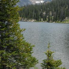
Hanging Lake, Natural landmark lake in Garfield County, Colorado, US
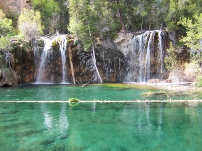
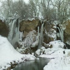
Hanging Lake sits at 2187 meters elevation and shows turquoise water formed by limestone deposits along a steep slope in Glenwood Canyon. The water comes from a small spring and flows over several steps, with pale mineral layers forming the edges of the basin.
The body of water formed when a section of ground slipped along a fault line and created a natural basin. Waters from Dead Horse Creek filled this area and shaped its current form.
The name refers to how the body of water appears suspended along a steep cliff face high above the canyon floor. Visitors come here to see the clear waters and walk the forest trails that wind through the surrounding woodland.
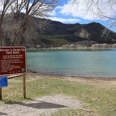
Visitors need to secure permits in advance for 12 dollars in summer or 10 dollars in winter, as daily entry is limited by number. The parking area sits at a rest stop near Interstate 70, where the trail to the water begins.
The water continuously deposits limestone that forms fine white crusts on logs and stones. This process slowly changes the shoreline and allows new structures to grow along the edges of the basin.
Location: Garfield County
Elevation above the sea: 2,187 m
GPS coordinates: 39.60165,-107.19200
Latest update: December 4, 2025 23:42
Colorado features natural areas and historical sites away from common routes. The locations range from sand formations at Paint Mines Park to Zapata waterfalls. Bishop Castle displays hand-built stone architecture in the forest, while Devil's Causeway presents narrow rock bridges in the wilderness. Fossil discoveries, dinosaur tracks, and abandoned mining towns document the state's history.
Glenwood Canyon
4 km
Hotel Colorado
12.7 km
Dotsero
15 km
Rifle Falls State Park
44.3 km
Glenwood Hot Springs Pool
12.7 km
Redstone Coke Oven Historic District
47 km
Flat Top Mountain
47 km
Redstone Castle
48.3 km
Rifle Gap State Park
48.4 km
Flat Tops Wilderness Area
39.6 km
Harvey Gap State Park
39.8 km
Sylvan Lake State Park
38 km
Glenwood Caverns Adventure Park
13.2 km
Redstone Inn
47.1 km
Cliffhanger
11.8 km
Redstone Historic District
47 km
Storm King Mountain
18 km
Castle Peak (Sawatch Range)
36.4 km
South Canon Bridge
19 km
Osgood Gamekeeper's Lodge
48.2 km
First Evangelical Lutheran Church
21.1 km
Lake Charles Trail
50.3 km
Osgood–Kuhnhausen House
46.3 km
Sumers Lodge
14.4 km
Citizens National Bank Building
12.9 km
Starr Manor
12.7 km
Missouri Heights School
19.4 km
Mount Sopris
38 kmReviews
Visited this place? Tap the stars to rate it and share your experience / photos with the community! Try now! You can cancel it anytime.
Discover hidden gems everywhere you go!
From secret cafés to breathtaking viewpoints, skip the crowded tourist spots and find places that match your style. Our app makes it easy with voice search, smart filtering, route optimization, and insider tips from travelers worldwide. Download now for the complete mobile experience.
A unique approach to discovering new places❞
— Le Figaro
All the places worth exploring❞
— France Info
A tailor-made excursion in just a few clicks❞
— 20 Minutes