Enable Location

We need your location to show you interesting places around you

Discover nearby places

Find interesting locations and hidden gems around you

Precise directions

Get accurate directions and distances to places

Your location is never shared with other users. It's only used when you tap the location button.

Rifle Gap State Park

Log in to your account

Start exploring — it's free

Trusted by 62,193 travelers worldwide

Continue with Google
Continue with Apple
or

We will send you a code to connect

By continuing, you accept our Terms and Conditions and our Privacy Policy

Check your inbox

We've sent a pincode in your inbox. Please enter the code below.

Rifle Gap State Park

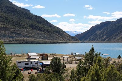
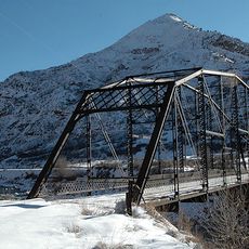
Rifle Gap State Park, State park with reservoir in Garfield County, United States.

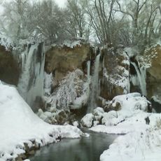
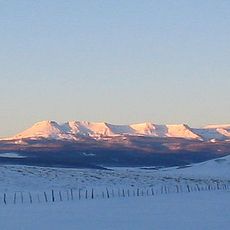
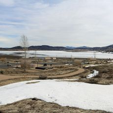
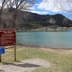
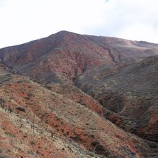
Rifle Gap State Park is a recreational area with a large reservoir in the Colorado highlands. The lake is surrounded by woodlands with juniper and sagebrush, and sits at the edge of a plateau with exposed rock formations.

The area was originally rangeland for cattle before a large lake was created in 1968. This transformation turned it into a popular recreation and holiday destination for the region.

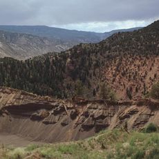
The park serves as a learning space where visitors can observe rock formations and natural layers exposed in the landscape. These geological features tell the story of how the land was shaped over millions of years.

Visitors find camping areas, picnic spots, and a boat launch for exploring the lake. The park is open from early morning to evening, with plenty of parking for various activities.

The lake is home to diverse wildlife including fish, herons, and raptors that can be spotted year-round. This abundance of species makes the place rewarding for those who enjoy watching and photographing animals.

The community of curious travelers

AroundUs brings together thousands of curated places, local tips, and hidden gems, enriched daily by 60,000 contributors worldwide.

Start exploring
Location
Inception
1966
GPS coordinates
39.63470,-107.75500
Latest update
December 9, 2025 18:48
Around this place
Hanging Lake
United States of America

Hanging Lake

48.4 km
Glenwood Canyon
United States of America

Glenwood Canyon

46.1 km
Dotsero
United States of America

Dotsero

61.8 km
Rifle Falls State Park
United States of America

Rifle Falls State Park

6.4 km
Glenwood Hot Springs Pool
United States of America

Glenwood Hot Springs Pool

38.2 km
Redstone Coke Oven Historic District
United States of America

Redstone Coke Oven Historic District

67.1 km
Redstone Castle
United States of America

Redstone Castle

68.1 km
Flat Tops Wilderness Area
United States of America

Flat Tops Wilderness Area

55.5 km
Vega State Park
United States of America

Vega State Park

45.8 km
Harvey Gap State Park
United States of America

Harvey Gap State Park

8.8 km
Redstone Historic District
United States of America

Redstone Historic District

67.2 km
Storm King Mountain
United States of America

Storm King Mountain

30.8 km
South Canon Bridge
United States of America

South Canon Bridge

30.9 km
Osgood Gamekeeper's Lodge
United States of America

Osgood Gamekeeper's Lodge

67.8 km
St. James Episcopal Church
United States of America

St. James Episcopal Church

46.9 km
Rifle Bridge
United States of America

Rifle Bridge

12.1 km
IOOF Hall
United States of America

IOOF Hall

51.8 km
Osgood–Kuhnhausen House
United States of America

Osgood–Kuhnhausen House

67 km
Sumers Lodge
United States of America

Sumers Lodge

40.1 km
Citizens National Bank Building
United States of America

Citizens National Bank Building

38.2 km
Starr Manor
United States of America

Starr Manor

38.6 km
Missouri Heights School
United States of America

Missouri Heights School

57.6 km
Wasson-McKay Place
United States of America

Wasson-McKay Place

32.8 km
Hay's Ranch Bridge
United States of America

Hay's Ranch Bridge

51.1 km
Meeker Historic District
United States of America

Meeker Historic District

46.8 km
Meeker I.O.O.F. Lodge—Valentine Lodge No. 47
United States of America

Meeker I.O.O.F. Lodge—Valentine Lodge No. 47

46.8 km
Mount Sopris
United States of America

Mount Sopris

65.6 km
Satank Bridge
United States of America

Satank Bridge

51.1 km
Show the full map
« Rifle Gap State Park - State park with reservoir in Garfield County, United States » is provided by Around Us (aroundus.com). Images and texts are derived from Wikimedia project under a Creative Commons license. You are allowed to copy, distribute, and modify copies of this page, under the conditions set by the license, as long as this note is clearly visible.

Discover hidden gems everywhere you go!

From secret cafés to breathtaking viewpoints, skip the crowded tourist spots and find places that match your style. Our app makes it easy with voice search, smart filtering, route optimization, and insider tips from travelers worldwide. Download now for the complete mobile experience.

Around Us App Screenshot

A unique approach to discovering new places

Le Figaro

All the places worth exploring

France Info

A tailor-made excursion in just a few clicks

20 Minutes

Around Us
Travel Guide & Maps
Download

Send to your phone

QR Code
1

Open the camera app on your mobile.

2

Point at the QR code with your camera. A notification will appear.

3

Tap the notification to open the link.