Enable Location

We need your location to show you interesting places around you

Discover nearby places

Find interesting locations and hidden gems around you

Precise directions

Get accurate directions and distances to places

Your location is never shared with other users. It's only used when you tap the location button.

Zapata Falls

Log in to your account

Start exploring — it's free

Trusted by 62,189 travelers worldwide

Continue with Google
Continue with Apple
or

We will send you a code to connect

By continuing, you accept our Terms and Conditions and our Privacy Policy

Check your inbox

We've sent a pincode in your inbox. Please enter the code below.

Zapata Falls

Zapata Falls, Waterfall in San Luis Valley, United States

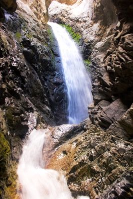
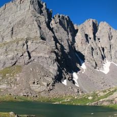
Zapata Falls is a waterfall in the San Luis Valley where water descends through a narrow rocky crevasse at the mountain base. The flow creates a natural water curtain between the canyon walls as it drops from the upper rock face.

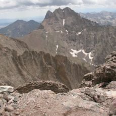
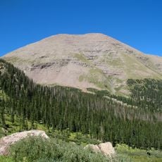
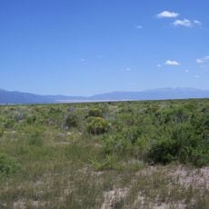
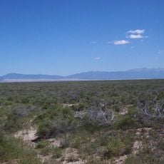
The falls sit near ancient Native American pathways that crossed the Sangre de Cristo Mountains to link settlements throughout the San Luis Valley. These routes shaped the region's early human movement and trade patterns.

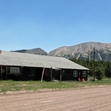
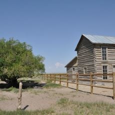
The Spanish name reflects the regional heritage of this area. Visitors encounter a natural landmark that has long held importance for the communities living in the surrounding valley and mountains.

The hike from the parking area goes uphill for about half a mile before you reach the falls. You will need to wade through shallow stream water to enter the chamber where the waterfall flows.

During winter months, the entire waterfall freezes into a transparent ice column while water continues moving beneath the surface. This rare occurrence transforms the site into a different kind of spectacle that attracts visitors seeking the frozen landscape.

The community of curious travelers

AroundUs brings together thousands of curated places, local tips, and hidden gems, enriched daily by 60,000 contributors worldwide.

Start exploring
Location
GPS coordinates
37.61903,-105.55316
Latest update
December 6, 2025 16:03
Colorado natural treasures and remote locations

Colorado contains natural areas and historical sites located away from main roads and common routes. These places tell the story of the state's geology and human history through varied landscapes. Visitors will find sand dunes, waterfalls, rock formations, and remains from the mining era. Locations...

Around this place
Blanca Peak
United States of America

Blanca Peak

7.5 km
Rio Grande Scenic Railroad
United States of America

Rio Grande Scenic Railroad

32.3 km
Crestone Peak
United States of America

Crestone Peak

38.8 km
North La Veta Pass
United States of America

North La Veta Pass

32.1 km
Crestone Needle
United States of America

Crestone Needle

38.5 km
UFO Watchtower
United States of America

UFO Watchtower

34.9 km
Fort Garland
United States of America

Fort Garland

24.2 km
Humboldt Peak
United States of America

Humboldt Peak

39.8 km
Little Bear Peak
United States of America

Little Bear Peak

7.6 km
Mount Lindsey
United States of America

Mount Lindsey

10.3 km
Baca National Wildlife Refuge
United States of America

Baca National Wildlife Refuge

35.1 km
Alamosa National Wildlife Refuge
United States of America

Alamosa National Wildlife Refuge

30.6 km
Ellingwood Point
United States of America

Ellingwood Point

6.7 km
Mount Mestas
United States of America

Mount Mestas

36 km
D&RGW 169
United States of America

D&RGW 169

31.9 km
Closed Basin Project
United States of America

Closed Basin Project

13.2 km
United States of America

Iron Mountain

26.5 km
St. Thomas Episcopal Church
United States of America

St. Thomas Episcopal Church

32.2 km
Broken Hand Peak
United States of America

Broken Hand Peak

37.6 km
Trujillo Homestead
United States of America

Trujillo Homestead

20.5 km
American National Bank Building
United States of America

American National Bank Building

32.2 km
Superintendent's Residence, Great Sand Dunes National Monument
United States of America

Superintendent's Residence, Great Sand Dunes National Monument

12.2 km
San Luis Southern Railway Trestle
United States of America

San Luis Southern Railway Trestle

25.9 km
Alamosa County Courthouse
United States of America

Alamosa County Courthouse

32.4 km
Husung Hardware
United States of America

Husung Hardware

32.3 km
Upper Sand Creek Lake
United States of America

Upper Sand Creek Lake

35.7 km
Big Spring Creek
United States of America

Big Spring Creek

17.6 km
Medano Ranch Headquarters
United States of America

Medano Ranch Headquarters

15.6 km
Show the full map
« Zapata Falls - Waterfall in San Luis Valley, United States » is provided by Around Us (aroundus.com). Images and texts are derived from Wikimedia project under a Creative Commons license. You are allowed to copy, distribute, and modify copies of this page, under the conditions set by the license, as long as this note is clearly visible.

Discover hidden gems everywhere you go!

From secret cafés to breathtaking viewpoints, skip the crowded tourist spots and find places that match your style. Our app makes it easy with voice search, smart filtering, route optimization, and insider tips from travelers worldwide. Download now for the complete mobile experience.

Around Us App Screenshot

A unique approach to discovering new places

Le Figaro

All the places worth exploring

France Info

A tailor-made excursion in just a few clicks

20 Minutes

Around Us
Travel Guide & Maps
Download

Send to your phone

QR Code
1

Open the camera app on your mobile.

2

Point at the QR code with your camera. A notification will appear.

3

Tap the notification to open the link.