Enable Location

We need your location to show you interesting places around you

Discover nearby places

Find interesting locations and hidden gems around you

Precise directions

Get accurate directions and distances to places

Your location is never shared with other users. It's only used when you tap the location button.

North La Veta Pass

Log in to your account

Start exploring — it's free

Trusted by 64,792 travelers worldwide

Continue with Google
Continue with Apple
or

We will send you a code to connect

By continuing, you accept our Terms and Conditions and our Privacy Policy

Check your inbox

We've sent a pincode in your inbox. Please enter the code below.

North La Veta Pass
Discussion Reviews 1 Photos
7k Popularity

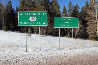
North La Veta Pass, Rail mountain pass in Sangre de Cristo Mountains, Colorado, US.

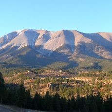
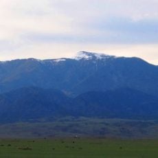
North La Veta Pass is a rail mountain pass in the Sangre de Cristo range in Colorado, linking Fort Garland in the San Luis Valley with Walsenburg to the east. The route runs through high-elevation terrain with steep grades and sharp curves that are typical of railroad lines built across this section of the Rocky Mountains.

The Denver and Rio Grande Railway built this line in 1877 to connect the San Luis Valley with eastern Colorado. The rail link allowed goods and settlers to move through the mountains far more easily than before, shaping growth on both sides of the pass.

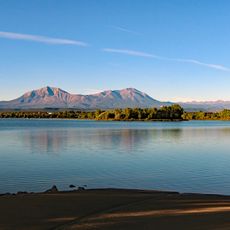
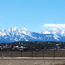
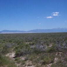
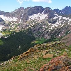
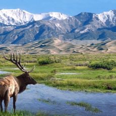
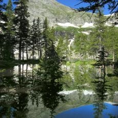
The name La Veta comes from Spanish and means "the vein," referring to the mineral deposits found in the surrounding hills. Travelers crossing the pass today can still see the open sweep of the San Luis Valley on one side and the Sangre de Cristo peaks on the other.

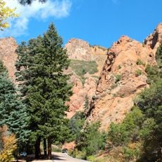
The road over the pass is open year-round, but snow and ice in winter can make driving much more demanding. Checking the weather before setting out is a good idea, since conditions at this elevation can change fast.

The railroad corridor here is one of the highest freight routes in North America that stays in regular use throughout the year. This was achieved with tools and methods from the 1870s, long before modern construction equipment existed.

The community of curious travelers

AroundUs brings together thousands of curated places, local tips, and hidden gems, enriched daily by 60,000 contributors worldwide.

Start exploring
Location
GPS coordinates
37.61390,-105.18900
Latest update
March 3, 2026 10:10
Around this place
Blanca Peak
United States of America

Blanca Peak

26.5 km
Spanish Peaks
United States of America

Spanish Peaks

32.5 km
Zapata Falls
United States of America

Zapata Falls

32.1 km
Spanish Peaks Wilderness
United States of America

Spanish Peaks Wilderness

31.7 km
West Spanish Peak
United States of America

West Spanish Peak

31.6 km
Lathrop State Park
United States of America

Lathrop State Park

31.4 km
Huerfano Butte
United States of America

Huerfano Butte

35.5 km
Greenhorn Mountain
United States of America

Greenhorn Mountain

33.6 km
Fort Garland
United States of America

Fort Garland

30.1 km
North Cheyenne Cañon Park
United States of America

North Cheyenne Cañon Park

34.4 km
Little Bear Peak
United States of America

Little Bear Peak

27.7 km
Mount Lindsey
United States of America

Mount Lindsey

22.8 km
East Spanish Peak
United States of America

East Spanish Peak

34.2 km
Ellingwood Point
United States of America

Ellingwood Point

27 km
Mount Mestas
United States of America

Mount Mestas

5.1 km
Closed Basin Project
United States of America

Closed Basin Project

43.4 km
United States of America

Iron Mountain

6.3 km
Montoya Ranch
United States of America

Montoya Ranch

17.9 km
Trujillo Homestead
United States of America

Trujillo Homestead

50 km
Francisco Plaza
United States of America

Francisco Plaza

19.7 km
Superintendent's Residence, Great Sand Dunes National Monument
United States of America

Superintendent's Residence, Great Sand Dunes National Monument

31.6 km
San Luis Southern Railway Trestle
United States of America

San Luis Southern Railway Trestle

40.5 km
Upper Sand Creek Lake
United States of America

Upper Sand Creek Lake

47.6 km
Big Spring Creek
United States of America

Big Spring Creek

42 km
Medano Ranch Headquarters
United States of America

Medano Ranch Headquarters

44.9 km
Lower Sand Creek Lake
United States of America

Lower Sand Creek Lake

46.3 km
Monument Lake Park Building and Hatchery Complex
United States of America

Monument Lake Park Building and Hatchery Complex

47 km
Maitland Arroyo Bridge
United States of America

Maitland Arroyo Bridge

31.8 km
Show the full map
Reviews
Share your experience

No review yet

Discussions
Start a discussion...

No discussion yet

« North La Veta Pass - Rail mountain pass in Sangre de Cristo Mountains, Colorado, US » is provided by Around Us (aroundus.com). Images and texts are derived from Wikimedia project under a Creative Commons license. You are allowed to copy, distribute, and modify copies of this page, under the conditions set by the license, as long as this note is clearly visible.

Discover hidden gems everywhere you go!

From secret cafés to breathtaking viewpoints, skip the crowded tourist spots and find places that match your style. Our app makes it easy with voice search, smart filtering, route optimization, and insider tips from travelers worldwide. Download now for the complete mobile experience.

Around Us App Screenshot

A unique approach to discovering new places

Le Figaro

All the places worth exploring

France Info

A tailor-made excursion in just a few clicks

20 Minutes

Around Us
Travel Guide & Maps
Download

Send to your phone

QR Code
1

Open the camera app on your mobile.

2

Point at the QR code with your camera. A notification will appear.

3

Tap the notification to open the link.