Closed Basin Project

Log in to your account

AroundUs is a community-driven map of interesting places, built by curious explorers like you. It grows with every review, story, and photo you share.
Connect to save your favorite spots, contribute locations, and create personalized routes.
By continuing, you accept our Terms and Conditions and our Privacy Policy

Closed Basin Project

Add to collection
Map
Suggest a change
Share

Closed Basin Project, Water management system in San Luis Valley, Colorado.

The Closed Basin Project is a water management system in the San Luis Valley that extracts groundwater through a network of wells and pipelines. The facility includes more than 115 miles of pipeline infrastructure spreading across the valley to transport water from natural underground sources to distribution points.

The project was established in 1972 by the US Bureau of Reclamation to fulfill obligations from the Rio Grande Compact of 1939. This agreement regulated water distribution among multiple states and made artificial groundwater extraction necessary.

The agricultural community in San Luis Valley relies on water distribution from the project for sustainable farming and economic development.

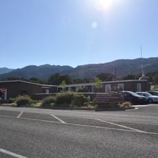
The project is monitored from a control center in Alamosa, where water quality is checked and flow is regulated through remote communication systems. Visitors should know that the facility spreads across a large area and cannot be fully explored on foot.

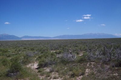
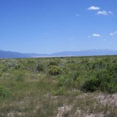
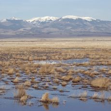
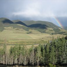
The zone encompasses approximately 2,940 square miles where water naturally percolates and collects without surface drainage outlets. This unique geological feature of the closed basin area is why mechanical pumping is required to make water available for use.

Location: Colorado

GPS coordinates: 37.54950,-105.67400

Latest update: December 14, 2025 14:41

Photos
Around this place
Blanca Peak
United States of America

Blanca Peak

16.9 km
Zapata Falls
United States of America

Zapata Falls

13.2 km
Rio Grande Scenic Railroad
United States of America

Rio Grande Scenic Railroad

19.2 km
North La Veta Pass
United States of America

North La Veta Pass

43.4 km
UFO Watchtower
United States of America

UFO Watchtower

32.6 km
Fort Garland
United States of America

Fort Garland

25.5 km
Little Bear Peak
United States of America

Little Bear Peak

15.7 km
Mount Lindsey
United States of America

Mount Lindsey

20.6 km
Baca National Wildlife Refuge
United States of America

Baca National Wildlife Refuge

37 km
Monte Vista National Wildlife Refuge
United States of America

Monte Vista National Wildlife Refuge

37.6 km
Alamosa National Wildlife Refuge
United States of America

Alamosa National Wildlife Refuge

18.1 km
Ellingwood Point
United States of America

Ellingwood Point

16.4 km
Pike's Stockade
United States of America

Pike's Stockade

30.9 km
D&RGW 169
United States of America

D&RGW 169

18.8 km
San Luis Hills
United States of America

San Luis Hills

43 km
Iron Mountain
United States of America

Iron Mountain

38.3 km
San Luis Valley Conservation Area
United States of America

San Luis Valley Conservation Area

38.6 km
St. Thomas Episcopal Church
United States of America

St. Thomas Episcopal Church

19.1 km
Trujillo Homestead
United States of America

Trujillo Homestead

21.2 km
American National Bank Building
United States of America

American National Bank Building

19.1 km
Carnegie Library
United States of America

Carnegie Library

41.7 km
Superintendent's Residence, Great Sand Dunes National Monument
United States of America

Superintendent's Residence, Great Sand Dunes National Monument

23.8 km
San Luis Southern Railway Trestle
United States of America

San Luis Southern Railway Trestle

21.3 km
Alamosa County Courthouse
United States of America

Alamosa County Courthouse

19.3 km
Monte Vista Downtown Historic District
United States of America

Monte Vista Downtown Historic District

41.9 km
Husung Hardware
United States of America

Husung Hardware

19.2 km
Big Spring Creek
United States of America

Big Spring Creek

24.6 km
Medano Ranch Headquarters
United States of America

Medano Ranch Headquarters

18.4 km
Show the full map
Reviews

Visited this place? Tap the stars to rate it and share your experience / photos with the community! Try now! You can cancel it anytime.

« Closed Basin Project - Water management system in San Luis Valley, Colorado » is provided by Around Us (aroundus.com). Images and texts are derived from Wikimedia project under a Creative Commons license. You are allowed to copy, distribute, and modify copies of this page, under the conditions set by the license, as long as this note is clearly visible.

Discover hidden gems everywhere you go!

From secret cafés to breathtaking viewpoints, skip the crowded tourist spots and find places that match your style. Our app makes it easy with voice search, smart filtering, route optimization, and insider tips from travelers worldwide. Download now for the complete mobile experience.

Around Us App Screenshot

A unique approach to discovering new places

Le Figaro

All the places worth exploring

France Info

A tailor-made excursion in just a few clicks

20 Minutes