Enable Location

We need your location to show you interesting places around you

Discover nearby places

Find interesting locations and hidden gems around you

Precise directions

Get accurate directions and distances to places

Your location is never shared with other users. It's only used when you tap the location button.

San Luis Valley Conservation Area

Log in to your account

Start exploring — it's free

Trusted by 62,594 travelers worldwide

Continue with Google
Continue with Apple
or

We will send you a code to connect

By continuing, you accept our Terms and Conditions and our Privacy Policy

Check your inbox

We've sent a pincode in your inbox. Please enter the code below.

San Luis Valley Conservation Area

San Luis Valley Conservation Area, Conservation area in San Luis Valley, Colorado.

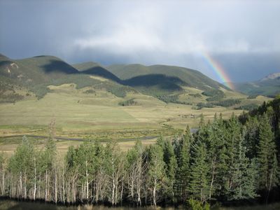
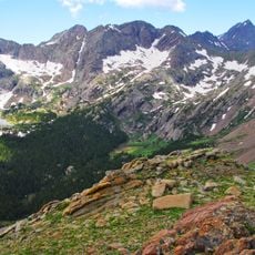
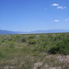
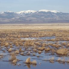
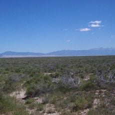
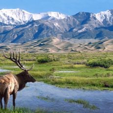
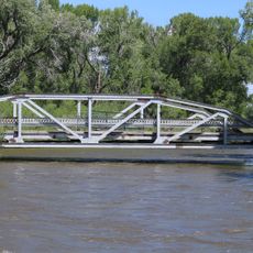
The San Luis Valley Conservation Area is an extensive protected landscape between two mountain ranges in southern Colorado, containing wetlands, riparian zones, and natural habitats. The terrain spans a high-elevation ecosystem shaped by water systems and native vegetation patterns.

The area came into being in the early 2000s through a land donation from a conservation organization and was formally established through federal designation. This origin reflects how modern land protection is achieved through partnerships between private entities and government.

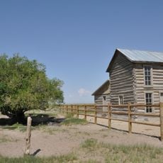
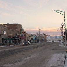
The valley represents a place where ranchers and hunters have long worked the land and maintained deep ties to wildlife. Today, collaboration between these groups and government agencies reflects how local communities actively shape conservation efforts.

The area is best explored at a slower pace due to the high elevation, which can be tiring for visitors not acclimated to altitude. Plan for variable weather depending on the season and bring appropriate gear for changing conditions.

The Rio Grande springs forth here in a high-elevation ecosystem and shapes vital wetlands that attract millions of migratory birds before they continue their long journeys. These wetlands are so valuable that they bring people with opposing interests together toward a shared goal.

The community of curious travelers

AroundUs brings together thousands of curated places, local tips, and hidden gems, enriched daily by 60,000 contributors worldwide.

Start exploring
Location
GPS coordinates
37.74000,-106.04000
Latest update
December 14, 2025 18:05
Around this place
Zapata Falls
United States of America

Zapata Falls

45 km
Rio Grande Scenic Railroad
United States of America

Rio Grande Scenic Railroad

34.1 km
Crestone Peak
United States of America

Crestone Peak

47.3 km
UFO Watchtower
United States of America

UFO Watchtower

14.5 km
Challenger Point
United States of America

Challenger Point

46.5 km
Kit Carson Peak
United States of America

Kit Carson Peak

46.8 km
Sangre de Cristo Wilderness
United States of America

Sangre de Cristo Wilderness

47.1 km
Baca National Wildlife Refuge
United States of America

Baca National Wildlife Refuge

25.4 km
Monte Vista National Wildlife Refuge
United States of America

Monte Vista National Wildlife Refuge

28.9 km
Alamosa National Wildlife Refuge
United States of America

Alamosa National Wildlife Refuge

43.7 km
United States of America

Bennett Peak

45 km
D&RGW 169
United States of America

D&RGW 169

33.9 km
Closed Basin Project
United States of America

Closed Basin Project

38.6 km
United States of America

Terrace Reservoir

47.6 km
St. Thomas Episcopal Church
United States of America

St. Thomas Episcopal Church

33.8 km
Trujillo Homestead
United States of America

Trujillo Homestead

26.8 km
Capilla de San Juan Bautista
United States of America

Capilla de San Juan Bautista

22.7 km
First Baptist Church of Moffat
United States of America

First Baptist Church of Moffat

31.1 km
American National Bank Building
United States of America

American National Bank Building

34 km
Carnegie Library
United States of America

Carnegie Library

20 km
Superintendent's Residence, Great Sand Dunes National Monument
United States of America

Superintendent's Residence, Great Sand Dunes National Monument

45.9 km
Monte Vista Downtown Historic District
United States of America

Monte Vista Downtown Historic District

20.1 km
Alamosa County Courthouse
United States of America

Alamosa County Courthouse

33.8 km
Husung Hardware
United States of America

Husung Hardware

33.9 km
Big Spring Creek
United States of America

Big Spring Creek

36.6 km
Medano Ranch Headquarters
United States of America

Medano Ranch Headquarters

31.6 km
Sutherland Bridge
United States of America

Sutherland Bridge

24.1 km
Wheeler Bridge
United States of America

Wheeler Bridge

23.8 km
Show the full map
« San Luis Valley Conservation Area - Conservation area in San Luis Valley, Colorado » is provided by Around Us (aroundus.com). Images and texts are derived from Wikimedia project under a Creative Commons license. You are allowed to copy, distribute, and modify copies of this page, under the conditions set by the license, as long as this note is clearly visible.

Discover hidden gems everywhere you go!

From secret cafés to breathtaking viewpoints, skip the crowded tourist spots and find places that match your style. Our app makes it easy with voice search, smart filtering, route optimization, and insider tips from travelers worldwide. Download now for the complete mobile experience.

Around Us App Screenshot

A unique approach to discovering new places

Le Figaro

All the places worth exploring

France Info

A tailor-made excursion in just a few clicks

20 Minutes

Around Us
Travel Guide & Maps
Download

Send to your phone

QR Code
1

Open the camera app on your mobile.

2

Point at the QR code with your camera. A notification will appear.

3

Tap the notification to open the link.