Enable Location

We need your location to show you interesting places around you

Discover nearby places

Find interesting locations and hidden gems around you

Precise directions

Get accurate directions and distances to places

Your location is never shared with other users. It's only used when you tap the location button.

Mount Mestas

Log in to your account

Start exploring — it's free

Trusted by 63,125 travelers worldwide

Continue with Google
Continue with Apple
or

We will send you a code to connect

By continuing, you accept our Terms and Conditions and our Privacy Policy

Check your inbox

We've sent a pincode in your inbox. Please enter the code below.

Mount Mestas
Discussion Reviews 1 Photos
2.4k Popularity

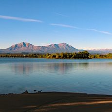
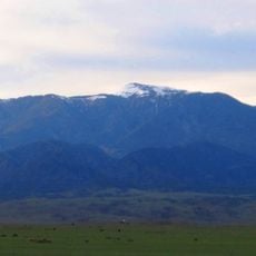
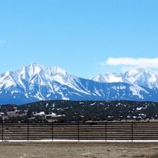
Mount Mestas, Mountain summit in Sangre de Cristo Range, Colorado, US.

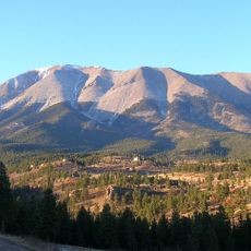
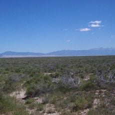
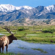
Mount Mestas is a summit in the Sangre de Cristo Range located in southeastern Colorado, rising to approximately 11,600 feet above sea level. The peak features steep terrain and stands prominently against the plains below.

Originally called La Veta Peak, this summit was renamed in 1949 to honor Private First Class Felix B. Mestas Jr., a local soldier who died during World War II. The name change reflects how the region commemorated its war dead.

The peak honors a fallen soldier from the area, reflecting how the local community names landmarks to remember those who served.

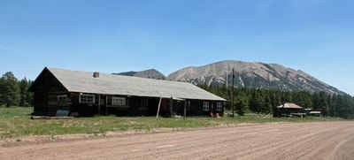
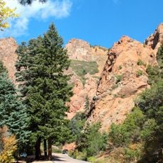
Access to the summit starts from a picnic area at lower elevation, with visitors following steep terrain over loose rock for the entire climb. The route works best during dry months when the ground offers better footing.

The eastern face of this peak drops steeply away, creating a sharp visual boundary between the mountains and the plains far below. This dramatic slope makes it easily recognizable from distant viewpoints.

The community of curious travelers

AroundUs brings together thousands of curated places, local tips, and hidden gems, enriched daily by 60,000 contributors worldwide.

Start exploring
Location
GPS coordinates
37.58279,-105.14722
Latest update
December 13, 2025 11:43
Around this place
Blanca Peak
United States of America

Blanca Peak

29.9 km
Spanish Peaks
United States of America

Spanish Peaks

27.5 km
Zapata Falls
United States of America

Zapata Falls

36 km
Spanish Peaks Wilderness
United States of America

Spanish Peaks Wilderness

26.8 km
West Spanish Peak
United States of America

West Spanish Peak

26.7 km
North La Veta Pass
United States of America

North La Veta Pass

5.1 km
Lathrop State Park
United States of America

Lathrop State Park

27.8 km
Huerfano Butte
United States of America

Huerfano Butte

34 km
Greenhorn Mountain
United States of America

Greenhorn Mountain

35.3 km
Fort Garland
United States of America

Fort Garland

30.7 km
North Cheyenne Cañon Park
United States of America

North Cheyenne Cañon Park

33.8 km
Little Bear Peak
United States of America

Little Bear Peak

30.9 km
Mount Lindsey
United States of America

Mount Lindsey

26.3 km
East Spanish Peak
United States of America

East Spanish Peak

29.1 km
Ellingwood Point
United States of America

Ellingwood Point

30.5 km
Closed Basin Project
United States of America

Closed Basin Project

46.6 km
United States of America

Iron Mountain

11.2 km
Montoya Ranch
United States of America

Montoya Ranch

19.2 km
Huerfano County Courthouse and Jail
United States of America

Huerfano County Courthouse and Jail

32.6 km
Francisco Plaza
United States of America

Francisco Plaza

14.7 km
A. A. Salazar House
United States of America

A. A. Salazar House

49 km
Huerfano County High School
United States of America

Huerfano County High School

32.3 km
Rito Seco Creek Culvert
United States of America

Rito Seco Creek Culvert

49.2 km
Superintendent's Residence, Great Sand Dunes National Monument
United States of America

Superintendent's Residence, Great Sand Dunes National Monument

36.4 km
San Luis Southern Railway Trestle
United States of America

San Luis Southern Railway Trestle

41.6 km
Big Spring Creek
United States of America

Big Spring Creek

46.8 km
Medano Ranch Headquarters
United States of America

Medano Ranch Headquarters

49.4 km
Monument Lake Park Building and Hatchery Complex
United States of America

Monument Lake Park Building and Hatchery Complex

42.8 km
Show the full map
Reviews
Share your experience

No review yet

Discussions
Start a discussion...

No discussion yet

« Mount Mestas - Mountain summit in Sangre de Cristo Range, Colorado, US » is provided by Around Us (aroundus.com). Images and texts are derived from Wikimedia project under a Creative Commons license. You are allowed to copy, distribute, and modify copies of this page, under the conditions set by the license, as long as this note is clearly visible.

Discover hidden gems everywhere you go!

From secret cafés to breathtaking viewpoints, skip the crowded tourist spots and find places that match your style. Our app makes it easy with voice search, smart filtering, route optimization, and insider tips from travelers worldwide. Download now for the complete mobile experience.

Around Us App Screenshot

A unique approach to discovering new places

Le Figaro

All the places worth exploring

France Info

A tailor-made excursion in just a few clicks

20 Minutes

Around Us
Travel Guide & Maps
Download

Send to your phone

QR Code
1

Open the camera app on your mobile.

2

Point at the QR code with your camera. A notification will appear.

3

Tap the notification to open the link.