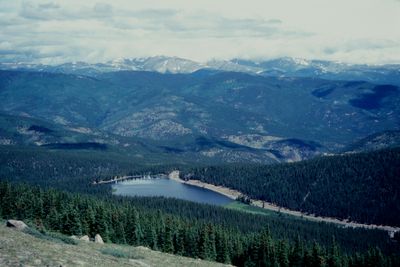
Mount Evans Scenic Byway, Mountain road in Colorado, United States.
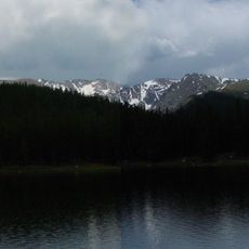
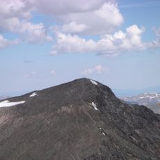
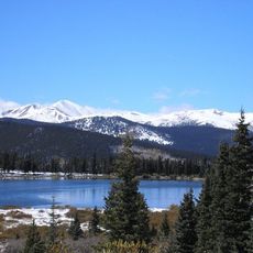
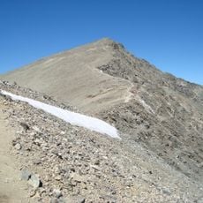
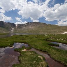
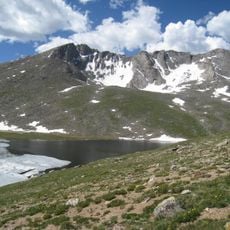
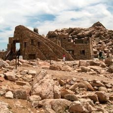
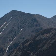
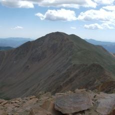
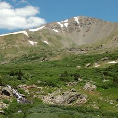
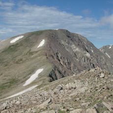
Mount Evans Scenic Byway is a mountain road in Colorado that extends 28 miles from Idaho Springs to the summit, reaching 14,271 feet in elevation. The route passes through changing landscapes, from forested areas at lower elevations to bare alpine terrain at the top.
The road was named after John Evans, who served as Colorado's second territorial governor from 1862 to 1865. The name honors his role in the region's early development.
The road draws photographers and nature observers who document seasonal changes, alpine plants, and mountain wildlife throughout the accessible months.
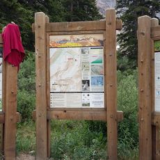
Visitors need to make vehicle reservations through recreation.gov and should carry warm clothing as temperatures drop significantly at higher elevations. The road is seasonally limited and can close during bad weather.
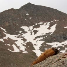
Mountain goats and bighorn sheep frequently appear along the road edges, particularly during early morning hours when fewer vehicles travel the route. These animals are adapted to the extreme elevation and offer visitors rare close-up views.
Location: Colorado
GPS coordinates: 39.59000,-105.64000
Latest update: December 20, 2025 13:50
The western United States protects some of North America's most diverse natural landscapes. From the layered canyons of Canyonlands in Utah to the white gypsum dunes of White Sands in New Mexico, this region spans multiple climate zones and geological formations. Visitors find national parks, Pueblo...
Colorado contains natural areas and historical sites located away from main roads and common routes. These places tell the story of the state's geology and human history through varied landscapes. Visitors will find sand dunes, waterfalls, rock formations, and remains from the mining era. Locations...
Mount Blue Sky
367 m
Grays Peak
16 km
Mount Bierstadt
2.6 km
Echo Lake Park
8.2 km
Torreys Peak
16.6 km
Argo Gold Mine and Mill
20.5 km
Argo Tunnel
20.5 km
Summit Lake Park
1 km
Mount Sniktau
21.1 km
Mount Evans Wilderness
355 m
Crest House
301 m
Grays Peak Trail
15.7 km
Grizzly Peak
18.9 km
Bard Peak
20.2 km
Argentine Peak
12 km
Georgetown-Silver Plume Historic District
13.6 km
Mount Edwards
14.2 km
Grace Episcopal Church
13.7 km
Methodist Episcopal Church
20.1 kmCooper Mountain
16.3 km
Idaho Springs Downtown Commercial District
20 km
Elks Lodge No. 607
20.1 km
Fraser Experimental Forest
11 km
Toll House
13.8 km
Montezuma Schoolhouse
19.4 km
Visitor Center
20.3 km
Devil's Gate High Bridge
13.6 km
Miner Street Bridge
20.1 kmVisited this place? Tap the stars to rate it and share your experience / photos with the community! Try now! You can cancel it anytime.
Discover hidden gems everywhere you go!
From secret cafés to breathtaking viewpoints, skip the crowded tourist spots and find places that match your style. Our app makes it easy with voice search, smart filtering, route optimization, and insider tips from travelers worldwide. Download now for the complete mobile experience.
A unique approach to discovering new places❞
— Le Figaro
All the places worth exploring❞
— France Info
A tailor-made excursion in just a few clicks❞
— 20 Minutes