Chest opened
+${chestReward.xp} XP
Explorer
NOUVEAU ×${chestReward.collectible.quantity}
tapez pour fermer
Chest locked

Open chests in the app

Around Us is built for your phone — chests unlock when you walk, explore and capture nearby places.

Enable Location

We need your location to show you interesting places around you

Discover nearby places

Find interesting locations and hidden gems around you

Precise directions

Get accurate directions and distances to places

Your location is never shared with other users. It's only used when you tap the location button.

Log in to your account

Start exploring — it's free

Trusted by 72,882 travelers worldwide

Continue with Google
Continue with Apple
or

We will send you a code to connect

By continuing, you accept our Terms and Conditions and our Privacy Policy

Check your inbox

We've sent a pincode in your inbox. Please enter the code below.

Glorieta Pass
Discussion Reviews Photo
9.9k Popularity

Glorieta Pass, Rail mountain pass in Santa Fe County, United States.

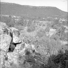
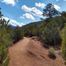
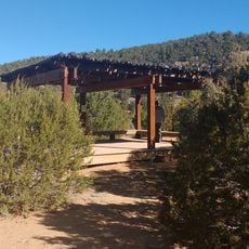
Glorieta Pass is a mountain crossing in the Sangre de Cristo Mountains that connects two major river valley systems. The pass reaches an elevation of about 7,500 feet (2,286 meters) and forms a natural route between the Pecos River and Rio Grande valleys.

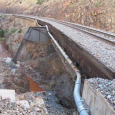
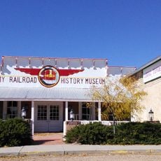
This pass played a significant role during the American Civil War when Union armies destroyed Confederate supply lines in 1862. The railroad reached the pass in 1879, making it a hub of the transcontinental connection across North America.

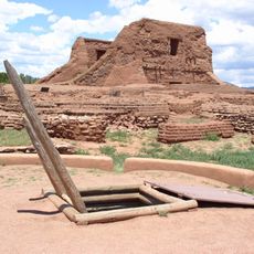
The pass formed part of the Santa Fe Trail, connecting frontier settlements with trading routes between the High Plains and New Mexico Territory.

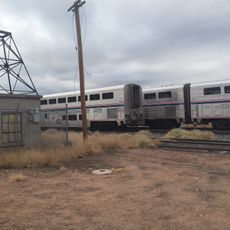
The area is easily reached today via Interstate 25 for drivers. The rail corridor still operates daily for passenger service but typically offers no public access for visitors wishing to board.

The railroad construction through Glorieta Pass in 1879 established this route as part of North America's second transcontinental railroad connection.

The community of curious travelers

AroundUs brings together thousands of curated places, local tips, and hidden gems, enriched daily by 60,000 contributors worldwide.

Start exploring
Location
GPS coordinates
35.59139,-105.77778
Latest update
December 10, 2025 15:56
Around this place
Pecos National Historical Park
United States of America

Pecos National Historical Park

9.2 km
Museum of International Folk Art
United States of America

Museum of International Folk Art

15.7 km
Museum of Indian Arts and Culture
United States of America

Museum of Indian Arts and Culture

15.6 km
Glorieta Pass Battlefield
United States of America

Glorieta Pass Battlefield

3.6 km
Wheelwright Museum of the American Indian
United States of America

Wheelwright Museum of the American Indian

15.7 km
Hyde Memorial State Park
United States of America

Hyde Memorial State Park

17 km
Upaya Institute and Zen Center
United States of America

Upaya Institute and Zen Center

15.6 km
Acequia Madre
United States of America

Acequia Madre

16.4 km
Dale Ball Trails
United States of America

Dale Ball Trails

15.4 km
National Park Service Southwest Regional Office
United States of America

National Park Service Southwest Regional Office

15.6 km
Acequia Madre House
United States of America

Acequia Madre House

17 km
Camino del Monte Sol Historic District
United States of America

Camino del Monte Sol Historic District

16.9 km
San Antonio de Padua Church
United States of America

San Antonio de Padua Church

9.3 km
Reredos of Our Lady of Light
United States of America

Reredos of Our Lady of Light

15.9 km
Our Lady of Light Community Center
United States of America

Our Lady of Light Community Center

15.6 km
El Zaguan
United States of America

El Zaguan

17.1 km
Delgado Street Bridge
United States of America

Delgado Street Bridge

17.3 km
Apache Canyon Railroad Bridge
United States of America

Apache Canyon Railroad Bridge

11.1 km
Santa Fe Botanical Garden
United States of America

Santa Fe Botanical Garden

15.8 km
Santa Fe Children's Museum
United States of America

Santa Fe Children's Museum

17 km
Gustave Baumann House
United States of America

Gustave Baumann House

17.3 km
Carlos Vierra House
United States of America

Carlos Vierra House

17.1 km
Forked Lightning Ranch
United States of America

Forked Lightning Ranch

11.6 km
The Legal Tender
United States of America

The Legal Tender

15.4 km
Davey Audubon Center & Sanctuary
United States of America

Davey Audubon Center & Sanctuary

14.8 km
Pflueger building
United States of America

Pflueger building

15.4 km
Lamy Well #2
United States of America

Lamy Well #2

15.6 km
Sheldon Parsons House and Studio
United States of America

Sheldon Parsons House and Studio

16.5 km
Show the full map
Reviews
Share your experience

No review yet

Discussions
Start a discussion...

No discussion yet

« Glorieta Pass - Rail mountain pass in Santa Fe County, United States » is provided by Around Us (aroundus.com). Images and texts are derived from Wikimedia project under a Creative Commons license. You are allowed to copy, distribute, and modify copies of this page, under the conditions set by the license, as long as this note is clearly visible.

Discover hidden gems everywhere you go!

From secret cafés to breathtaking viewpoints, skip the crowded tourist spots and find places that match your style. Our app makes it easy with voice search, smart filtering, route optimization, and insider tips from travelers worldwide. Download now for the complete mobile experience.

Around Us App Screenshot

A unique approach to discovering new places

Le Figaro

All the places worth exploring

France Info

A tailor-made excursion in just a few clicks

20 Minutes

Around Us
Travel Guide & Maps
Download

Send to your phone

QR Code
1

Open the camera app on your mobile.

2

Point at the QR code with your camera. A notification will appear.

3

Tap the notification to open the link.