Enable Location

We need your location to show you interesting places around you

Discover nearby places

Find interesting locations and hidden gems around you

Precise directions

Get accurate directions and distances to places

Your location is never shared with other users. It's only used when you tap the location button.

Acequia Madre

Log in to your account

Start exploring — it's free

Trusted by 61,595 travelers worldwide

Continue with Google
Continue with Apple
or

We will send you a code to connect

By continuing, you accept our Terms and Conditions and our Privacy Policy

Check your inbox

We've sent a pincode in your inbox. Please enter the code below.

Acequia Madre

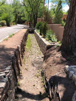
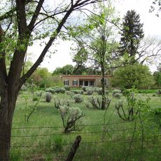
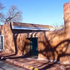
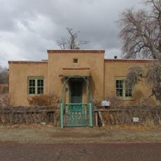
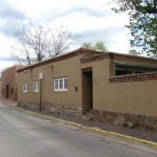
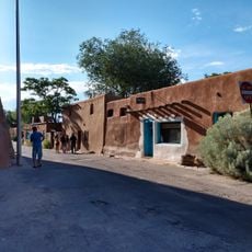
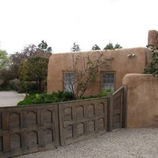
Acequia Madre, Irrigation canal in Historic Eastside, Santa Fe, United States.

Description

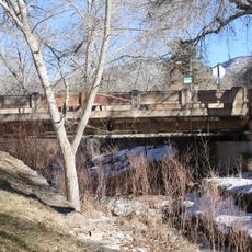
The Acequia Madre is an irrigation canal running through Santa Fe from a reservoir and lined with stone along its path. The waterway is shallow, roughly 1 to 2 feet (0.3 to 0.6 m) deep, and shaded by tall cottonwood trees that grow along its banks.

History

Spanish settlers built this water system before 1610, bringing irrigation techniques and water management methods from their homeland to this region. The system has remained in continuous use and operation for more than 4 centuries, making it one of the oldest of its kind in the United States.

Culture

The canal's Spanish names and terms are still used by residents today to identify different sections and water rights along its path. This shared language keeps the connection to the community's past alive and shows how water management is woven into local identity.

Practical

The canal is most active during spring months when residents perform maintenance and distribute water to adjacent properties. Visitors can walk along the waterway, but should be aware that the water is in use for irrigation and some areas may be actively managed during this season.

Did you know?

Properties along the canal were historically divided into long, narrow parcels so that each owner could have equal access to water. This division system was an early form of fair resource distribution that ensured every neighbor had a stake in the water supply.

GPS coordinates
35.67939,-105.92349
Latest update
December 12, 2025 17:46

AroundUs brings together thousands of curated places, local tips, and hidden gems, enriched daily by 60,000 contributors worldwide. Discover all places nearby (United States of America).

Around this place
Loretto Chapel
United States of America

Loretto Chapel

1.5 km
San Miguel Mission
United States of America

San Miguel Mission

1.4 km
Cathedral Basilica of Saint Francis of Assisi
United States of America

Cathedral Basilica of Saint Francis of Assisi

1.4 km
De Vargas Street House
United States of America

De Vargas Street House

1.4 km
Fort Marcy
United States of America

Fort Marcy

1.4 km
Santa Fe Historic District
United States of America

Santa Fe Historic District

1.3 km
School for Advanced Research
United States of America

School for Advanced Research

839 m
Upaya Institute and Zen Center
United States of America

Upaya Institute and Zen Center

1.5 km
National Park Service Southwest Regional Office
United States of America

National Park Service Southwest Regional Office

1.4 km
Barrio De Analco Historic District
United States of America

Barrio De Analco Historic District

1.2 km
Acequia Madre House
United States of America

Acequia Madre House

690 m
Camino del Monte Sol Historic District
United States of America

Camino del Monte Sol Historic District

556 m
Reredos of Our Lady of Light
United States of America

Reredos of Our Lady of Light

623 m
Santa Fe Playhouse
United States of America

Santa Fe Playhouse

1.5 km
Lamy Building
United States of America

Lamy Building

1.4 km
New Mexico Supreme Court Building
United States of America

New Mexico Supreme Court Building

1.5 km
Cross of the Martyrs
United States of America

Cross of the Martyrs

1.4 km
El Zaguan
United States of America

El Zaguan

646 m
Delgado Street Bridge
United States of America

Delgado Street Bridge

892 m
Santa Fe Children's Museum
United States of America

Santa Fe Children's Museum

1.4 km
Gustave Baumann House
United States of America

Gustave Baumann House

1.2 km
Gregorio Crespin House
United States of America

Gregorio Crespin House

1.5 km
Museum of Contemporary Native Arts
United States of America

Museum of Contemporary Native Arts

1.5 km
Oldest House Museum
United States of America

Oldest House Museum

1.3 km
Carlos Vierra House
United States of America

Carlos Vierra House

1.4 km
Gerald Peters Gallery
United States of America

Gerald Peters Gallery

986 m
Loretto staircase
United States of America

Loretto staircase

1.5 km
Cathedral Park
United States of America

Cathedral Park

1.4 km
Show the full map
« Acequia Madre - Irrigation canal in Historic Eastside, Santa Fe, United States » is provided by Around Us (aroundus.com). Images and texts are derived from Wikimedia project under a Creative Commons license. You are allowed to copy, distribute, and modify copies of this page, under the conditions set by the license, as long as this note is clearly visible.

Discover hidden gems everywhere you go!

From secret cafés to breathtaking viewpoints, skip the crowded tourist spots and find places that match your style. Our app makes it easy with voice search, smart filtering, route optimization, and insider tips from travelers worldwide. Download now for the complete mobile experience.

Around Us App Screenshot

A unique approach to discovering new places

Le Figaro

All the places worth exploring

France Info

A tailor-made excursion in just a few clicks

20 Minutes

Around Us
Travel Guide & Maps
Download

Send to your phone

QR Code
1

Open the camera app on your mobile.

2

Point at the QR code with your camera. A notification will appear.

3

Tap the notification to open the link.