Carracas Rim, cliff in Rio Arriba County, Albuquerque-Santa Fe-Las Vegas, NM Combined Statistical Area, United States of America
Location: Rio Arriba County
GPS coordinates: 36.99083,-107.29417
Latest update: November 17, 2025 08:26
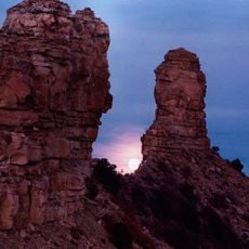
Chimney Rock National Monument
21.6 km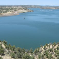
Navajo Lake
33.4 km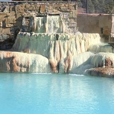
Pagosa hot springs
39.1 km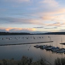
Navajo State Park
10.4 km
Horse Mountain
35.4 km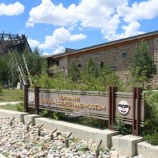
Southern Ute Cultural Center and Museum
34.3 km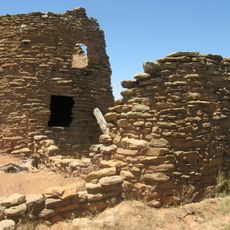
Frances Canyon Ruin
31 km
Echo Canyon Reservoir State Wildlife Area
36.4 km
Jicarilla Apache Historic District
26.9 km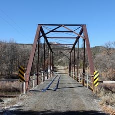
Labo Del Rio Bridge
13.7 km
Broken Off Point
27.7 km
Pagosa Springs Museum
40.4 km
Navajo Reservoir
8.7 km
Carracas Rim
4 km
Cañon Pintado
8.2 km
Cemetery Canyon
27 km
Capote Lake
23.6 km
John Mills Lake
30.2 km
Agua Canyon
17 km
La Jara Lake
38.3 km
Lake Hatcher
39.6 km
Box Canyon
40.1 km
Piedra Peak
18.1 km
Ponderosa
37.1 km
Pinon
36.9 km
Meadows
36.6 km
The Springs Resort and Spa Bath House
39.7 km
Scenic viewpoint
29.8 kmReviews
Visited this place? Tap the stars to rate it and share your experience / photos with the community! Try now! You can cancel it anytime.
Discover hidden gems everywhere you go!
From secret cafés to breathtaking viewpoints, skip the crowded tourist spots and find places that match your style. Our app makes it easy with voice search, smart filtering, route optimization, and insider tips from travelers worldwide. Download now for the complete mobile experience.

A unique approach to discovering new places❞
— Le Figaro
All the places worth exploring❞
— France Info
A tailor-made excursion in just a few clicks❞
— 20 Minutes