Rio Arriba County

Log in to your account

AroundUs is a community-driven map of interesting places, built by curious explorers like you. It grows with every review, story, and photo you share.
Connect to save your favorite spots, contribute locations, and create personalized routes.
Continue with Google
Continue with Apple
Continue with X
Continue with Facebook
Continue with email
By continuing, you accept our Terms and Conditions and our Privacy Policy
Create an account
Add to collection
Map
Suggest a change
Share

Rio Arriba County, Administrative county in northern New Mexico, US

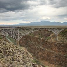
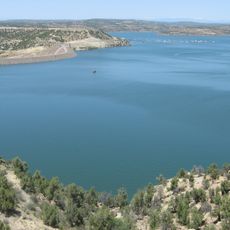
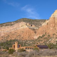
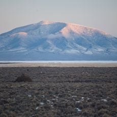
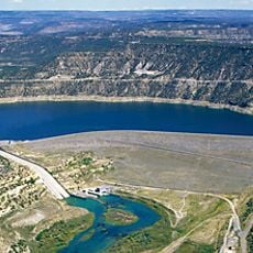
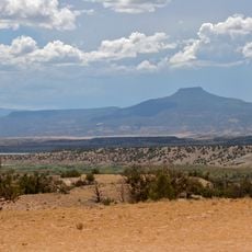
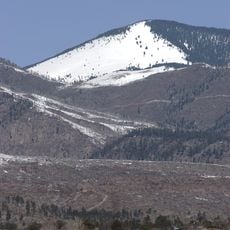
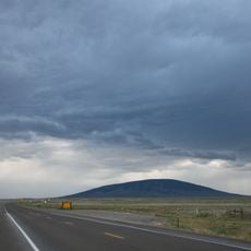
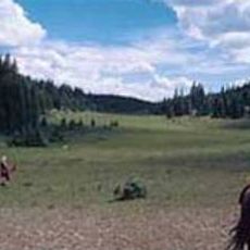
Rio Arriba County is a county in northern New Mexico with mountains, lakes, and expansive terrain across thousands of square miles. The landscape is defined by high peaks and river valleys, with Abiquiu Lake and multiple mountain summits shaping the natural geography.

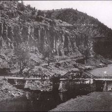
The county was established in 1852 and takes its name from its location along the upper Rio Grande river system. Its original territory was much larger, stretching far westward before boundary changes reduced its size.

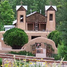
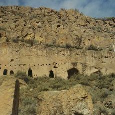
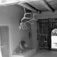
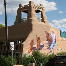
The Hispano heritage shapes the region through local music traditions and celebrations that bring communities together throughout the year. These cultural practices remain visible in festivals, family gatherings, and everyday life across the county's villages.

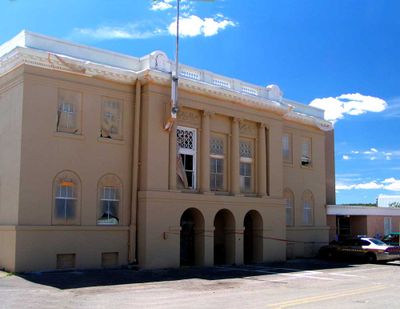
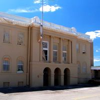
Tierra Amarilla serves as the county seat where visitors can find local services and information. The area is best explored by car since communities are spread across large distances.

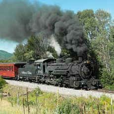
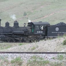
The Cumbres & Toltec Scenic Railroad connects the area to Colorado by running historic train lines through mountain passages and valleys. Visitors can experience this rail route that has been enjoyed for generations.

Location: New Mexico

Inception: 1852

Capital city: Tierra Amarilla

Shares border with: Archuleta County, Sandoval County, Santa Fe County, Los Alamos County, San Juan County, Mora County, Taos County, Conejos County

Website: http://rio-arriba.org

GPS coordinates: 36.51000,-106.70000

Latest update: December 20, 2025 00:14

Photos
Around this place
El Santuario de Chimayo
United States of America

El Santuario de Chimayo

90.1 km
Ghost Ranch
United States of America

Ghost Ranch

28.5 km
Rio Grande Gorge Bridge
United States of America

Rio Grande Gorge Bridge

86.7 km
Cumbres and Toltec Scenic Railroad
United States of America

Cumbres and Toltec Scenic Railroad

44.6 km
Navajo Lake
United States of America

Navajo Lake

87.3 km
D. H. Lawrence Ranch
United States of America

D. H. Lawrence Ranch

99.3 km
Puye Cliff Dwellings
United States of America

Puye Cliff Dwellings

73 km
Georgia O'Keeffe Home and Studio
United States of America

Georgia O'Keeffe Home and Studio

48.1 km
Monastery of Christ in the Desert
United States of America

Monastery of Christ in the Desert

14.8 km
Rio Grande del Norte National Monument
United States of America

Rio Grande del Norte National Monument

88.8 km
Navajo Dam
United States of America

Navajo Dam

87.7 km
Truchas Peak
United States of America

Truchas Peak

112.7 km
Cerro Pedernal
United States of America

Cerro Pedernal

42.4 km
Mabel Dodge Luhan House
United States of America

Mabel Dodge Luhan House

102.3 km
Taos Downtown Historic District
United States of America

Taos Downtown Historic District

101.6 km
United States of America

Heron Lake

20.1 km
United States of America

Millicent Rogers Museum

99.3 km
Ojo Caliente Mineral Springs Resort & Spa
United States of America

Ojo Caliente Mineral Springs Resort & Spa

62.6 km
Kit Carson House
United States of America

Kit Carson House

101.6 km
Chicoma Mountain
United States of America

Chicoma Mountain

62.7 km
San Antonio Mountain
United States of America

San Antonio Mountain

72.2 km
United States of America

Manby Hot Springs

87.3 km
Martinez Hacienda
United States of America

Martinez Hacienda

98.5 km
United States of America

El Vado Lake

11.4 km
D&RGW 463
United States of America

D&RGW 463

45.1 km
San Pedro Parks Wilderness
United States of America

San Pedro Parks Wilderness

47.4 km
Harwood Museum of Art
United States of America

Harwood Museum of Art

101.2 km
John Dunn Bridge
United States of America

John Dunn Bridge

88.7 km
Show the full map
Reviews

Visited this place? Tap the stars to rate it and share your experience / photos with the community! Try now! You can cancel it anytime.

Administrative divisions
« Rio Arriba County - Administrative county in northern New Mexico, US » is provided by Around Us (aroundus.com). Images and texts are derived from Wikimedia project under a Creative Commons license. You are allowed to copy, distribute, and modify copies of this page, under the conditions set by the license, as long as this note is clearly visible.

Discover hidden gems everywhere you go!

From secret cafés to breathtaking viewpoints, skip the crowded tourist spots and find places that match your style. Our app makes it easy with voice search, smart filtering, route optimization, and insider tips from travelers worldwide. Download now for the complete mobile experience.

Around Us App Screenshot

A unique approach to discovering new places

Le Figaro

All the places worth exploring

France Info

A tailor-made excursion in just a few clicks

20 Minutes