Enable Location

We need your location to show you interesting places around you

Discover nearby places

Find interesting locations and hidden gems around you

Precise directions

Get accurate directions and distances to places

Your location is never shared with other users. It's only used when you tap the location button.

Rio Grande del Norte National Monument

Log in to your account

Start exploring — it's free

Trusted by 62,248 travelers worldwide

Continue with Google
Continue with Apple
or

We will send you a code to connect

By continuing, you accept our Terms and Conditions and our Privacy Policy

Check your inbox

We've sent a pincode in your inbox. Please enter the code below.

Rio Grande del Norte National Monument

Rio Grande del Norte National Monument, Nature reserve in Rio Arriba County, US.

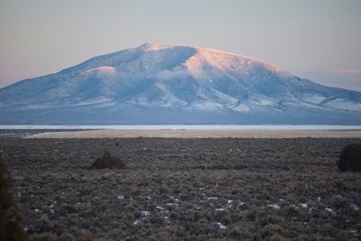
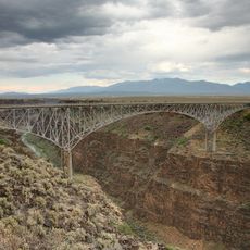
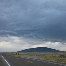
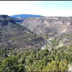
Rio Grande del Norte National Monument is a 242,555-acre protected area in New Mexico featuring a deep gorge carved through volcanic basalt flows. The river has cut through layers of rock over millennia, creating sheer canyon walls that rise hundreds of feet above the water.

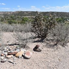
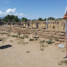
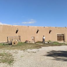
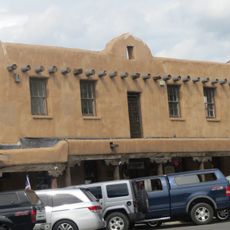
The site shows archaeological evidence of human settlement from the Archaic period, with numerous petroglyphs and prehistoric dwelling sites scattered throughout. These early cultures left marks and structures that remain visible in the monument today.

The lands hold deep meaning for the Jicarilla Apache, Utes, Taos Pueblo, and Picuris Pueblo, whose ancestors lived here for countless generations. Visitors can see traces of this long connection in how the communities still relate to these places today.

The monument has five campgrounds offering basic facilities and can be reached via paved highways from nearby towns. Two Bureau of Land Management visitor centers provide information to help plan your visit and answer questions about the area.

The monument contains two wilderness areas, Rio San Antonio and Cerro del Yuta, which were officially designated in 2019 through federal conservation law. These sections offer visitors remote hiking trails far from the main access points.

The community of curious travelers

AroundUs brings together thousands of curated places, local tips, and hidden gems, enriched daily by 60,000 contributors worldwide.

Start exploring
Operator
Bureau of Land Management
GPS coordinates
36.64023,-105.71945
Latest update
December 8, 2025 19:57
Around this place
Rio Grande Gorge Bridge
United States of America

Rio Grande Gorge Bridge

18.3 km
D. H. Lawrence Ranch
United States of America

D. H. Lawrence Ranch

13 km
Mabel Dodge Luhan House
United States of America

Mabel Dodge Luhan House

29.3 km
Taos Downtown Historic District
United States of America

Taos Downtown Historic District

29.1 km
Ojo Caliente Mineral Springs Resort & Spa
United States of America

Ojo Caliente Mineral Springs Resort & Spa

47 km
Kit Carson House
United States of America

Kit Carson House

29.1 km
San Antonio Mountain
United States of America

San Antonio Mountain

36.2 km
Martinez Hacienda
United States of America

Martinez Hacienda

28.5 km
Harwood Museum of Art
United States of America

Harwood Museum of Art

29 km
John Dunn Bridge
United States of America

John Dunn Bridge

11.8 km
Wild Rivers Recreation Area
United States of America

Wild Rivers Recreation Area

6.1 km
Taos Inn
United States of America

Taos Inn

29 km
Nicolai Fechin House
United States of America

Nicolai Fechin House

28.9 km
Ojo Caliente Hot Springs Round Barn
United States of America

Ojo Caliente Hot Springs Round Barn

47 km
Ranchos de Taos Plaza
United States of America

Ranchos de Taos Plaza

32.9 km
Taos Art Museum
United States of America

Taos Art Museum

28.9 km
Governor Charles Bent House
United States of America

Governor Charles Bent House

28.9 km
Ernest L. Blumenschein House
United States of America

Ernest L. Blumenschein House

29.1 km
Eanger Irving Couse House and Studio—Joseph Henry Sharp Studios
United States of America

Eanger Irving Couse House and Studio—Joseph Henry Sharp Studios

29.2 km
Posi-ouinge
United States of America

Posi-ouinge

47.7 km
Taos Pueblo
United States of America

Taos Pueblo

27.3 km
La Loma Plaza Historic District
United States of America

La Loma Plaza Historic District

28.8 km
Carson School
United States of America

Carson School

30.9 km
Bernard J. Beimer House
United States of America

Bernard J. Beimer House

28.2 km
Hernández-Manby House
United States of America

Hernández-Manby House

29 km
Hacienda de Los Martinez Museum
United States of America

Hacienda de Los Martinez Museum

28.4 km
Veterans Memorial
United States of America

Veterans Memorial

29 km
Old Taos County Courthouse
United States of America

Old Taos County Courthouse

29 km
Show the full map
« Rio Grande del Norte National Monument - Nature reserve in Rio Arriba County, US » is provided by Around Us (aroundus.com). Images and texts are derived from Wikimedia project under a Creative Commons license. You are allowed to copy, distribute, and modify copies of this page, under the conditions set by the license, as long as this note is clearly visible.

Discover hidden gems everywhere you go!

From secret cafés to breathtaking viewpoints, skip the crowded tourist spots and find places that match your style. Our app makes it easy with voice search, smart filtering, route optimization, and insider tips from travelers worldwide. Download now for the complete mobile experience.

Around Us App Screenshot

A unique approach to discovering new places

Le Figaro

All the places worth exploring

France Info

A tailor-made excursion in just a few clicks

20 Minutes

Around Us
Travel Guide & Maps
Download

Send to your phone

QR Code
1

Open the camera app on your mobile.

2

Point at the QR code with your camera. A notification will appear.

3

Tap the notification to open the link.