San Antonio Mountain

Log in to your account

AroundUs is a community-driven map of interesting places, built by curious explorers like you. It grows with every review, story, and photo you share.
Connect to save your favorite spots, contribute locations, and create personalized routes.
Continue with Google
Continue with Apple
Continue with X
Continue with Facebook
Continue with email
By continuing, you accept our Terms and Conditions and our Privacy Policy
Create an account
Add to collection
Map
Suggest a change
Share

San Antonio Mountain, Volcanic summit in Rio Arriba County, New Mexico, US.

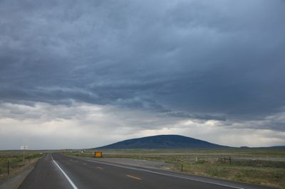
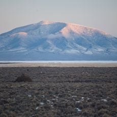
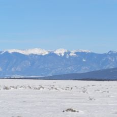
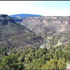
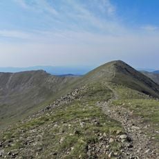
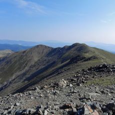
San Antonio Mountain is a standalone volcanic peak in Rio Arriba County reaching an elevation of about 10,900 feet in the Taos Plateau volcanic field. The summit rises sharply from sagebrush plains and measures roughly 5 miles (8 kilometers) across its base.

The peak formed approximately 3 to 3.5 million years ago through dacite dome construction during the Taos Plateau's volcanic activity. This initial formation permanently shaped the geological landscape of northern New Mexico.

The Tewa people of the Rio Grande valley call this peak Bear Mountain and regard it as a sacred location connected to the north direction in their traditional beliefs. It serves as an important marker in their understanding of the landscape.

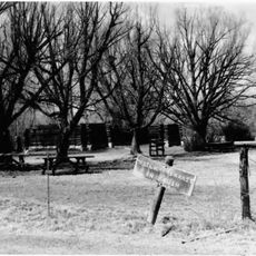
Forest Road 418 provides the main approach to the summit, though visitors must navigate around private property boundaries and hike the final stretch through Carson National Forest. Plan for rough terrain and minimal facilities at the mountain.

The peak remains visible from remarkable distances and can be spotted from up to 60 miles away across Colorado and New Mexico under clear conditions. This visibility made it a crucial landmark for travelers navigating the plateau region.

Location: New Mexico

GPS coordinates: 36.85974,-106.01891

Latest update: December 10, 2025 20:06

Photos
Around this place
Rio Grande Gorge Bridge
United States of America

Rio Grande Gorge Bridge

49.8 km
Cumbres and Toltec Scenic Railroad
United States of America

Cumbres and Toltec Scenic Railroad

50.5 km
D. H. Lawrence Ranch
United States of America

D. H. Lawrence Ranch

49 km
Rio Grande del Norte National Monument
United States of America

Rio Grande del Norte National Monument

36.2 km
Cumbres Pass
United States of America

Cumbres Pass

42.3 km
Ojo Caliente Mineral Springs Resort & Spa
United States of America

Ojo Caliente Mineral Springs Resort & Spa

61.2 km
Martinez Hacienda
United States of America

Martinez Hacienda

62.9 km
D&RGW 463
United States of America

D&RGW 463

50 km
John Dunn Bridge
United States of America

John Dunn Bridge

45.5 km
Latir Peak Wilderness
United States of America

Latir Peak Wilderness

48.4 km
Wild Rivers Recreation Area
United States of America

Wild Rivers Recreation Area

36.8 km
Ojo Caliente Hot Springs Round Barn
United States of America

Ojo Caliente Hot Springs Round Barn

61.2 km
Wheeler Peak Wilderness
United States of America

Wheeler Peak Wilderness

61.3 km
Pike's Stockade
United States of America

Pike's Stockade

51.7 km
Mount Walter
United States of America

Mount Walter

63.4 km
Posi-ouinge
United States of America

Posi-ouinge

61.8 km
Taos Pueblo
United States of America

Taos Pueblo

63.1 km
United States of America

San Luis Hills

42.1 km
Terrace Reservoir
United States of America

Terrace Reservoir

61.1 km
Fort Lowell
United States of America

Fort Lowell

50.1 km
Samuel Sanchez House
United States of America

Samuel Sanchez House

49.3 km
Palace Hotel
United States of America

Palace Hotel

24.1 km
Carson School
United States of America

Carson School

59.6 km
Gilbert Martinez Barn
United States of America

Gilbert Martinez Barn

52.2 km
Sanchez-March House
United States of America

Sanchez-March House

50.8 km
Hacienda de Los Martinez Museum
United States of America

Hacienda de Los Martinez Museum

62.9 km
La Jara Reservoir
United States of America

La Jara Reservoir

54.2 km
Costilla Crossing Bridge
United States of America

Costilla Crossing Bridge

33.7 km
Show the full map
Reviews

Visited this place? Tap the stars to rate it and share your experience / photos with the community! Try now! You can cancel it anytime.

« San Antonio Mountain - Volcanic summit in Rio Arriba County, New Mexico, US » is provided by Around Us (aroundus.com). Images and texts are derived from Wikimedia project under a Creative Commons license. You are allowed to copy, distribute, and modify copies of this page, under the conditions set by the license, as long as this note is clearly visible.

Discover hidden gems everywhere you go!

From secret cafés to breathtaking viewpoints, skip the crowded tourist spots and find places that match your style. Our app makes it easy with voice search, smart filtering, route optimization, and insider tips from travelers worldwide. Download now for the complete mobile experience.

Around Us App Screenshot

A unique approach to discovering new places

Le Figaro

All the places worth exploring

France Info

A tailor-made excursion in just a few clicks

20 Minutes