Enable Location

We need your location to show you interesting places around you

Discover nearby places

Find interesting locations and hidden gems around you

Precise directions

Get accurate directions and distances to places

Your location is never shared with other users. It's only used when you tap the location button.

Log in to your account

Start exploring — it's free

Trusted by 62,249 travelers worldwide

Continue with Google
Continue with Apple
or

We will send you a code to connect

By continuing, you accept our Terms and Conditions and our Privacy Policy

Check your inbox

We've sent a pincode in your inbox. Please enter the code below.

Heron Lake

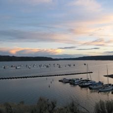
Heron Lake, body of water

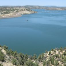
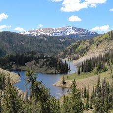
Heron Lake is a reservoir in Rio Arriba County surrounded by tall pine forests and mountains at about 7,167 feet elevation. The water is calm and cold, with shorelines marked by gentle hills and rocky banks where vegetation grows close to the water's edge.

The earth dam was built in the early 1970s at Willow Creek to store water for cities like Albuquerque and Santa Fe. The project was part of a larger water diversion system that channels water from distant rivers across mountain ranges.

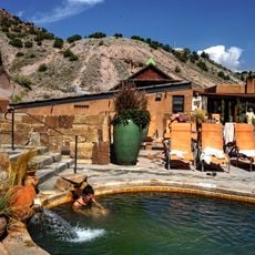
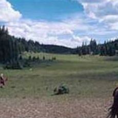
The lake serves as a gathering place for fishing communities who practice seasonal traditions like kokanee salmon snagging in fall. The strict no-wake speed rules reflect local values about preserving the quiet and protecting the peaceful character that defines the area.

The visitor center staffed by volunteers provides trail maps, fishing regulations, and helpful information for planning your visit. Check conditions and safety updates before arriving, especially if planning ice fishing or winter activities.

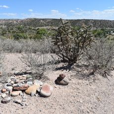
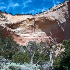
The rock layers around the lake reveal prehistoric history with fossil remains from a sea that existed 80 million years ago. Visible sandstone and shale formations show ripple marks from ancient water movements across the seabed.

The community of curious travelers

AroundUs brings together thousands of curated places, local tips, and hidden gems, enriched daily by 60,000 contributors worldwide.

Start exploring
GPS coordinates
36.69000,-106.69000
Latest update
February 7, 2026 11:01
Around this place
Ghost Ranch
United States of America

Ghost Ranch

44.5 km
Cumbres and Toltec Scenic Railroad
United States of America

Cumbres and Toltec Scenic Railroad

25.2 km
Chimney Rock National Monument
United States of America

Chimney Rock National Monument

78 km
Navajo Lake
United States of America

Navajo Lake

82.4 km
Georgia O'Keeffe Home and Studio
United States of America

Georgia O'Keeffe Home and Studio

63.2 km
Monastery of Christ in the Desert
United States of America

Monastery of Christ in the Desert

34.7 km
Cerro Pedernal
United States of America

Cerro Pedernal

61 km
Pagosa hot springs
United States of America

Pagosa hot springs

70.9 km
Cumbres Pass
United States of America

Cumbres Pass

42.6 km
Navajo State Park
United States of America

Navajo State Park

73.2 km
Ojo Caliente Mineral Springs Resort & Spa
United States of America

Ojo Caliente Mineral Springs Resort & Spa

71.4 km
Chicoma Mountain
United States of America

Chicoma Mountain

80.7 km
San Antonio Mountain
United States of America

San Antonio Mountain

62.8 km
D&RGW 463
United States of America

D&RGW 463

25.7 km
San Pedro Parks Wilderness
United States of America

San Pedro Parks Wilderness

67.3 km
Conejos Peak
United States of America

Conejos Peak

67.5 km
Ojo Caliente Hot Springs Round Barn
United States of America

Ojo Caliente Hot Springs Round Barn

71.4 km
United States of America

Apache Nugget Casino

79.2 km
Posi-ouinge
United States of America

Posi-ouinge

71.4 km
Frances Canyon Ruin
United States of America

Frances Canyon Ruin

72.5 km
Tsama Pueblo
United States of America

Tsama Pueblo

69.6 km
Labo Del Rio Bridge
United States of America

Labo Del Rio Bridge

76.8 km
Fort Lowell
United States of America

Fort Lowell

12.6 km
Samuel Sanchez House
United States of America

Samuel Sanchez House

14.4 km
Palace Hotel
United States of America

Palace Hotel

74.4 km
Gilbert Martinez Barn
United States of America

Gilbert Martinez Barn

10.5 km
Sanchez-March House
United States of America

Sanchez-March House

12.1 km
Echo amphitheatre
United States of America

Echo amphitheatre

39.5 km
Show the full map
« Heron Lake - body of water » is provided by Around Us (aroundus.com). Images and texts are derived from Wikimedia project under a Creative Commons license. You are allowed to copy, distribute, and modify copies of this page, under the conditions set by the license, as long as this note is clearly visible.

Discover hidden gems everywhere you go!

From secret cafés to breathtaking viewpoints, skip the crowded tourist spots and find places that match your style. Our app makes it easy with voice search, smart filtering, route optimization, and insider tips from travelers worldwide. Download now for the complete mobile experience.

Around Us App Screenshot

A unique approach to discovering new places

Le Figaro

All the places worth exploring

France Info

A tailor-made excursion in just a few clicks

20 Minutes

Around Us
Travel Guide & Maps
Download

Send to your phone

QR Code
1

Open the camera app on your mobile.

2

Point at the QR code with your camera. A notification will appear.

3

Tap the notification to open the link.