Enable Location

We need your location to show you interesting places around you

Discover nearby places

Find interesting locations and hidden gems around you

Precise directions

Get accurate directions and distances to places

Your location is never shared with other users. It's only used when you tap the location button.

Navajo Lake

Log in to your account

Join the adventure

Create your free account and start exploring (like 60k+ others)

We will send you a code to connect

or
Continue with Google
Continue with Apple
By continuing, you accept our Terms and Conditions and our Privacy Policy

Check your inbox

We've sent a pincode in your inbox. Please enter the code below.

Navajo Lake

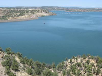
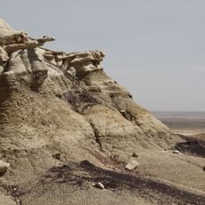
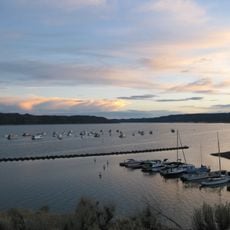
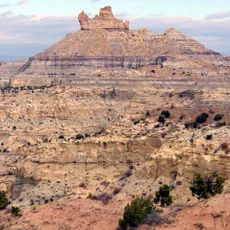
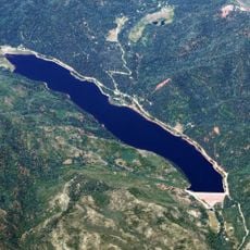
Navajo Lake, Reservoir in northwestern New Mexico, US.

Description

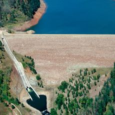
Navajo Lake extends across a large area with waters reaching elevations of about 6,085 feet, forming the second largest water body in New Mexico. The reservoir has seven campgrounds with developed sites, five public boat ramps, and three marinas offering rentals and supplies.

History

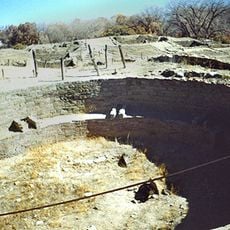
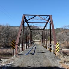
The Navajo Dam was built in the 1960s to create this reservoir as part of a major water management project for the San Juan River. The project permanently changed the landscape and reshaped settlement patterns across the region.

Culture

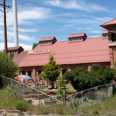
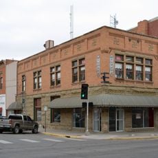
The lake sits in territory with deep roots in local communities, where people have built their lives around the water and land for generations. Today, both residents and visitors gather here as a place for leisure and family time together.

Practical

The lake is easily accessible with multiple entry points and provides visitors with many ways to enjoy the water and surroundings. The best time to visit is during warmer months when all facilities are fully open and weather conditions are pleasant.

Did you know?

Below the dam, the San Juan River flows through a section known for its special rainbow trout population. This stretch draws anglers seeking specific fishing opportunities in waters managed under particular regulations.

i
Location
i
GPS coordinates
36.81667,-107.60000
i
Latest update
December 7, 2025 19:30

AroundUs brings together thousands of curated places, local tips, and hidden gems, enriched daily by 60,000 contributors worldwide. Discover all places nearby (New Mexico).

Around this place
Durango and Silverton Narrow Gauge Railroad
United States of America

Durango and Silverton Narrow Gauge Railroad

58.7 km
Aztec Ruins National Monument
United States of America

Aztec Ruins National Monument

35.7 km
Chimney Rock National Monument
United States of America

Chimney Rock National Monument

48.3 km
Kirtland Formation
United States of America

Kirtland Formation

68 km
Salmon Ruins
United States of America

Salmon Ruins

40.2 km
Navajo State Park
United States of America

Navajo State Park

27.3 km
Strater Hotel
United States of America

Strater Hotel

56.4 km
Angel Peak Scenic Area
United States of America

Angel Peak Scenic Area

37.9 km
Lemon Dam
United States of America

Lemon Dam

63.2 km
Southern Ute Cultural Center and Museum
United States of America

Southern Ute Cultural Center and Museum

35.5 km
Crow Canyon Archaeological District
United States of America

Crow Canyon Archaeological District

30.1 km
Farmington Public Library
United States of America

Farmington Public Library

52.2 km
Main Avenue Historic District
United States of America

Main Avenue Historic District

56.6 km
Frances Canyon Ruin
United States of America

Frances Canyon Ruin

10.8 km
Durango High School
United States of America

Durango High School

56.9 km
Durango Discovery Museum
United States of America

Durango Discovery Museum

57.1 km
Farmington Historic Downtown Commercial District
United States of America

Farmington Historic Downtown Commercial District

54.9 km
Labo Del Rio Bridge
United States of America

Labo Del Rio Bridge

33.7 km
Aztec Ruins Administration Building-Museum
United States of America

Aztec Ruins Administration Building-Museum

35.7 km
American Hotel
United States of America

American Hotel

35.5 km
Aztec Main Street Historic District
United States of America

Aztec Main Street Historic District

35.5 km
D.C. Ball House
United States of America

D.C. Ball House

34.6 km
Aztec Motor Company Building
United States of America

Aztec Motor Company Building

35.3 km
Engleman-Thomas Building
United States of America

Engleman-Thomas Building

35.8 km
Church Avenue-Lovers Lane Historic District
United States of America

Church Avenue-Lovers Lane Historic District

35.2 km
Hillcrest Golf Club
United States of America

Hillcrest Golf Club

57 km
Lemon Reservoir
United States of America

Lemon Reservoir

65.1 km
Aztec Museum
United States of America

Aztec Museum

35.2 km
Show the full map
« Navajo Lake - Reservoir in northwestern New Mexico, US » is provided by Around Us (aroundus.com). Images and texts are derived from Wikimedia project under a Creative Commons license. You are allowed to copy, distribute, and modify copies of this page, under the conditions set by the license, as long as this note is clearly visible.

Discover hidden gems everywhere you go!

From secret cafés to breathtaking viewpoints, skip the crowded tourist spots and find places that match your style. Our app makes it easy with voice search, smart filtering, route optimization, and insider tips from travelers worldwide. Download now for the complete mobile experience.

Around Us App Screenshot

A unique approach to discovering new places

Le Figaro

All the places worth exploring

France Info

A tailor-made excursion in just a few clicks

20 Minutes

Around Us
Travel Guide & Maps
Download

Send to your phone

QR Code
1

Open the camera app on your mobile.

2

Point at the QR code with your camera. A notification will appear.

3

Tap the notification to open the link.