Tierra Amarilla

Log in to your account

AroundUs is a community-driven map of interesting places, built by curious explorers like you. It grows with every review, story, and photo you share.
Connect to save your favorite spots, contribute locations, and create personalized routes.
Continue with Google
Continue with Apple
Continue with X
Continue with Facebook
Continue with email
By continuing, you accept our Terms and Conditions and our Privacy Policy
Create an account
Add to collection
Map
Suggest a change
Share

Tierra Amarilla, County seat in Rio Arriba County, New Mexico.

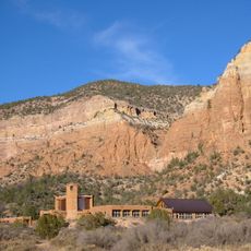
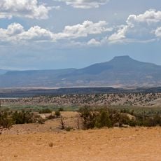
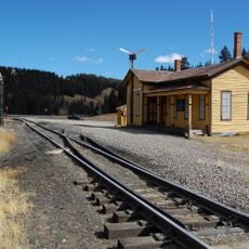
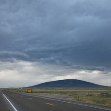
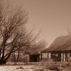
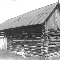
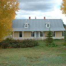
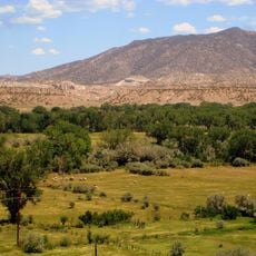
Tierra Amarilla is the county seat of Rio Arriba County located in the high valleys of northern New Mexico. The community sits at about 2,300 meters elevation and consists of a small cluster of residential buildings typical of rural settlements in the region.

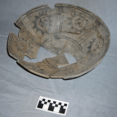
The Mexican government granted land to Manuel Martinez and settlers from Abiquiu in 1832, marking the establishment of the community. In the following generations, these land rights became contested, leading to complex ownership questions that persisted into modern times.

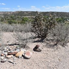
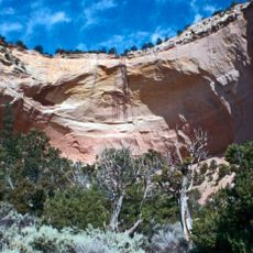
The name refers to yellow clay deposits found in the Chama River Valley, a natural feature that shaped how people understood the landscape. This geographical characteristic became part of the community's identity over time.

The small community operates under Mountain Time and sits in a mountain valley best explored during warmer months. Visitors should note that the area is sparsely populated and local services may be limited.

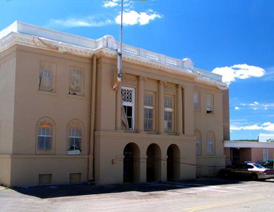
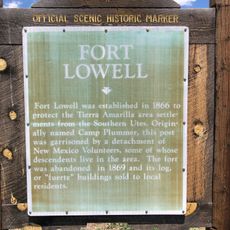
The courthouse built in 1917 became the site of an armed raid in 1967 when activists occupied the building to protest land rights. This event brought national attention to the long-standing land disputes affecting the Hispanic population in the region.

Location: Rio Arriba County

Elevation above the sea: 2,295 m

GPS coordinates: 36.70028,-106.54972

Latest update: December 7, 2025 20:41

Photos
Around this place
Ghost Ranch
United States of America

Ghost Ranch

41.8 km
Cumbres and Toltec Scenic Railroad
United States of America

Cumbres and Toltec Scenic Railroad

22.4 km
Georgia O'Keeffe Home and Studio
United States of America

Georgia O'Keeffe Home and Studio

58.6 km
Monastery of Christ in the Desert
United States of America

Monastery of Christ in the Desert

37.7 km
Rio Grande del Norte National Monument
United States of America

Rio Grande del Norte National Monument

74.4 km
Cerro Pedernal
United States of America

Cerro Pedernal

59.9 km
Pagosa hot springs
United States of America

Pagosa hot springs

76 km
Cumbres Pass
United States of America

Cumbres Pass

36.7 km
Ojo Caliente Mineral Springs Resort & Spa
United States of America

Ojo Caliente Mineral Springs Resort & Spa

62.5 km
San Antonio Mountain
United States of America

San Antonio Mountain

50.5 km
D&RGW 463
United States of America

D&RGW 463

22.7 km
San Pedro Parks Wilderness
United States of America

San Pedro Parks Wilderness

71.5 km
Conejos Peak
United States of America

Conejos Peak

65.5 km
Ojo Caliente Hot Springs Round Barn
United States of America

Ojo Caliente Hot Springs Round Barn

62.5 km
Posi-ouinge
United States of America

Posi-ouinge

62.6 km
Tsama Pueblo
United States of America

Tsama Pueblo

63.7 km
Terrace Reservoir
United States of America

Terrace Reservoir

77.2 km
Embudo Stream Gauging Station
United States of America

Embudo Stream Gauging Station

76.1 km
Fort Lowell
United States of America

Fort Lowell

2.3 km
Samuel Sanchez House
United States of America

Samuel Sanchez House

7.4 km
Palace Hotel
United States of America

Palace Hotel

63.8 km
Gilbert Martinez Barn
United States of America

Gilbert Martinez Barn

3.5 km
Sanchez-March House
United States of America

Sanchez-March House

4.7 km
Classical Gas Museum
United States of America

Classical Gas Museum

76.5 km
Echo amphitheatre
United States of America

Echo amphitheatre

38 km
Georgia O'keefe museum and home
United States of America

Georgia O'keefe museum and home

58.6 km
La Jara Reservoir
United States of America

La Jara Reservoir

65.5 km
Embudo Historic District
United States of America

Embudo Historic District

76.1 km
Show the full map
Reviews

Visited this place? Tap the stars to rate it and share your experience / photos with the community! Try now! You can cancel it anytime.

« Tierra Amarilla - County seat in Rio Arriba County, New Mexico » is provided by Around Us (aroundus.com). Images and texts are derived from Wikimedia project under a Creative Commons license. You are allowed to copy, distribute, and modify copies of this page, under the conditions set by the license, as long as this note is clearly visible.

Discover hidden gems everywhere you go!

From secret cafés to breathtaking viewpoints, skip the crowded tourist spots and find places that match your style. Our app makes it easy with voice search, smart filtering, route optimization, and insider tips from travelers worldwide. Download now for the complete mobile experience.

Around Us App Screenshot

A unique approach to discovering new places

Le Figaro

All the places worth exploring

France Info

A tailor-made excursion in just a few clicks

20 Minutes